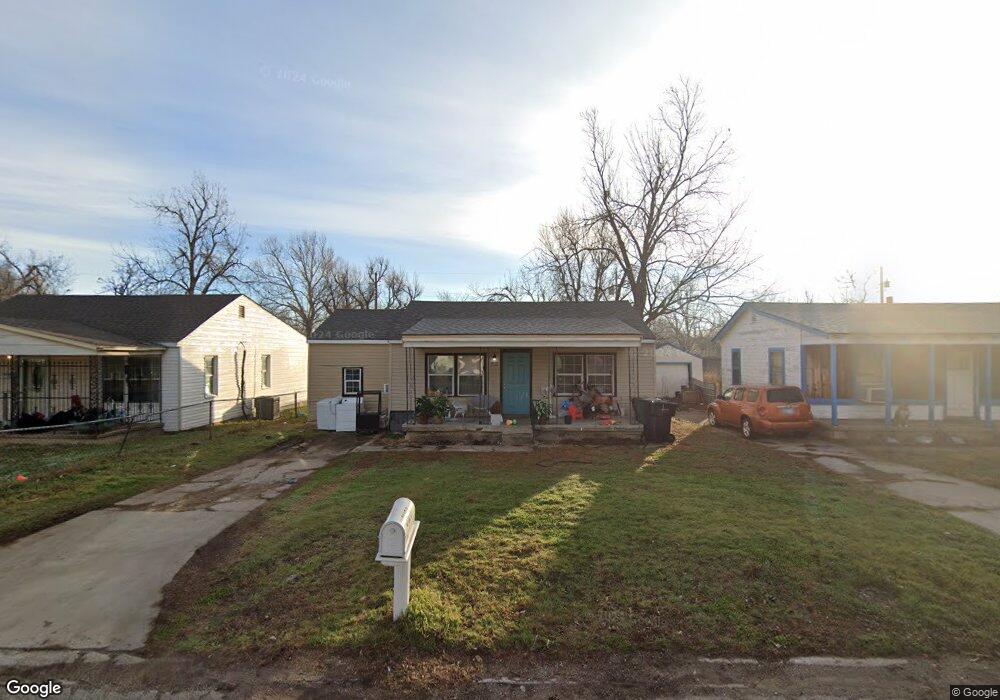
3420 S Liberty St Oklahoma City, OK 73119
Airline NeighborhoodEstimated Value: $73,000 - $97,000
2
Beds
1
Bath
1,026
Sq Ft
$83/Sq Ft
Est. Value
About This Home
This home is located at 3420 S Liberty St, Oklahoma City, OK 73119 and is currently estimated at $85,481, approximately $83 per square foot. 3420 S Liberty St is a home located in Oklahoma County with nearby schools including Adams Elementary School, Roosevelt Middle School, and U. S. Grant High School.
Ownership History
Date
Name
Owned For
Owner Type
Purchase Details
Closed on
Jan 8, 2019
Sold by
Bdt Properties Llc
Bought by
Mitchell And Son Llc
Current Estimated Value
Purchase Details
Closed on
Dec 27, 2017
Sold by
Titan Properties & Investments Llc
Bought by
Bdt Properties Llc
Purchase Details
Closed on
Sep 25, 2017
Sold by
Titan Properties & Instruments Llc
Bought by
Bdt Property Llc
Purchase Details
Closed on
Oct 27, 2010
Sold by
Fleshman Family Investments Inc
Bought by
King Michael and King Lisa
Create a Home Valuation Report for This Property
The Home Valuation Report is an in-depth analysis detailing your home's value as well as a comparison with similar homes in the area
Home Values in the Area
Average Home Value in this Area
Purchase History
| Date | Buyer | Sale Price | Title Company |
|---|---|---|---|
| Mitchell And Son Llc | -- | None Available | |
| Bdt Properties Llc | -- | None Available | |
| Bdt Property Llc | -- | None Available | |
| King Michael | $12,000 | None Available |
Source: Public Records
Tax History Compared to Growth
Tax History
| Year | Tax Paid | Tax Assessment Tax Assessment Total Assessment is a certain percentage of the fair market value that is determined by local assessors to be the total taxable value of land and additions on the property. | Land | Improvement |
|---|---|---|---|---|
| 2024 | $791 | $7,019 | $776 | $6,243 |
| 2023 | $791 | $6,684 | $876 | $5,808 |
| 2022 | $717 | $6,366 | $927 | $5,439 |
| 2021 | $681 | $6,063 | $759 | $5,304 |
| 2020 | $654 | $5,775 | $798 | $4,977 |
| 2019 | $652 | $5,775 | $798 | $4,977 |
| 2018 | $132 | $1,169 | $0 | $0 |
| 2017 | $114 | $2,007 | $396 | $1,611 |
| 2016 | $107 | $1,949 | $412 | $1,537 |
| 2015 | $216 | $1,892 | $488 | $1,404 |
| 2014 | $210 | $1,844 | $488 | $1,356 |
Source: Public Records
Map
Nearby Homes
- 3204 S Portland Ave
- 3816 SW 34th St
- 3609 S Quapah Ave
- 3820 SW 34th St
- 3300 S Stults Ave
- 3522 SW 39th St
- 3520 S Parkview Ave
- 3615 SW 40th St
- 3616 S Parkview Ave
- 3325 S Independence Ave
- 3720 SW 40th Place
- 3601 SW 41st St
- 3427 Campbell Place
- 3704 SW 40th St
- 3236 SW 38th St
- 3833 SW 41st St
- 4300 Newcastle Rd
- 3713 SW 44th St
- 3309 SW 27th St
- 4200 SW 29th St
- 3500 S Liberty St
- 3416 S Liberty St
- 3504 S Liberty St
- 3412 S Liberty St
- 3421 S Saint Clair Ave
- 3417 S Saint Clair Ave
- 3501 S Saint Clair Ave
- 3508 S Liberty St
- 3408 S Liberty St
- 3413 S Saint Clair Ave
- 3505 S Saint Clair Ave
- 3421 S Liberty St
- 3417 S Liberty St
- 3413 S Liberty Ave
- 3501 S Liberty St
- 3409 S Saint Clair Ave
- 3509 S Saint Clair Ave
- 3413 S Liberty St
- 3505 S Liberty St
- 3512 S Liberty St