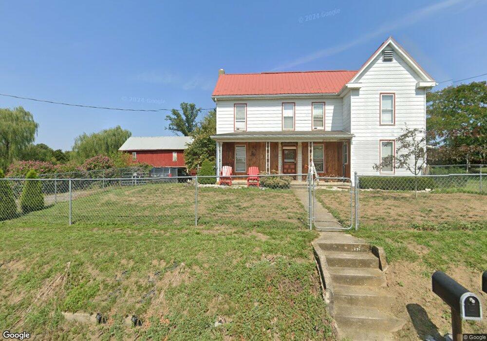
3431 Hill Rd Unit CLAY Greencastle, PA 17225
Estimated Value: $504,000 - $663,000
--
Bed
1
Bath
3,245
Sq Ft
$183/Sq Ft
Est. Value
About This Home
This home is located at 3431 Hill Rd Unit CLAY, Greencastle, PA 17225 and is currently estimated at $592,872, approximately $182 per square foot. 3431 Hill Rd Unit CLAY is a home located in Franklin County with nearby schools including Greencastle-Antrim Primary School, Greencastle-Antrim Elementary School, and Greencastle-Antrim Middle School.
Ownership History
Date
Name
Owned For
Owner Type
Purchase Details
Closed on
Jan 8, 2014
Sold by
Maple Springs Llc
Bought by
Hess Galen E and Hess Monica J
Current Estimated Value
Home Financials for this Owner
Home Financials are based on the most recent Mortgage that was taken out on this home.
Original Mortgage
$130,000
Outstanding Balance
$97,765
Interest Rate
4.29%
Mortgage Type
Future Advance Clause Open End Mortgage
Estimated Equity
$495,107
Purchase Details
Closed on
Mar 29, 2005
Sold by
Franklin County Tax Claim Bureau
Bought by
Weller Martin L and Weller Diana M
Create a Home Valuation Report for This Property
The Home Valuation Report is an in-depth analysis detailing your home's value as well as a comparison with similar homes in the area
Home Values in the Area
Average Home Value in this Area
Purchase History
| Date | Buyer | Sale Price | Title Company |
|---|---|---|---|
| Hess Galen E | $320,764 | None Available | |
| Weller Martin L | $339 | None Available |
Source: Public Records
Mortgage History
| Date | Status | Borrower | Loan Amount |
|---|---|---|---|
| Open | Hess Galen E | $130,000 |
Source: Public Records
Tax History Compared to Growth
Tax History
| Year | Tax Paid | Tax Assessment Tax Assessment Total Assessment is a certain percentage of the fair market value that is determined by local assessors to be the total taxable value of land and additions on the property. | Land | Improvement |
|---|---|---|---|---|
| 2025 | $4,981 | $34,140 | $4,310 | $29,830 |
| 2024 | $4,828 | $34,140 | $4,310 | $29,830 |
| 2023 | $4,695 | $34,140 | $4,310 | $29,830 |
| 2022 | $4,558 | $34,140 | $4,310 | $29,830 |
| 2021 | $4,422 | $34,140 | $4,310 | $29,830 |
| 2020 | $4,422 | $34,140 | $4,310 | $29,830 |
| 2019 | $4,319 | $34,140 | $4,310 | $29,830 |
| 2018 | $4,174 | $34,140 | $4,310 | $29,830 |
| 2017 | $3,442 | $28,800 | $4,310 | $24,490 |
| 2016 | $719 | $25,090 | $4,310 | $20,780 |
| 2015 | $670 | $25,090 | $4,310 | $20,780 |
| 2014 | $670 | $25,090 | $4,310 | $20,780 |
Source: Public Records
Map
Nearby Homes
- 1256 Emilys Ct
- 9337 Lindale Ave
- 3632 Oakley Ln
- 3125 Buchanan Trail W
- 3474 Harold Place
- 9705 Rabbit Rd S
- 281 Toms Ln
- 707 Shook Ct W
- 2384 Castlegreen Dr
- 11765 Melrose Ave
- 20 Helens Dr
- LOT 666B Maya Dr
- 5089 Buchanan Trail W
- 7980 Golf Vista Dr
- 107 Makayla Dr
- 10937 Grant Shook Rd
- 10925 Grant Shook Rd
- 8140 Golf Vista Dr
- 112526 Delanie Dr
- 112521 Delanie Dr