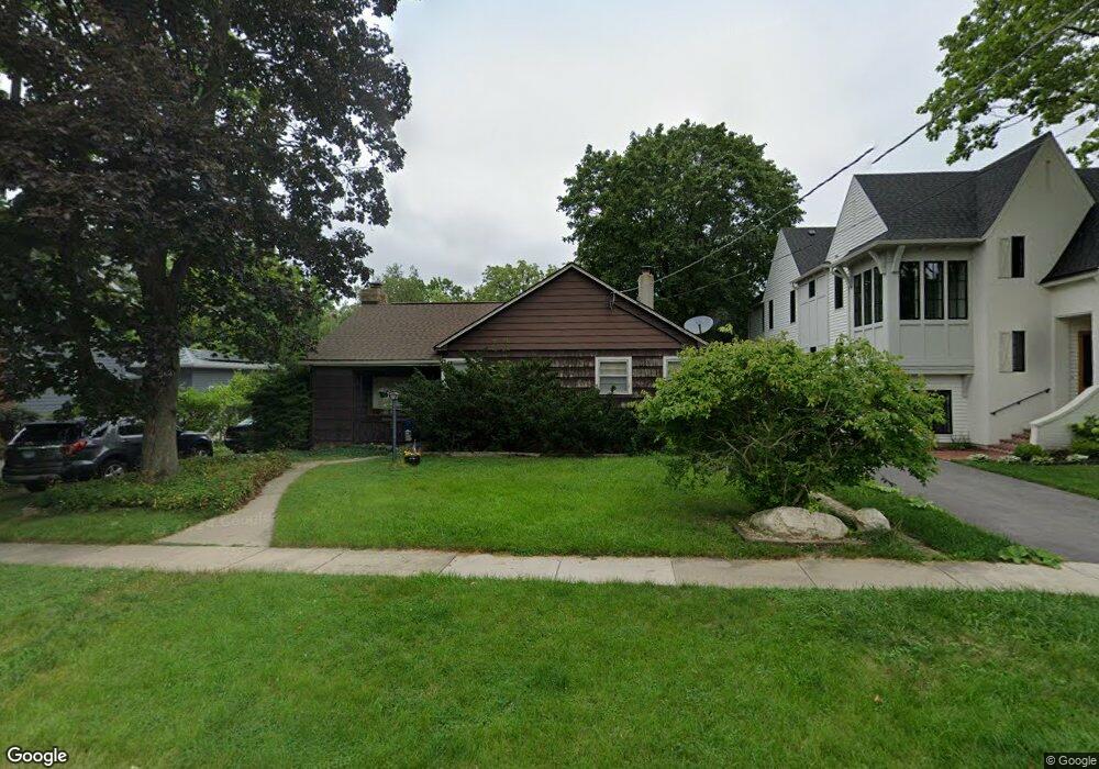
344 Mckinley Ave Libertyville, IL 60048
South Libertyville NeighborhoodEstimated Value: $510,000 - $575,000
--
Bed
2
Baths
1,518
Sq Ft
$357/Sq Ft
Est. Value
About This Home
This home is located at 344 Mckinley Ave, Libertyville, IL 60048 and is currently estimated at $541,390, approximately $356 per square foot. 344 Mckinley Ave is a home located in Lake County with nearby schools including Rockland Elementary School, Highland Middle School, and Libertyville High School.
Ownership History
Date
Name
Owned For
Owner Type
Purchase Details
Closed on
Nov 6, 2002
Sold by
Vento Donald V and Trust #344
Bought by
Hoaglin Michael J and Hoaglin Mary R
Current Estimated Value
Home Financials for this Owner
Home Financials are based on the most recent Mortgage that was taken out on this home.
Original Mortgage
$150,000
Interest Rate
6.23%
Purchase Details
Closed on
Jun 3, 1999
Sold by
Rogers Evon and Trust #Dvi
Bought by
Vento Donald V and Trust #344
Create a Home Valuation Report for This Property
The Home Valuation Report is an in-depth analysis detailing your home's value as well as a comparison with similar homes in the area
Home Values in the Area
Average Home Value in this Area
Purchase History
| Date | Buyer | Sale Price | Title Company |
|---|---|---|---|
| Hoaglin Michael J | $300,000 | First American Title | |
| Vento Donald V | -- | -- |
Source: Public Records
Mortgage History
| Date | Status | Borrower | Loan Amount |
|---|---|---|---|
| Closed | Hoaglin Michael J | $150,000 |
Source: Public Records
Tax History Compared to Growth
Tax History
| Year | Tax Paid | Tax Assessment Tax Assessment Total Assessment is a certain percentage of the fair market value that is determined by local assessors to be the total taxable value of land and additions on the property. | Land | Improvement |
|---|---|---|---|---|
| 2024 | $8,988 | $129,680 | $79,976 | $49,704 |
| 2023 | $8,714 | $119,609 | $73,765 | $45,844 |
| 2022 | $8,714 | $114,952 | $70,900 | $44,052 |
| 2021 | $8,386 | $112,478 | $69,374 | $43,104 |
| 2020 | $8,613 | $117,646 | $72,562 | $45,084 |
| 2019 | $8,399 | $116,527 | $71,872 | $44,655 |
| 2018 | $8,076 | $115,969 | $71,276 | $44,693 |
| 2017 | $7,961 | $112,308 | $69,026 | $43,282 |
| 2016 | $7,690 | $106,483 | $65,446 | $41,037 |
| 2015 | $7,610 | $99,526 | $61,170 | $38,356 |
| 2014 | $7,204 | $91,765 | $56,401 | $35,364 |
| 2012 | $6,963 | $93,499 | $57,466 | $36,033 |
Source: Public Records
Map
Nearby Homes
- 308 Mckinley Ave
- 551 W Park Ave Unit E
- 1754 Glenmore Rd
- 423 Ames St
- 0 Ames St
- 212 Elm Ct
- 505 Lange Ct
- 420 W Cook Ave
- 426 S Milwaukee Ave
- 533 Drake St
- 217 E Church St
- 112 3rd St
- 747 Garfield Ave Unit C
- 121 4th St
- 401 S 4th Ave
- 777 Garfield Ave Unit A
- 224 Newberry Ave
- 601 Broadway St
- 1137 Pine Tree Ln
- 851 Garfield Ave Unit C
- 408 Mckinley Ave
- 340 Mckinley Ave
- 412 Mckinley Ave
- 326 Mckinley Ave
- 322 Mckinley Ave
- 260 Florence Ct
- 420 Mckinley Ave
- 262 Florence Ct
- 318 Mckinley Ave
- 401 Mckinley Ave
- 248 Florence Ct Unit 248
- 246 Florence Ct
- 424 Mckinley Ave
- 333 Mckinley Ave
- 407 Mckinley Ave
- 329 Mckinley Ave
- 312 Mckinley Ave
- 415 Mckinley Ave
- 325 Mckinley Ave
- 419 Mckinley Ave