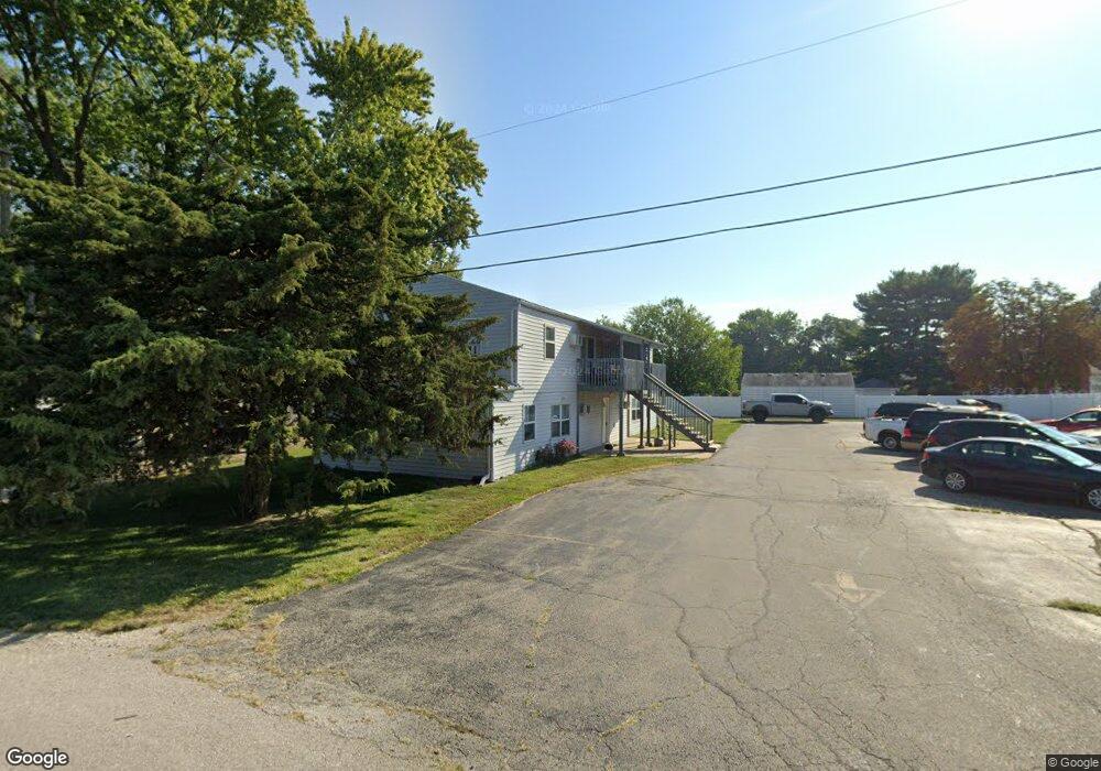
345 N Shabbona St Coal City, IL 60416
Estimated Value: $270,000 - $326,000
8
Beds
4
Baths
2,772
Sq Ft
$111/Sq Ft
Est. Value
About This Home
This home is located at 345 N Shabbona St, Coal City, IL 60416 and is currently estimated at $307,141, approximately $110 per square foot. 345 N Shabbona St is a home located in Grundy County with nearby schools including Coal City Elementary School, Coal City Intermediate School, and Coal City Middle School.
Ownership History
Date
Name
Owned For
Owner Type
Purchase Details
Closed on
Jan 4, 2012
Sold by
America Bk Of
Bought by
Ltd K.D.R. Real Estate
Current Estimated Value
Home Financials for this Owner
Home Financials are based on the most recent Mortgage that was taken out on this home.
Original Mortgage
$243,000
Interest Rate
3.95%
Mortgage Type
Commercial
Create a Home Valuation Report for This Property
The Home Valuation Report is an in-depth analysis detailing your home's value as well as a comparison with similar homes in the area
Home Values in the Area
Average Home Value in this Area
Purchase History
| Date | Buyer | Sale Price | Title Company |
|---|---|---|---|
| Ltd K.D.R. Real Estate | $108,000 | -- |
Source: Public Records
Mortgage History
| Date | Status | Borrower | Loan Amount |
|---|---|---|---|
| Closed | Ltd K.D.R. Real Estate | $243,000 |
Source: Public Records
Tax History Compared to Growth
Tax History
| Year | Tax Paid | Tax Assessment Tax Assessment Total Assessment is a certain percentage of the fair market value that is determined by local assessors to be the total taxable value of land and additions on the property. | Land | Improvement |
|---|---|---|---|---|
| 2024 | $4,811 | $65,548 | $9,821 | $55,727 |
| 2023 | $4,501 | $61,323 | $9,188 | $52,135 |
| 2022 | $4,242 | $57,445 | $8,607 | $48,838 |
| 2021 | $4,060 | $54,296 | $8,135 | $46,161 |
| 2020 | $3,978 | $53,206 | $7,972 | $45,234 |
| 2019 | $3,713 | $50,195 | $7,521 | $42,674 |
| 2018 | $3,668 | $50,289 | $7,535 | $42,754 |
| 2017 | $3,449 | $48,472 | $7,263 | $41,209 |
| 2016 | $3,397 | $48,120 | $7,210 | $40,910 |
| 2015 | $3,119 | $46,529 | $6,972 | $39,557 |
| 2014 | $3,066 | $45,787 | $6,861 | $38,926 |
| 2013 | $3,076 | $46,650 | $6,990 | $39,660 |
Source: Public Records
Map
Nearby Homes
- 295 N Lincoln St
- 540 N 1st Ave
- 395 N Kankakee St
- Lot 2 Mcardle Rd
- Lot 6 Mcardle Rd
- Lot 1 Mcardle Rd
- Lot 3 Mcardle Rd
- Lot 5 Mcardle Rd
- Lot 4 Mcardle Rd
- 105 N Kankakee St
- 385 S Kankakee St
- 0 E Division St Unit MRD12083414
- 1060 Regent Ct
- 310 W Oak St
- 573-585 S Mazon St
- 595 W Rathburn St
- 120 E Elm St
- 120 Kevin Dr
- 110 Kevin Dr
- 210 Kevin Dr
- 345 N Shabbona St Unit 2E
- 345 N Shabbona St Unit 1E
- 345 N Shabbona St Unit 2W
- 345 N Shabbona St Unit 1W
- 355 N Shabbona St
- 530 E 3rd St Unit D
- 530 E 3rd St Unit B
- 530 E 3rd St Unit F
- 530 E 3rd St Unit 1E
- 530 E 3rd St Unit A
- 530 E 3rd St Unit G
- 530 E 3rd St
- 530 E 3rd St Unit E
- 375 N Shabbona St
- 340 N Shabbona St
- 380 N Shabbona St
- 490 E 3rd St
- 360 N Lincoln St
- 390 N Shabbona St
- 505 E 3rd St