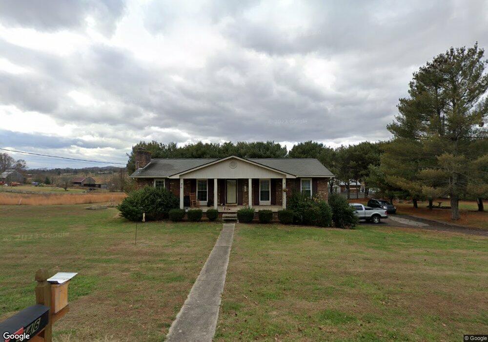
346 Green Ln Blountville, TN 37617
Estimated Value: $218,000 - $479,000
--
Bed
2
Baths
1,377
Sq Ft
$236/Sq Ft
Est. Value
About This Home
This home is located at 346 Green Ln, Blountville, TN 37617 and is currently estimated at $325,076, approximately $236 per square foot. 346 Green Ln is a home located in Sullivan County with nearby schools including Holston Elementary School, Sullivan Central Middle School, and Tri-Cities Christian Academy.
Ownership History
Date
Name
Owned For
Owner Type
Purchase Details
Closed on
Oct 23, 2017
Sold by
Chandler Scotty A and Chandler Stephen A
Bought by
Gilbert Claude B
Current Estimated Value
Home Financials for this Owner
Home Financials are based on the most recent Mortgage that was taken out on this home.
Original Mortgage
$119,300
Outstanding Balance
$99,542
Interest Rate
3.78%
Mortgage Type
New Conventional
Estimated Equity
$225,534
Purchase Details
Closed on
Jan 29, 2004
Sold by
Chandler Steve A and Chandler Pamela J
Bought by
Deloris Chandler
Purchase Details
Closed on
Oct 30, 1995
Create a Home Valuation Report for This Property
The Home Valuation Report is an in-depth analysis detailing your home's value as well as a comparison with similar homes in the area
Home Values in the Area
Average Home Value in this Area
Purchase History
| Date | Buyer | Sale Price | Title Company |
|---|---|---|---|
| Gilbert Claude B | $116,000 | Ecu Title | |
| Deloris Chandler | -- | -- | |
| -- | $72,000 | -- |
Source: Public Records
Mortgage History
| Date | Status | Borrower | Loan Amount |
|---|---|---|---|
| Open | Gilbert Claude B | $119,300 |
Source: Public Records
Tax History Compared to Growth
Tax History
| Year | Tax Paid | Tax Assessment Tax Assessment Total Assessment is a certain percentage of the fair market value that is determined by local assessors to be the total taxable value of land and additions on the property. | Land | Improvement |
|---|---|---|---|---|
| 2024 | $829 | $33,200 | $4,325 | $28,875 |
| 2023 | $799 | $33,200 | $4,325 | $28,875 |
| 2022 | $799 | $33,200 | $4,325 | $28,875 |
| 2021 | $799 | $33,200 | $4,325 | $28,875 |
| 2020 | $798 | $33,200 | $4,325 | $28,875 |
| 2019 | $798 | $31,050 | $4,325 | $26,725 |
| 2018 | $792 | $31,050 | $4,325 | $26,725 |
| 2017 | $792 | $31,050 | $4,325 | $26,725 |
| 2016 | $757 | $29,375 | $4,325 | $25,050 |
| 2014 | $677 | $29,378 | $0 | $0 |
Source: Public Records
Map
Nearby Homes
- 355 Holston Dr
- 101 Bond Town Rd
- 550 Country View Private Dr
- 2188 Tennessee 75
- 210 Centenary Rd
- The Quinn Plan at Ashland Oaks
- The Audrey Plan at Ashland Oaks
- Phoenix Single Plan at Ashland Oaks
- 132 Sanders St
- 1091 Shipley Ferry Rd
- 239 Brown Cir
- 129 Forest Ln N
- 304 Rutledge Ln
- 205 Grande Harbor Way
- 191 Grande Harbor Way
- 148 Forest Ln S
- 295 Brown Cir
- 205 Forest Ct
- 999 Muddy Creek Rd
- 1009 Muddy Creek Rd