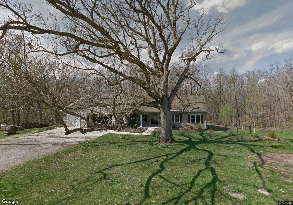
3485 Martha Dr Decatur, IL 62521
Estimated Value: $203,000 - $329,494
--
Bed
1
Bath
2,256
Sq Ft
$130/Sq Ft
Est. Value
About This Home
This home is located at 3485 Martha Dr, Decatur, IL 62521 and is currently estimated at $293,874, approximately $130 per square foot. 3485 Martha Dr is a home located in Macon County with nearby schools including McGaughey Elementary School, Mt. Zion Elementary School, and Mt. Zion Intermediate School.
Ownership History
Date
Name
Owned For
Owner Type
Purchase Details
Closed on
Sep 3, 2013
Sold by
Nunn William E and Nunn Sharon L
Bought by
Ratts Darryl A and Catherine Ratts A
Current Estimated Value
Home Financials for this Owner
Home Financials are based on the most recent Mortgage that was taken out on this home.
Original Mortgage
$222,800
Outstanding Balance
$165,534
Interest Rate
4.29%
Mortgage Type
New Conventional
Estimated Equity
$128,340
Purchase Details
Closed on
Apr 18, 2006
Sold by
Fair John D and Fair Amy M
Bought by
Nunn William E and Nunn Sharon L
Create a Home Valuation Report for This Property
The Home Valuation Report is an in-depth analysis detailing your home's value as well as a comparison with similar homes in the area
Home Values in the Area
Average Home Value in this Area
Purchase History
| Date | Buyer | Sale Price | Title Company |
|---|---|---|---|
| Ratts Darryl A | $278,500 | Decatur Title Company Llc | |
| Nunn William E | $25,000 | None Available |
Source: Public Records
Mortgage History
| Date | Status | Borrower | Loan Amount |
|---|---|---|---|
| Open | Ratts Darryl A | $222,800 |
Source: Public Records
Tax History Compared to Growth
Tax History
| Year | Tax Paid | Tax Assessment Tax Assessment Total Assessment is a certain percentage of the fair market value that is determined by local assessors to be the total taxable value of land and additions on the property. | Land | Improvement |
|---|---|---|---|---|
| 2024 | $4,758 | $86,666 | $5,742 | $80,924 |
| 2023 | $4,588 | $80,529 | $5,335 | $75,194 |
| 2022 | $4,286 | $75,717 | $5,016 | $70,701 |
| 2021 | $4,140 | $71,782 | $4,756 | $67,026 |
| 2020 | $3,960 | $68,605 | $4,546 | $64,059 |
| 2019 | $3,960 | $68,605 | $4,546 | $64,059 |
| 2018 | $3,853 | $67,102 | $4,446 | $62,656 |
| 2017 | $3,832 | $66,273 | $4,391 | $61,882 |
| 2016 | $3,441 | $60,611 | $4,388 | $56,223 |
| 2015 | $3,663 | $59,833 | $4,332 | $55,501 |
| 2014 | $3,556 | $59,833 | $4,332 | $55,501 |
| 2013 | $3,620 | $59,833 | $4,332 | $55,501 |
Source: Public Records
Map
Nearby Homes
- 3330 S Baltimore Ave
- 860 W Wildwood Dr
- 1610 Robin Ct
- 50 Sundance Dr
- 2130 Buckhead Ave
- 2125 Buckhead Ave
- 1625 Ridgewood Ct
- 2110 Buckhead Ln
- 1820 Buckhead Ln
- 2020 Buckhead Ln
- 2030 Buckhead Ln
- 925 S Wildwood Dr
- 1935 Buckhead Ct
- 695 Country Ct
- 570 Fawn Ct
- 3930 S Mount Zion Rd
- 2554 S Nantucket Dr
- 2571 Lansdowne Dr
- 1440 N Alexander Dr
- 2504 S Nantucket Dr
- 3490 Martha Dr
- 3495 Martha Dr
- 3475 Martha Dr
- 3480 Martha Dr
- 4505 Walton Dr
- 3470 Martha Dr
- 4534 Walton Dr
- 4544 Walton Dr
- 3460 Martha Dr
- 4545 Walton Dr
- 4533 Walton Dr
- 3495 Jeanette Dr
- 3485 Jeanette Dr
- 3471 Jeanette Dr
- 4595 Walton Dr
- 3434 Martha Dr
- 3459 Jeanette Dr
- 4597 Walton Dr
- 3490 Jeanette Dr
- 3480 Jeanette Dr