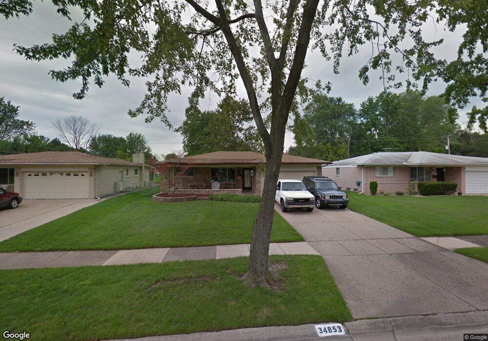
34853 Robinson Ct Sterling Heights, MI 48310
Estimated Value: $331,000 - $368,000
--
Bed
--
Bath
1,618
Sq Ft
$212/Sq Ft
Est. Value
About This Home
This home is located at 34853 Robinson Ct, Sterling Heights, MI 48310 and is currently estimated at $343,233, approximately $212 per square foot. 34853 Robinson Ct is a home located in Macomb County with nearby schools including Angus Elementary School, Grissom Middle School, and Warren Mott High School.
Ownership History
Date
Name
Owned For
Owner Type
Purchase Details
Closed on
May 9, 2007
Sold by
Ciach James E and Ciach Karen S
Bought by
Buck Randall B
Current Estimated Value
Home Financials for this Owner
Home Financials are based on the most recent Mortgage that was taken out on this home.
Original Mortgage
$202,800
Outstanding Balance
$124,029
Interest Rate
6.27%
Mortgage Type
New Conventional
Estimated Equity
$219,204
Purchase Details
Closed on
Jan 30, 1997
Sold by
Fabbri T and Fabbri C
Bought by
Ciach J and Ciach K
Create a Home Valuation Report for This Property
The Home Valuation Report is an in-depth analysis detailing your home's value as well as a comparison with similar homes in the area
Home Values in the Area
Average Home Value in this Area
Purchase History
| Date | Buyer | Sale Price | Title Company |
|---|---|---|---|
| Buck Randall B | $202,800 | Alpha Title Agency Inc | |
| Ciach J | $145,000 | -- |
Source: Public Records
Mortgage History
| Date | Status | Borrower | Loan Amount |
|---|---|---|---|
| Open | Buck Randall B | $202,800 |
Source: Public Records
Tax History Compared to Growth
Tax History
| Year | Tax Paid | Tax Assessment Tax Assessment Total Assessment is a certain percentage of the fair market value that is determined by local assessors to be the total taxable value of land and additions on the property. | Land | Improvement |
|---|---|---|---|---|
| 2025 | $4,390 | $160,500 | $0 | $0 |
| 2024 | $4,052 | $152,500 | $0 | $0 |
| 2023 | $3,883 | $140,000 | $0 | $0 |
| 2022 | $4,051 | $132,000 | $0 | $0 |
| 2021 | $4,160 | $123,300 | $0 | $0 |
| 2020 | $4,027 | $114,600 | $0 | $0 |
| 2019 | $3,447 | $106,100 | $0 | $0 |
| 2018 | $3,834 | $93,900 | $0 | $0 |
| 2017 | $3,813 | $91,800 | $19,900 | $71,900 |
| 2016 | $3,447 | $91,800 | $0 | $0 |
| 2015 | -- | $85,500 | $0 | $0 |
| 2014 | -- | $70,200 | $0 | $0 |
Source: Public Records
Map
Nearby Homes
- 3538 Cero Dr
- 2528 Koper Dr
- 2630 Pall Mall Dr
- 2600 Pall Mall Dr
- 3040 Alden Dr
- 2269 Serra Dr
- 4468 15 Mile Rd Unit F104
- 2268 Serra Dr
- 35078 Cavant Dr
- 4215 Nickolas Dr
- 33569 Breckenridge Dr
- 35272 Vito Dr
- 3131 Elmcrest Rd
- 2448 Oakcrest Rd
- 2109 Chesley Dr
- 33735 Kennedy Dr
- 2121 Chesley Dr
- 33731 Newport Dr
- 3528 Byrd Dr
- 2595 Elmcrest Rd
- 34841 Robinson Ct
- 34865 Robinson Ct
- 34829 Robinson Ct
- 34877 Robinson Ct
- 34856 Robinson Ct
- 34817 Robinson Ct
- 34844 Robinson Ct
- 34868 Robinson Ct
- 34889 Robinson Ct
- 34832 Robinson Ct
- 34880 Robinson Ct
- 34803 Robinson Ct
- 34775 Forman Dr
- 34892 Robinson Ct
- 3411 Rhoten Dr
- 34654 Sandwood Dr
- 3427 Rhoten Dr
- 34763 Robinson Ct
- 34763 Forman Dr
- 3439 Rhoten Dr