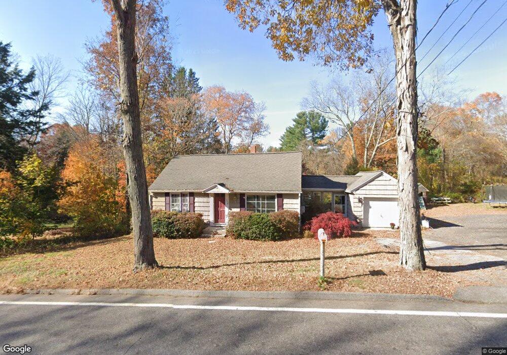
349 Route 197 Woodstock, CT 06281
Estimated Value: $268,000 - $365,000
2
Beds
1
Bath
1,229
Sq Ft
$265/Sq Ft
Est. Value
About This Home
This home is located at 349 Route 197, Woodstock, CT 06281 and is currently estimated at $325,171, approximately $264 per square foot. 349 Route 197 is a home located in Windham County with nearby schools including Woodstock Elementary School, Woodstock Middle School, and The Woodstock Academy.
Ownership History
Date
Name
Owned For
Owner Type
Purchase Details
Closed on
Oct 16, 2009
Sold by
Fhlmc
Bought by
Ellis 2Nd James
Current Estimated Value
Home Financials for this Owner
Home Financials are based on the most recent Mortgage that was taken out on this home.
Original Mortgage
$127,546
Interest Rate
5.14%
Mortgage Type
Purchase Money Mortgage
Purchase Details
Closed on
Jun 14, 2002
Sold by
Peiser Rudolph E and Peiser Laura L
Bought by
Edmonston Steven P
Create a Home Valuation Report for This Property
The Home Valuation Report is an in-depth analysis detailing your home's value as well as a comparison with similar homes in the area
Home Values in the Area
Average Home Value in this Area
Purchase History
| Date | Buyer | Sale Price | Title Company |
|---|---|---|---|
| Ellis 2Nd James | $129,900 | -- | |
| Edmonston Steven P | $75,000 | -- |
Source: Public Records
Mortgage History
| Date | Status | Borrower | Loan Amount |
|---|---|---|---|
| Open | Edmonston Steven P | $118,288 | |
| Closed | Edmonston Steven P | $127,546 | |
| Previous Owner | Edmonston Steven P | $50,000 |
Source: Public Records
Tax History Compared to Growth
Tax History
| Year | Tax Paid | Tax Assessment Tax Assessment Total Assessment is a certain percentage of the fair market value that is determined by local assessors to be the total taxable value of land and additions on the property. | Land | Improvement |
|---|---|---|---|---|
| 2025 | $3,552 | $145,500 | $33,600 | $111,900 |
| 2024 | $3,352 | $145,500 | $33,600 | $111,900 |
| 2023 | $3,261 | $145,500 | $33,600 | $111,900 |
| 2022 | $3,034 | $145,500 | $33,600 | $111,900 |
| 2021 | $3,055 | $119,800 | $33,600 | $86,200 |
| 2020 | $2,577 | $105,200 | $33,600 | $71,600 |
| 2019 | $2,577 | $105,200 | $33,600 | $71,600 |
| 2018 | $2,577 | $105,200 | $33,600 | $71,600 |
| 2017 | $2,556 | $105,200 | $33,600 | $71,600 |
| 2016 | $2,344 | $97,500 | $44,100 | $53,400 |
| 2015 | $2,278 | $97,500 | $44,100 | $53,400 |
| 2014 | $2,252 | $97,500 | $44,100 | $53,400 |
Source: Public Records
Map
Nearby Homes
- 36 Olde Meadow Rd
- 417 Dugg Hill Rd
- 00 Prospect St
- 0 Blash Rd Unit 24105055
- 81 Parkway Dr
- 1669 Route 169
- 10 Highland Dr
- 71 Rawson Rd
- 26 Center Rd
- 0 English Neighborhood Rd
- 126 Old Southbridge Rd
- 0 Center Rd
- 128 Old Southbridge Rd
- 40 Hagstrom Rd
- 468 Fabyan Rd
- 10 Green Acres Ln
- 433 Fabyan Rd
- 1023 N Woodstock Rd
- 101 Center Rd
- 717 Tipton Rock Rd
- 260 Prospect St
- 361 Route 197
- 264 Prospect St
- 246 Prospect St
- 371 Route 197
- 356 Route 197
- 0 Olde Meadow Rd Unit E269612
- 0 Olde Meadow Rd Unit E269610
- 0 Olde Meadow Rd Unit G495893
- 0 Olde Meadow Rd Unit G495897
- 0 Olde Meadow Rd Unit E227705
- 0 Olde Meadow Rd Unit E227701
- 0 Olde Meadow Rd Unit E250341
- 0 Olde Meadow Rd Unit E250342
- 0 Olde Meadow Rd Unit E260703
- 0 Olde Meadow Rd Unit E260702
- 0 Olde Meadow Rd Unit G671570
- 0 Olde Meadow Rd Unit G10155203
- 0 Olde Meadow Rd Unit G10153896
- 0000 Olde Meadow Rd