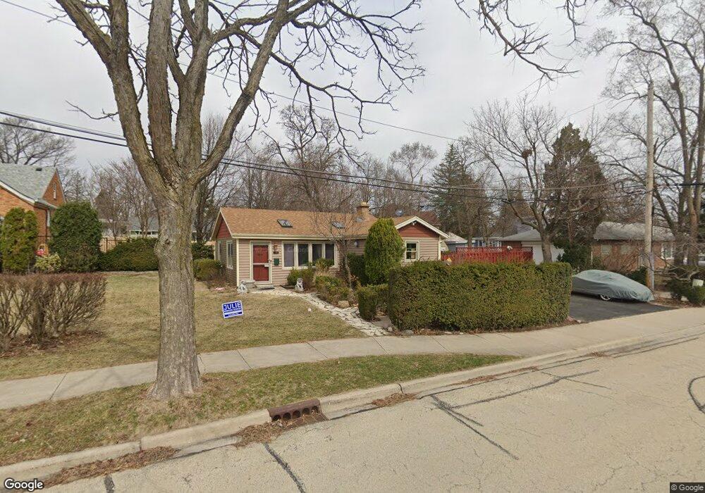
349 S Brewster Ave Lombard, IL 60148
North Lombard NeighborhoodEstimated Value: $282,396 - $436,000
--
Bed
--
Bath
1,049
Sq Ft
$340/Sq Ft
Est. Value
About This Home
This home is located at 349 S Brewster Ave, Lombard, IL 60148 and is currently estimated at $356,349, approximately $339 per square foot. 349 S Brewster Ave is a home located in DuPage County with nearby schools including Madison Elementary School, Wm Hammerschmidt Elementary School, and Pleasant Lane Elementary School.
Ownership History
Date
Name
Owned For
Owner Type
Purchase Details
Closed on
Mar 27, 1998
Sold by
Sasicki Richard L and Sasicki Josie V
Bought by
Velasco Sarah J
Current Estimated Value
Home Financials for this Owner
Home Financials are based on the most recent Mortgage that was taken out on this home.
Original Mortgage
$102,250
Outstanding Balance
$19,393
Interest Rate
7.09%
Mortgage Type
FHA
Estimated Equity
$336,956
Purchase Details
Closed on
Oct 5, 1993
Sold by
Susicki Richard L
Bought by
Susicki Josie
Create a Home Valuation Report for This Property
The Home Valuation Report is an in-depth analysis detailing your home's value as well as a comparison with similar homes in the area
Home Values in the Area
Average Home Value in this Area
Purchase History
| Date | Buyer | Sale Price | Title Company |
|---|---|---|---|
| Velasco Sarah J | $121,000 | -- | |
| Susicki Josie | -- | -- |
Source: Public Records
Mortgage History
| Date | Status | Borrower | Loan Amount |
|---|---|---|---|
| Open | Velasco Sarah J | $102,250 |
Source: Public Records
Tax History Compared to Growth
Tax History
| Year | Tax Paid | Tax Assessment Tax Assessment Total Assessment is a certain percentage of the fair market value that is determined by local assessors to be the total taxable value of land and additions on the property. | Land | Improvement |
|---|---|---|---|---|
| 2024 | $5,719 | $81,613 | $22,277 | $59,336 |
| 2023 | $5,426 | $75,470 | $20,600 | $54,870 |
| 2022 | $5,310 | $72,540 | $19,800 | $52,740 |
| 2021 | $5,140 | $70,740 | $19,310 | $51,430 |
| 2020 | $5,029 | $69,190 | $18,890 | $50,300 |
| 2019 | $4,769 | $65,780 | $17,960 | $47,820 |
| 2018 | $4,827 | $64,160 | $23,170 | $40,990 |
| 2017 | $4,683 | $61,140 | $22,080 | $39,060 |
| 2016 | $4,545 | $57,600 | $20,800 | $36,800 |
| 2015 | $4,282 | $53,660 | $19,380 | $34,280 |
| 2014 | $4,237 | $51,790 | $24,140 | $27,650 |
| 2013 | $4,175 | $52,520 | $24,480 | $28,040 |
Source: Public Records
Map
Nearby Homes
- 407 S Brewster Ave
- 465 S Elizabeth St
- 250 St Regis
- 408 S Miller Ct
- 575 S Finley Rd
- 1 S Lincoln Ave Unit 301
- 23 N West Rd
- 121 W Park Dr
- 635 S Finley Rd
- 6 W Harding Rd
- 78 N Elizabeth St
- 25 E Parkside Ave
- 49 Orchard Terrace Unit 1
- 635 S Charlotte St
- 107 S Charlotte St
- 555 W Saint Charles Rd
- 564 W Harrison Rd
- 610 Hammerschmidt Ave
- 33 N Main St Unit 11A
- 105 E Grove St
- 390 S Elizabeth St
- 343 S Brewster Ave
- 384 S Elizabeth St
- 401 S Brewster Ave
- 337 S Brewster Ave
- 400 S Elizabeth St
- 380 S Elizabeth St
- 376 S Elizabeth St
- 410 S Elizabeth St
- 420 S Elizabeth St
- 411 S Brewster Ave
- 372 S Elizabeth St
- 399 S Elizabeth St
- 350 S Brewster Ave
- 325 S Brewster Ave
- 342 S Brewster Ave
- 430 S Elizabeth St
- 255 W Hickory Rd
- 338 S Brewster Ave
- 404 S Brewster Ave