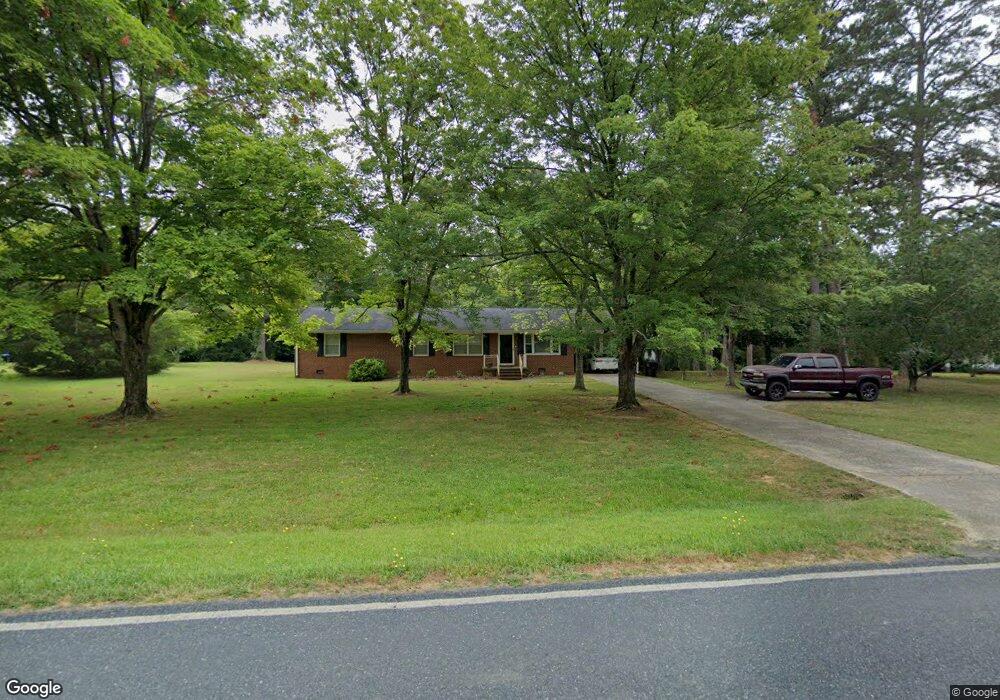
349 Sawyersville Rd Asheboro, NC 27205
Estimated Value: $209,241 - $289,000
--
Bed
1
Bath
1,624
Sq Ft
$164/Sq Ft
Est. Value
About This Home
This home is located at 349 Sawyersville Rd, Asheboro, NC 27205 and is currently estimated at $266,060, approximately $163 per square foot. 349 Sawyersville Rd is a home located in Randolph County with nearby schools including Sycamore Elementary School, Tabernacle Elementary School, and Uwharrie Ridge Six-Twelve.
Ownership History
Date
Name
Owned For
Owner Type
Purchase Details
Closed on
Jan 25, 2010
Sold by
Hoover Michael Dale and Hoover Angela Morgan
Bought by
Hoover Michael Dale
Current Estimated Value
Home Financials for this Owner
Home Financials are based on the most recent Mortgage that was taken out on this home.
Original Mortgage
$129,222
Outstanding Balance
$86,843
Interest Rate
5.5%
Mortgage Type
FHA
Estimated Equity
$179,217
Purchase Details
Closed on
Nov 6, 1996
Bought by
Hoover Michael Dale
Create a Home Valuation Report for This Property
The Home Valuation Report is an in-depth analysis detailing your home's value as well as a comparison with similar homes in the area
Home Values in the Area
Average Home Value in this Area
Purchase History
| Date | Buyer | Sale Price | Title Company |
|---|---|---|---|
| Hoover Michael Dale | -- | None Available | |
| Hoover Michael Dale | $60,000 | -- |
Source: Public Records
Mortgage History
| Date | Status | Borrower | Loan Amount |
|---|---|---|---|
| Open | Hoover Michael Dale | $129,222 |
Source: Public Records
Tax History Compared to Growth
Tax History
| Year | Tax Paid | Tax Assessment Tax Assessment Total Assessment is a certain percentage of the fair market value that is determined by local assessors to be the total taxable value of land and additions on the property. | Land | Improvement |
|---|---|---|---|---|
| 2025 | $1,027 | $155,530 | $44,460 | $111,070 |
| 2024 | $1,011 | $155,530 | $44,460 | $111,070 |
| 2023 | $1,011 | $155,530 | $44,460 | $111,070 |
| 2022 | $809 | $103,410 | $26,380 | $77,030 |
| 2021 | $809 | $103,410 | $26,380 | $77,030 |
| 2020 | $789 | $103,410 | $26,380 | $77,030 |
| 2019 | $789 | $103,410 | $26,380 | $77,030 |
| 2018 | $769 | $98,310 | $21,820 | $76,490 |
| 2016 | $759 | $98,311 | $21,820 | $76,491 |
| 2015 | $752 | $98,311 | $21,820 | $76,491 |
| 2014 | $746 | $98,311 | $21,820 | $76,491 |
Source: Public Records
Map
Nearby Homes
- 0 Gregory Ct
- 941 Sawyersville Rd
- 5218 Old Lexington Rd
- 4804 Old Lexington Rd
- 388 Back Creek Rd
- 1669 Moore Rd
- 2547 Beechwood Dr
- 2140 Poole Town Rd
- 2209 Cedarwood Ct
- 1191 Back Creek Rd
- 1746 Taylors Creek Dr
- 00 U S Highway 64
- 677 Mount Shepherd Rd
- 1559 Allen Ct
- 0 Nc Highway 49 S Unit 1162269
- 2442 Farmwood Ln
- 1374 W Lake Dr
- 2087 Old Lexington Rd
- 995 Chamberlin Dr
- 1273 Cedar Creek Dr
- 369 Sawyersville Rd
- 337 Sawyersville Rd
- 350 Sawyersville Rd
- 338 Sawyersville Rd
- 328 Sawyersville Rd
- 378 Sawyersville Rd
- 317 Sawyersville Rd
- 396 Sawyersville Rd
- 306 Sawyersville Rd
- 3067 Brookside Ct
- 409 Sawyersville Rd
- 3132 Poplar Forest Ln
- 285 Sawyersville Rd
- 288 Sawyersville Rd
- 3063 Brookside Ct
- 420 Sawyersville Rd
- 3054 Brookside Ct
- 425 Sawyersville Rd
- 273 Sawyersville Rd
- 278 Sawyersville Rd