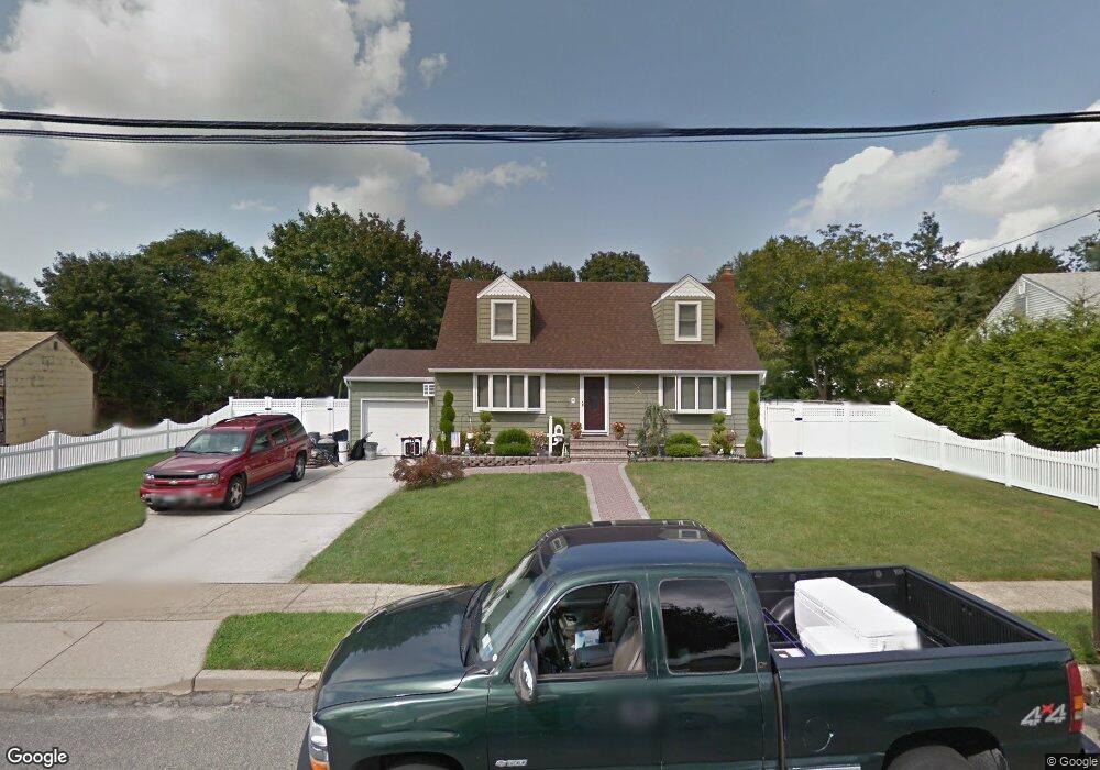
35 Armon Dr Bethpage, NY 11714
Estimated Value: $694,000 - $722,836
--
Bed
2
Baths
1,243
Sq Ft
$570/Sq Ft
Est. Value
About This Home
This home is located at 35 Armon Dr, Bethpage, NY 11714 and is currently estimated at $708,418, approximately $569 per square foot. 35 Armon Dr is a home located in Nassau County with nearby schools including Charles Campagne Elementary School, John F Kennedy Middle School, and Bethpage Senior High School.
Ownership History
Date
Name
Owned For
Owner Type
Purchase Details
Closed on
Dec 16, 1999
Sold by
Peterson Paul G
Bought by
Mercer Robert J and Mercer Kathleen
Current Estimated Value
Home Financials for this Owner
Home Financials are based on the most recent Mortgage that was taken out on this home.
Original Mortgage
$190,000
Interest Rate
7.61%
Mortgage Type
Purchase Money Mortgage
Create a Home Valuation Report for This Property
The Home Valuation Report is an in-depth analysis detailing your home's value as well as a comparison with similar homes in the area
Home Values in the Area
Average Home Value in this Area
Purchase History
| Date | Buyer | Sale Price | Title Company |
|---|---|---|---|
| Mercer Robert J | $237,500 | First American Title Ins Co | |
| Mercer Robert J | $237,500 | First American Title Ins Co | |
| Mercer Robert J | $237,500 | First American Title Ins Co | |
| Mercer Robert J | $237,500 | First American Title Ins Co |
Source: Public Records
Mortgage History
| Date | Status | Borrower | Loan Amount |
|---|---|---|---|
| Closed | Mercer Robert J | $190,000 |
Source: Public Records
Tax History Compared to Growth
Tax History
| Year | Tax Paid | Tax Assessment Tax Assessment Total Assessment is a certain percentage of the fair market value that is determined by local assessors to be the total taxable value of land and additions on the property. | Land | Improvement |
|---|---|---|---|---|
| 2025 | $13,299 | $508 | $383 | $125 |
| 2024 | $5,024 | $508 | $383 | $125 |
| 2023 | $13,031 | $508 | $383 | $125 |
| 2022 | $13,031 | $508 | $383 | $125 |
| 2021 | $13,754 | $493 | $372 | $121 |
| 2020 | $14,279 | $898 | $772 | $126 |
| 2019 | $14,705 | $898 | $772 | $126 |
| 2018 | $13,445 | $898 | $0 | $0 |
| 2017 | $7,214 | $898 | $772 | $126 |
| 2016 | $11,829 | $898 | $772 | $126 |
| 2015 | $4,071 | $898 | $772 | $126 |
| 2014 | $4,071 | $898 | $772 | $126 |
| 2013 | $3,691 | $898 | $772 | $126 |
Source: Public Records
Map
Nearby Homes