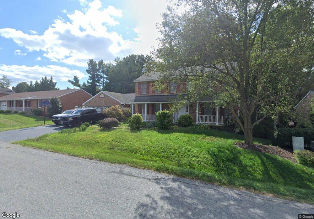
35 Stanford Rd Hagerstown, MD 21742
South End NeighborhoodEstimated Value: $432,000 - $503,000
5
Beds
3
Baths
2,567
Sq Ft
$176/Sq Ft
Est. Value
About This Home
This home is located at 35 Stanford Rd, Hagerstown, MD 21742 and is currently estimated at $451,520, approximately $175 per square foot. 35 Stanford Rd is a home located in Washington County with nearby schools including Ruth Ann Monroe Primary School, Eastern Elementary School, and E. Russell Hicks Middle School.
Ownership History
Date
Name
Owned For
Owner Type
Purchase Details
Closed on
Aug 15, 2018
Sold by
Kershner Barbara A and Kershner Larry W
Bought by
Powell Michael D
Current Estimated Value
Home Financials for this Owner
Home Financials are based on the most recent Mortgage that was taken out on this home.
Original Mortgage
$209,142
Outstanding Balance
$183,078
Interest Rate
4.87%
Mortgage Type
FHA
Estimated Equity
$268,442
Purchase Details
Closed on
Nov 19, 1992
Sold by
Home Construction Corp
Bought by
Kershner Larry W and Kershner Barbara A
Home Financials for this Owner
Home Financials are based on the most recent Mortgage that was taken out on this home.
Original Mortgage
$184,000
Interest Rate
8.32%
Create a Home Valuation Report for This Property
The Home Valuation Report is an in-depth analysis detailing your home's value as well as a comparison with similar homes in the area
Home Values in the Area
Average Home Value in this Area
Purchase History
| Date | Buyer | Sale Price | Title Company |
|---|---|---|---|
| Powell Michael D | $213,000 | Cla Title & Escrow | |
| Kershner Larry W | $189,600 | -- |
Source: Public Records
Mortgage History
| Date | Status | Borrower | Loan Amount |
|---|---|---|---|
| Open | Powell Michael D | $209,142 | |
| Previous Owner | Kershner Larry W | $184,000 |
Source: Public Records
Tax History Compared to Growth
Tax History
| Year | Tax Paid | Tax Assessment Tax Assessment Total Assessment is a certain percentage of the fair market value that is determined by local assessors to be the total taxable value of land and additions on the property. | Land | Improvement |
|---|---|---|---|---|
| 2025 | $3,683 | $385,633 | $0 | $0 |
| 2024 | $3,683 | $355,700 | $65,100 | $290,600 |
| 2023 | $3,449 | $333,100 | $0 | $0 |
| 2022 | $3,215 | $310,500 | $0 | $0 |
| 2021 | $3,052 | $287,900 | $65,100 | $222,800 |
| 2020 | $2,990 | $283,333 | $0 | $0 |
| 2019 | $2,955 | $278,767 | $0 | $0 |
| 2018 | $2,904 | $274,200 | $65,100 | $209,100 |
| 2017 | $2,693 | $264,133 | $0 | $0 |
| 2016 | -- | $254,067 | $0 | $0 |
| 2015 | $2,910 | $244,000 | $0 | $0 |
| 2014 | $2,910 | $244,000 | $0 | $0 |
Source: Public Records
Map
Nearby Homes
- 501 Cornell Ave
- 1 Dartmouth Dr
- 631 Cornell Ave
- 19 Catawba Place
- 21 Harvard Rd
- 1230 Mount Aetna Rd
- 151 Brynwood St
- 190 Brynwood St
- 212 Brynwood St
- 226 Brynwood St
- 1522 Dual Hwy
- 206 Division Ave
- 1001 Jefferson Blvd
- 101 Tulip Ct
- 0 Jefferson Blvd Unit MDWA2032528
- 761 Jefferson Blvd
- 30 Willard St
- 354 Pangborn Blvd
- 732 Jefferson Blvd
- 1619 Dual Hwy
- 39 Stanford Rd
- 31 Stanford Rd
- 43 Stanford Rd
- 42 Stanford Rd
- 9 Sweet Briar Ln
- 38 Stanford Rd
- 5 Sweet Briar Ln
- 34 Stanford Rd
- 46 Stanford Rd
- 1 Sweet Briar Ln
- 219 N Colonial Dr
- 30 Stanford Rd
- 47 Stanford Rd
- 51 Stanford Rd
- 26 Stanford Rd
- 106 Dartmouth Dr
- 110 Dartmouth Dr
- 10 Sweet Briar Ln
- 102 Dartmouth Dr
- 6 Sweet Briar Ln