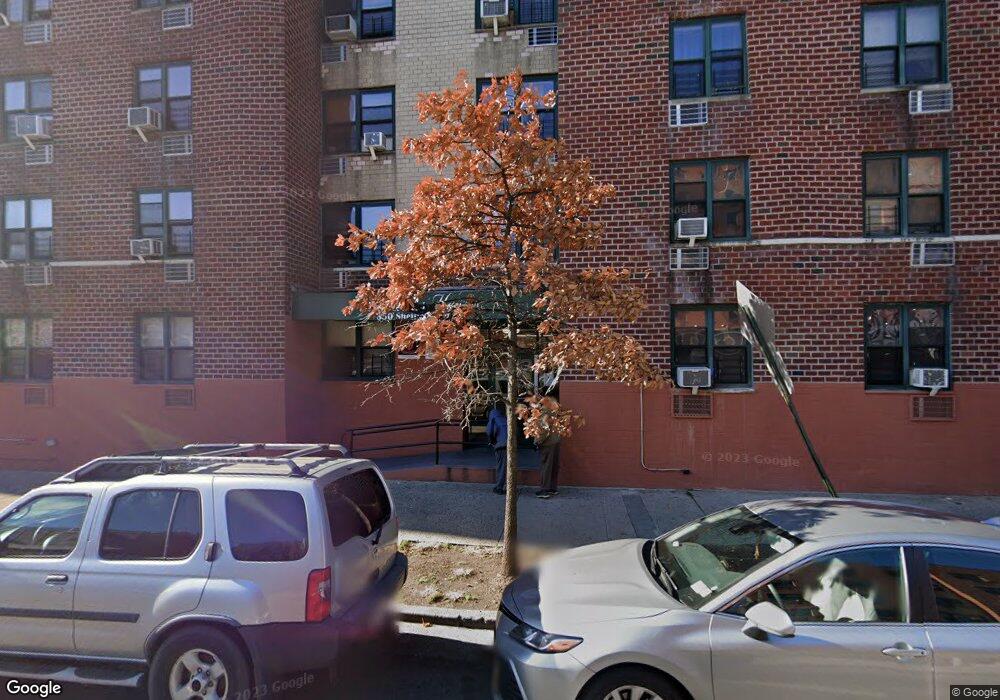
350 Sheffield Ave Brooklyn, NY 11207
Brownsville Neighborhood
--
Bed
--
Bath
2,550
Sq Ft
0.31
Acres
About This Home
This home is located at 350 Sheffield Ave, Brooklyn, NY 11207. 350 Sheffield Ave is a home located in Kings County with nearby schools including P.S. 328 - Phyllis Wheatley, J.H.S 292 Margaret S. Douglas, and Hyde Leadership Charter School-Brooklyn.
Ownership History
Date
Name
Owned For
Owner Type
Purchase Details
Closed on
Dec 23, 2021
Sold by
Remeeder Houses Housing Development Fund
Bought by
Remeeder Houses Housing Development Fund and Remeeder Houses Owner Llc
Home Financials for this Owner
Home Financials are based on the most recent Mortgage that was taken out on this home.
Original Mortgage
$63,000,000
Outstanding Balance
$58,028,314
Interest Rate
3.22%
Mortgage Type
Purchase Money Mortgage
Create a Home Valuation Report for This Property
The Home Valuation Report is an in-depth analysis detailing your home's value as well as a comparison with similar homes in the area
Home Values in the Area
Average Home Value in this Area
Purchase History
| Date | Buyer | Sale Price | Title Company |
|---|---|---|---|
| Remeeder Houses Housing Development Fund | $107,500,000 | -- |
Source: Public Records
Mortgage History
| Date | Status | Borrower | Loan Amount |
|---|---|---|---|
| Open | Remeeder Houses Housing Development Fund | $63,000,000 |
Source: Public Records
Tax History Compared to Growth
Tax History
| Year | Tax Paid | Tax Assessment Tax Assessment Total Assessment is a certain percentage of the fair market value that is determined by local assessors to be the total taxable value of land and additions on the property. | Land | Improvement |
|---|---|---|---|---|
| 2025 | $29,236 | $354,600 | $144,450 | $210,150 |
| 2024 | -- | $309,150 | $144,450 | $164,700 |
| 2023 | $84,754 | $309,150 | $144,287 | $164,863 |
| 2022 | $9,861 | $295,814 | $144,287 | $151,527 |
| 2021 | $88,565 | $2,645,550 | $496,350 | $2,149,200 |
| 2020 | $56,631 | $2,698,650 | $496,350 | $2,202,300 |
| 2019 | $76,329 | $2,731,050 | $496,350 | $2,234,700 |
| 2018 | $53,883 | $2,650,050 | $496,350 | $2,153,700 |
| 2017 | $26,754 | $2,590,200 | $496,350 | $2,093,850 |
| 2016 | $54,724 | $2,530,350 | $496,350 | $2,034,000 |
| 2015 | -- | $1,901,250 | $496,350 | $1,404,900 |
| 2014 | -- | $1,689,750 | $496,350 | $1,193,400 |
Source: Public Records
Map
Nearby Homes
- 317 Pennsylvania Ave
- 297 Pennsylvania Ave
- 353 Pennsylvania Ave
- 637 Blake Ave
- 663 Sutter Ave
- 444 New Jersey Ave
- 667 Sutter Ave
- 34&36 Marginal St
- 297 Hinsdale St
- 439 Vermont St
- 342 Wyona St
- 486 Vermont St
- 477 Vermont St
- 459 Belmont Ave
- 412 Bradford St
- 440 Miller Ave
- 243 Wyona St
- 443 Miller Ave
- 406 Hinsdale St
- 358 van Siclen Ave
- 349 Sheffield Ave
- 351 Sheffield Ave
- 353 Sheffield Ave
- 355 Sheffield Ave
- 357 Sheffield Ave
- 340 Georgia Ave
- 626 Sutter Ave
- 359 Sheffield Ave
- 361 Sheffield Ave
- 363 Sheffield Ave Unit 367
- 363-367 Sheffield Ave
- 369 Sheffield Ave
- 605 Sutter Ave
- 609 Sutter Ave
- 603 Sutter Ave
- 611 Sutter Ave
- 366 Pennsylvania Ave
- 601 Sutter Ave
- 613 Sutter Ave
- 599 Sutter Ave