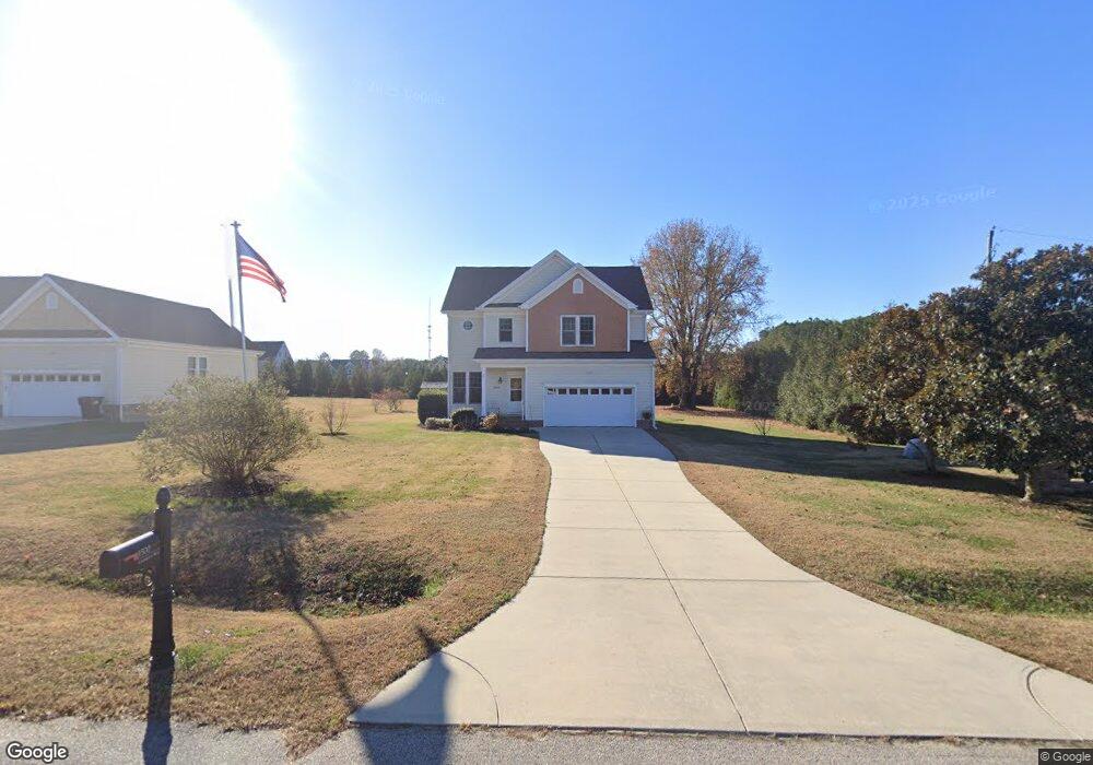
3500 Taviswood Way Wake Forest, NC 27587
Estimated Value: $449,000 - $484,000
3
Beds
3
Baths
2,073
Sq Ft
$224/Sq Ft
Est. Value
About This Home
This home is located at 3500 Taviswood Way, Wake Forest, NC 27587 and is currently estimated at $465,018, approximately $224 per square foot. 3500 Taviswood Way is a home located in Wake County with nearby schools including Rolesville Elementary School, Rolesville Middle School, and Rolesville High School.
Ownership History
Date
Name
Owned For
Owner Type
Purchase Details
Closed on
Oct 30, 2008
Sold by
Homeplaces Llc
Bought by
Trabucco Anthony J
Current Estimated Value
Home Financials for this Owner
Home Financials are based on the most recent Mortgage that was taken out on this home.
Original Mortgage
$222,095
Outstanding Balance
$143,610
Interest Rate
5.78%
Mortgage Type
VA
Estimated Equity
$321,408
Create a Home Valuation Report for This Property
The Home Valuation Report is an in-depth analysis detailing your home's value as well as a comparison with similar homes in the area
Home Values in the Area
Average Home Value in this Area
Purchase History
| Date | Buyer | Sale Price | Title Company |
|---|---|---|---|
| Trabucco Anthony J | $215,000 | None Available |
Source: Public Records
Mortgage History
| Date | Status | Borrower | Loan Amount |
|---|---|---|---|
| Open | Trabucco Anthony J | $222,095 |
Source: Public Records
Tax History Compared to Growth
Tax History
| Year | Tax Paid | Tax Assessment Tax Assessment Total Assessment is a certain percentage of the fair market value that is determined by local assessors to be the total taxable value of land and additions on the property. | Land | Improvement |
|---|---|---|---|---|
| 2025 | $2,837 | $440,497 | $85,000 | $355,497 |
| 2024 | $2,755 | $440,497 | $85,000 | $355,497 |
| 2023 | $2,270 | $288,624 | $50,000 | $238,624 |
| 2022 | $2,104 | $288,624 | $50,000 | $238,624 |
| 2021 | $2,048 | $288,624 | $50,000 | $238,624 |
| 2020 | $2,014 | $288,624 | $50,000 | $238,624 |
| 2019 | $2,162 | $262,298 | $40,000 | $222,298 |
| 2018 | $1,988 | $262,298 | $40,000 | $222,298 |
| 2017 | $1,885 | $262,298 | $40,000 | $222,298 |
| 2016 | $1,847 | $262,298 | $40,000 | $222,298 |
| 2015 | $1,833 | $261,107 | $40,000 | $221,107 |
| 2014 | $1,738 | $261,107 | $40,000 | $221,107 |
Source: Public Records
Map
Nearby Homes
- 3612 Bailey Meadows Dr
- 5833 Mitchell Mill Rd
- 3604 Bailey Meadows Dr
- 5709 Flowery Meadow Ct
- Norman Plan at Kalas Falls
- Jordan Plan at Kalas Falls
- Hampshire Plan at Kalas Falls
- Hartwell Plan at Kalas Falls
- Summit Plan at Kalas Falls
- Fleetwood Plan at Kalas Falls
- Wylie Plan at Kalas Falls
- 3608 Manly Farm Rd
- 3628 Manly Farm Rd
- 3904 Manly Farm Rd
- 6200 Emily Ln
- 0 Jones Cousins Way
- 2205 Seraphic Way Unit 403
- 2201 Seraphic Way Unit 404
- 2208 Seraphic Way Unit 381
- Leland Plan at The Point - Palisade
- 3504 Taviswood Way
- 3508 Taviswood Way
- 1809 Rolesville Rd
- 3816 Hartland Manor Ct
- 3509 Taviswood Way
- 3820 Hartland Manor Ct
- 3512 Taviswood Way
- 3801 Taviston Ct
- 3813 Taviston Ct
- 3821 Hartland Manor Ct
- 3812 Hartland Manor Ct
- 3508 Taviston Ct
- 1917 Rolesville Rd
- 3817 Hartland Manor Ct
- 3812 Taviston Ct
- 3816 Taviston Ct
- 3813 Hartland Manor Ct
- 3808 Taviston Ct
- 3804 Taviston Ct
- 3820 Taviston Ct