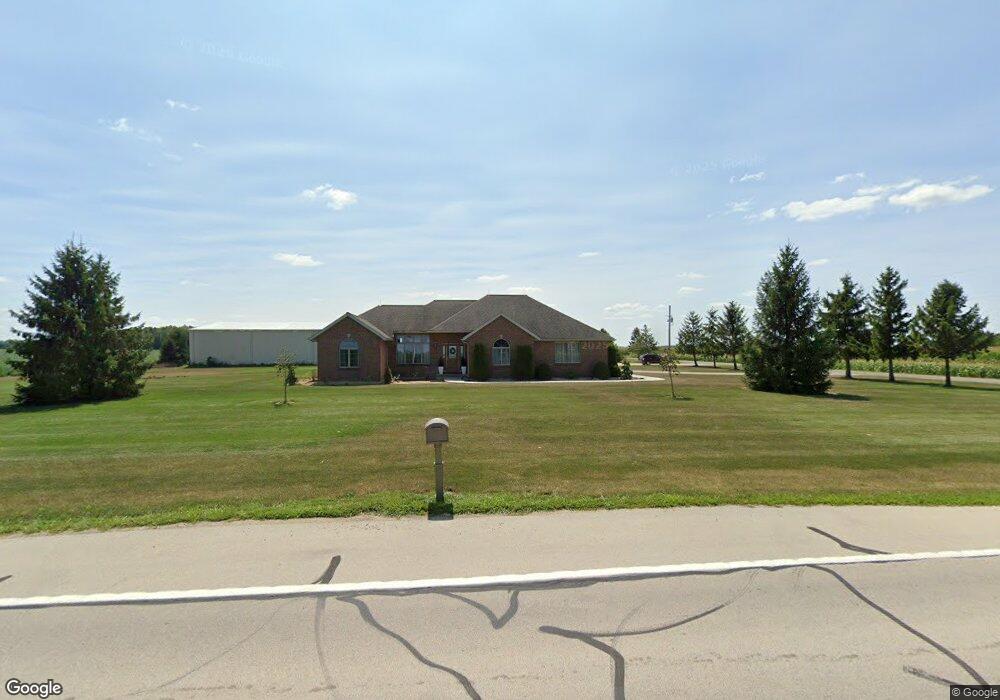
3514 State Route 707 Rockford, OH 45882
Estimated Value: $301,000 - $487,081
3
Beds
3
Baths
2,003
Sq Ft
$208/Sq Ft
Est. Value
About This Home
This home is located at 3514 State Route 707, Rockford, OH 45882 and is currently estimated at $416,360, approximately $207 per square foot. 3514 State Route 707 is a home located in Mercer County with nearby schools including Parkway Elementary School, Parkway Middle School, and Parkway High School.
Ownership History
Date
Name
Owned For
Owner Type
Purchase Details
Closed on
Dec 22, 2021
Sold by
Gates Frank L
Bought by
Luginbill Kyle and Luginbill Lea
Current Estimated Value
Home Financials for this Owner
Home Financials are based on the most recent Mortgage that was taken out on this home.
Original Mortgage
$235,000
Outstanding Balance
$183,519
Interest Rate
2.27%
Mortgage Type
New Conventional
Estimated Equity
$232,841
Purchase Details
Closed on
Aug 16, 1994
Bought by
Gates Frank L
Create a Home Valuation Report for This Property
The Home Valuation Report is an in-depth analysis detailing your home's value as well as a comparison with similar homes in the area
Home Values in the Area
Average Home Value in this Area
Purchase History
| Date | Buyer | Sale Price | Title Company |
|---|---|---|---|
| Luginbill Kyle | $410,000 | None Available | |
| Gates Frank L | $16,500 | -- |
Source: Public Records
Mortgage History
| Date | Status | Borrower | Loan Amount |
|---|---|---|---|
| Open | Luginbill Kyle | $235,000 |
Source: Public Records
Tax History Compared to Growth
Tax History
| Year | Tax Paid | Tax Assessment Tax Assessment Total Assessment is a certain percentage of the fair market value that is determined by local assessors to be the total taxable value of land and additions on the property. | Land | Improvement |
|---|---|---|---|---|
| 2024 | $5,449 | $157,570 | $9,100 | $148,470 |
| 2023 | $5,449 | $157,570 | $9,100 | $148,470 |
| 2022 | $4,333 | $101,400 | $8,750 | $92,650 |
| 2021 | $4,181 | $101,400 | $8,750 | $92,650 |
| 2020 | $2,121 | $101,400 | $8,750 | $92,650 |
| 2019 | $3,821 | $96,050 | $8,160 | $87,890 |
| 2018 | $3,727 | $96,050 | $8,160 | $87,890 |
| 2017 | $3,729 | $96,050 | $8,160 | $87,890 |
| 2016 | $3,608 | $99,440 | $7,040 | $92,400 |
| 2015 | $3,571 | $99,440 | $7,040 | $92,400 |
| 2014 | $3,575 | $99,440 | $7,040 | $92,400 |
| 2013 | $4,280 | $108,050 | $7,630 | $100,420 |
Source: Public Records
Map
Nearby Homes
- 0 Wilson Unit 1037059
- 0 Wilson Unit 306333
- 11164 Erastus Durbin Rd
- 0 Rockford West Rd Unit Lots 14- 28
- 208 W Pearl St
- 208 Market St
- 7957 W Bridge St
- 9155 Us Route 127
- 5062 Mercer van Wert County Line Rd
- 0 Mercer van Wert County Line Rd
- 12223 Ohio 49
- 1218 Brittany Dr
- 1101 Timothy Ln
- 1528 Mary Ln
- 6699 Gause Rd
- 0 Drake St
- 206 Glenn St
- 4640 Sierra Dr
- 12029 Dutton Rd
- 6764 Silver Lakes Dr
- 10487 Now Rd
- 3586 State Route 707
- 3553 State Route 707
- 3446 State Route 707
- 3446 Ohio 707
- 3419 State Route 707
- 3680 State Route 707
- 3733 Ohio 707
- 3733 State Route 707
- 10701 Now Rd
- 3311 State Route 707
- 10721 Now Rd
- 3287 State Route 707
- 3792 State Route 707
- 10200 Now Rd
- 3799 State Route 707
- 0 Now Rd
- 3206 State Route 707
- 3879 State Route 707
- 10105 Now Rd