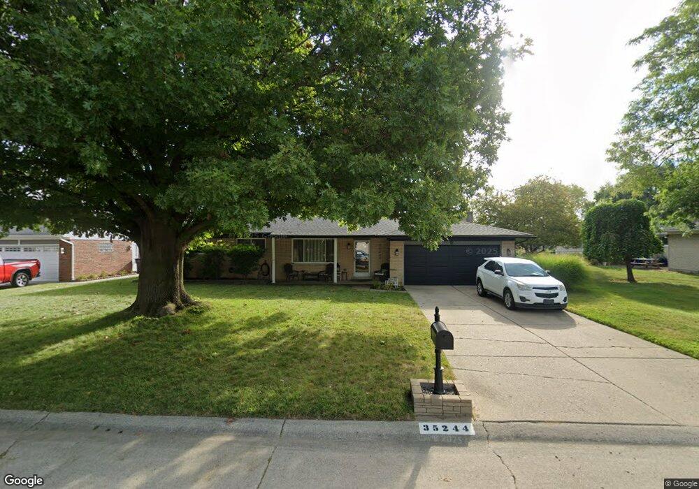
35244 Rhoades Dr Clinton Township, MI 48035
Estimated Value: $291,000 - $341,000
3
Beds
2
Baths
1,675
Sq Ft
$186/Sq Ft
Est. Value
About This Home
This home is located at 35244 Rhoades Dr, Clinton Township, MI 48035 and is currently estimated at $311,055, approximately $185 per square foot. 35244 Rhoades Dr is a home located in Macomb County with nearby schools including Salk Elementary School, Richards Middle School, and Fraser High School.
Ownership History
Date
Name
Owned For
Owner Type
Purchase Details
Closed on
Apr 21, 2009
Sold by
Lasalle Bank National Association
Bought by
Virgona Justin R
Current Estimated Value
Home Financials for this Owner
Home Financials are based on the most recent Mortgage that was taken out on this home.
Original Mortgage
$92,631
Interest Rate
4.83%
Mortgage Type
FHA
Purchase Details
Closed on
Jul 14, 2008
Sold by
Mortgage Electronic Registration Systems
Bought by
Lasalle Bank Na and Emc Mortgage Loan Trust 2005-A Mortgage
Purchase Details
Closed on
Jul 11, 2008
Sold by
Walsh John L and Walsh Cathy L
Bought by
Mortgage Electronic Registration Systems
Purchase Details
Closed on
Nov 10, 2000
Sold by
Stauch Johann
Bought by
Walsh John L
Create a Home Valuation Report for This Property
The Home Valuation Report is an in-depth analysis detailing your home's value as well as a comparison with similar homes in the area
Home Values in the Area
Average Home Value in this Area
Purchase History
| Date | Buyer | Sale Price | Title Company |
|---|---|---|---|
| Virgona Justin R | $94,340 | None Available | |
| Lasalle Bank Na | -- | None Available | |
| Mortgage Electronic Registration Systems | $191,975 | None Available | |
| Walsh John L | $167,000 | -- |
Source: Public Records
Mortgage History
| Date | Status | Borrower | Loan Amount |
|---|---|---|---|
| Previous Owner | Virgona Justin R | $92,631 |
Source: Public Records
Tax History Compared to Growth
Tax History
| Year | Tax Paid | Tax Assessment Tax Assessment Total Assessment is a certain percentage of the fair market value that is determined by local assessors to be the total taxable value of land and additions on the property. | Land | Improvement |
|---|---|---|---|---|
| 2025 | $3,392 | $139,100 | $0 | $0 |
| 2024 | $1,965 | $127,500 | $0 | $0 |
| 2023 | $1,864 | $122,300 | $0 | $0 |
| 2022 | $3,073 | $114,700 | $0 | $0 |
| 2021 | $2,990 | $106,200 | $0 | $0 |
| 2020 | $1,711 | $99,500 | $0 | $0 |
| 2019 | $2,780 | $93,900 | $0 | $0 |
| 2018 | $2,723 | $89,100 | $0 | $0 |
| 2017 | $2,696 | $80,500 | $19,100 | $61,400 |
| 2016 | $2,680 | $80,500 | $0 | $0 |
| 2015 | -- | $74,400 | $0 | $0 |
| 2014 | -- | $70,700 | $0 | $0 |
| 2011 | -- | $71,200 | $23,000 | $48,200 |
Source: Public Records
Map
Nearby Homes
- 35249 Wagner Dr
- 35260 Silver Maple Dr Unit 21
- 34894 Mercer Unit 9
- 34900 Mercer Unit 10
- 35530 Morris Dr
- 16143 Clarkson Dr Unit 2
- 34670 Clarkson Dr W Unit 35
- 15949 Athens Ave
- 34500 Mulvey Unit 8
- 36014 Chapel Ct Unit 27
- 16520 Savor Ln
- 16540 Savor Ln
- 34261 Garfield Cir
- 16655 Savor Ln Unit 5
- 15568 Austin Ave Unit 44
- 36270 Vita Bella Dr Unit 4
- 35016 Bobcean Rd
- 35152 Kings Forest Blvd
- 34130 Utica Rd
- 35251 Kings Forest Blvd Unit 62
- 35302 Riebel Ct
- 35260 Rhoades Dr
- 16351 Wysong Dr
- 16363 Wysong Dr
- 16333 Wysong Dr
- 35276 Rhoades Dr
- 16309 Wysong Dr
- 16375 Wysong Dr
- 35292 Rhoades Dr
- 35301 Riebel Ct
- 35135 Hammond Dr
- 35346 Riebel Ct
- 35251 Rhoades Dr
- 16348 Wysong Dr
- 35235 Rhoades Dr
- 16387 Wysong Dr
- 35267 Rhoades Dr
- 35310 Rhoades Dr
- 16332 Wysong Dr
- 16316 Wysong Dr