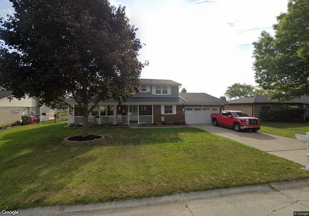
35260 Rhoades Dr Clinton Township, MI 48035
Estimated Value: $306,941 - $391,000
--
Bed
--
Bath
2,281
Sq Ft
$159/Sq Ft
Est. Value
About This Home
This home is located at 35260 Rhoades Dr, Clinton Township, MI 48035 and is currently estimated at $363,735, approximately $159 per square foot. 35260 Rhoades Dr is a home located in Macomb County with nearby schools including Salk Elementary School, Richards Middle School, and Fraser High School.
Ownership History
Date
Name
Owned For
Owner Type
Purchase Details
Closed on
May 3, 2025
Sold by
Lindamood Brad Dewayne and Lindamood Patricia Gay
Bought by
Lindamood Daniel Scott and Kucharek Brittany Lee
Current Estimated Value
Purchase Details
Closed on
May 25, 2005
Sold by
Seib Siegfried and Seib Elfriede
Bought by
Lindamood Brad D and Lindamood Patricia G
Create a Home Valuation Report for This Property
The Home Valuation Report is an in-depth analysis detailing your home's value as well as a comparison with similar homes in the area
Home Values in the Area
Average Home Value in this Area
Purchase History
| Date | Buyer | Sale Price | Title Company |
|---|---|---|---|
| Lindamood Daniel Scott | $4,069 | None Listed On Document | |
| Lindamood Daniel Scott | $4,069 | None Listed On Document | |
| Lindamood Brad D | $246,000 | Homeowners Title Agency |
Source: Public Records
Tax History Compared to Growth
Tax History
| Year | Tax Paid | Tax Assessment Tax Assessment Total Assessment is a certain percentage of the fair market value that is determined by local assessors to be the total taxable value of land and additions on the property. | Land | Improvement |
|---|---|---|---|---|
| 2025 | $3,958 | $164,700 | $0 | $0 |
| 2024 | $2,294 | $152,200 | $0 | $0 |
| 2023 | $2,175 | $144,600 | $0 | $0 |
| 2022 | $3,586 | $134,600 | $0 | $0 |
| 2021 | $3,489 | $124,900 | $0 | $0 |
| 2020 | $1,997 | $119,900 | $0 | $0 |
| 2019 | $3,245 | $112,300 | $0 | $0 |
| 2018 | $3,186 | $108,400 | $0 | $0 |
| 2017 | $3,147 | $96,800 | $20,300 | $76,500 |
| 2016 | $3,128 | $96,800 | $0 | $0 |
| 2015 | -- | $89,900 | $0 | $0 |
| 2014 | -- | $83,500 | $0 | $0 |
| 2011 | -- | $81,200 | $24,500 | $56,700 |
Source: Public Records
Map
Nearby Homes
- 35249 Wagner Dr
- 35260 Silver Maple Dr Unit 21
- 34894 Mercer Unit 9
- 35530 Morris Dr
- 34900 Mercer Unit 10
- 16143 Clarkson Dr Unit 2
- 34670 Clarkson Dr W Unit 35
- 15949 Athens Ave
- 36014 Chapel Ct Unit 27
- 16520 Savor Ln
- 16540 Savor Ln
- 34500 Mulvey Unit 8
- 16655 Savor Ln Unit 5
- 36270 Vita Bella Dr Unit 4
- 34261 Garfield Cir
- 15568 Austin Ave Unit 44
- 35016 Bobcean Rd
- 35152 Kings Forest Blvd
- 35251 Kings Forest Blvd Unit 62
- 15851 Horseshoe Path Ct
- 35244 Rhoades Dr
- 35302 Riebel Ct
- 35276 Rhoades Dr
- 16351 Wysong Dr
- 16363 Wysong Dr
- 16333 Wysong Dr
- 35292 Rhoades Dr
- 16309 Wysong Dr
- 35301 Riebel Ct
- 16375 Wysong Dr
- 35346 Riebel Ct
- 35310 Rhoades Dr
- 35251 Rhoades Dr
- 35267 Rhoades Dr
- 35235 Rhoades Dr
- 35329 Riebel Ct
- 35135 Hammond Dr
- 35283 Rhoades Dr
- 16387 Wysong Dr
- 16348 Wysong Dr