Estimated Value: $274,950 - $397,000
--
Bed
3
Baths
2,105
Sq Ft
$151/Sq Ft
Est. Value
About This Home
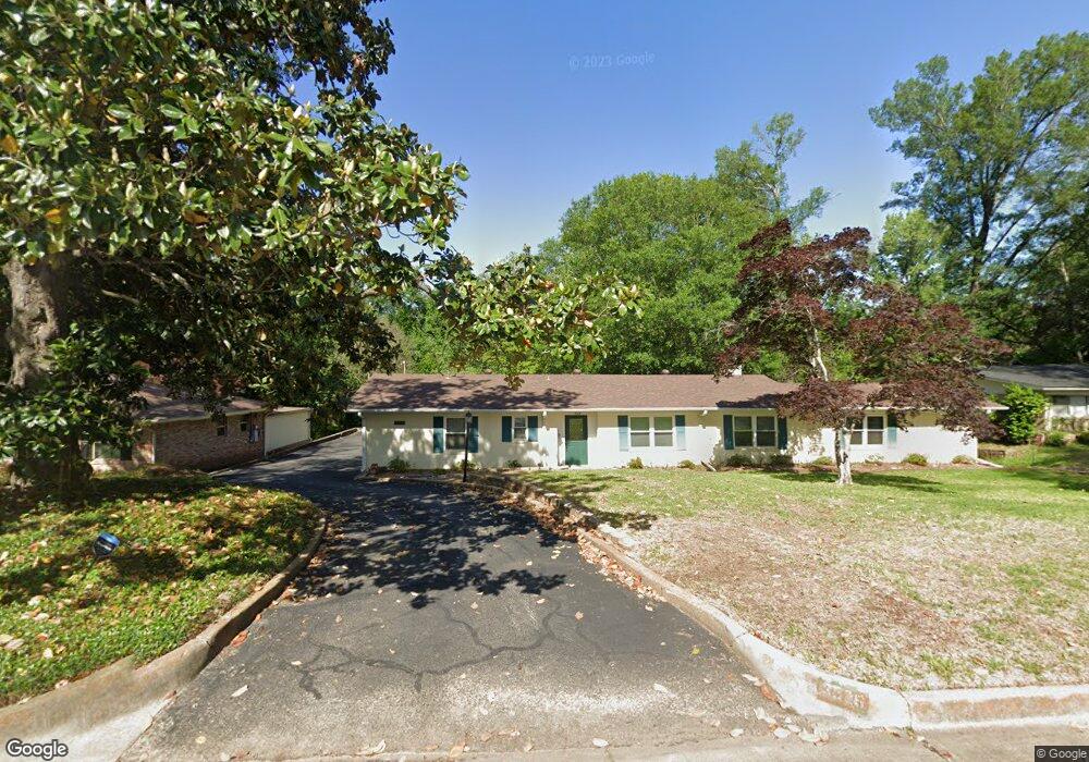
This home is located at 3529 Wynnwood Dr, Tyler, TX 75701 and is currently estimated at $317,488, approximately $150 per square foot. 3529 Wynnwood Dr is a home located in Smith County with nearby schools including Woods Elementary School, Hubbard Middle School, and Tyler Legacy High School.
Ownership History
Date
Name
Owned For
Owner Type
Purchase Details
Closed on
Jun 21, 2016
Sold by
Solomon Esther Robins
Bought by
Revocabl Solomon Esther Robins and Revocabl Esther Robins Solomon
Current Estimated Value
Purchase Details
Closed on
Mar 24, 2011
Sold by
Solomon David E
Bought by
Solomon Esther R
Home Financials for this Owner
Home Financials are based on the most recent Mortgage that was taken out on this home.
Original Mortgage
$74,000
Interest Rate
4.98%
Mortgage Type
New Conventional
Create a Home Valuation Report for This Property
The Home Valuation Report is an in-depth analysis detailing your home's value as well as a comparison with similar homes in the area
Home Values in the Area
Average Home Value in this Area
Purchase History
| Date | Buyer | Sale Price | Title Company |
|---|---|---|---|
| Revocabl Solomon Esther Robins | -- | None Available | |
| Solomon Esther R | -- | First American |
Source: Public Records
Mortgage History
| Date | Status | Borrower | Loan Amount |
|---|---|---|---|
| Previous Owner | Solomon Esther R | $74,000 |
Source: Public Records
Tax History Compared to Growth
Tax History
| Year | Tax Paid | Tax Assessment Tax Assessment Total Assessment is a certain percentage of the fair market value that is determined by local assessors to be the total taxable value of land and additions on the property. | Land | Improvement |
|---|---|---|---|---|
| 2025 | $813 | $306,604 | $62,757 | $243,847 |
| 2024 | $813 | $222,320 | $40,040 | $251,029 |
| 2023 | $3,523 | $288,969 | $40,040 | $248,929 |
| 2022 | $3,600 | $217,742 | $34,320 | $183,422 |
| 2021 | $3,504 | $182,204 | $34,320 | $147,884 |
| 2020 | $3,249 | $160,339 | $34,320 | $126,019 |
| 2019 | $3,019 | $138,043 | $22,880 | $115,163 |
| 2018 | $2,793 | $128,407 | $22,880 | $105,527 |
| 2017 | $2,741 | $128,407 | $22,880 | $105,527 |
| 2016 | $2,818 | $131,995 | $19,955 | $112,040 |
| 2015 | $2,346 | $124,987 | $19,955 | $105,032 |
| 2014 | $2,346 | $121,378 | $19,955 | $101,423 |
Source: Public Records
Map
Nearby Homes
- 3712 Colony Park Dr
- 3511 S Keaton Ave
- 3710 Bain Place
- 3210 S Donnybrook Ave
- 3202 S Donnybrook Ave
- 4021 New Copeland Rd
- 3523 S Cameron Ave
- 1018 Pollard Dr
- 1113 E Amherst Dr
- 315 Ridgecrest Dr
- 1107 Pinedale Place
- 611 E Watkins St
- 1408 Westfield St
- 1101 Clyde Dr
- 204 Ridgecrest Dr
- 1024 Clyde Dr
- 905 E Watkins St
- 3300 Old Bullard Rd
- 3308 Greenoak Place
- 3006 de Charles St
- 3521 3521 Wynnwood Dr
- 3533 Wynnwood Dr
- 3521 Wynnwood Dr
- 3528 New Copeland Rd
- 3524 3524 Wynnwood Dr
- 3537 Wynnwood Dr
- 3515 Wynnwood Dr
- 3520 New Copeland Rd
- 3600 New Copeland Rd
- 3528 3528 New Copeland Rd
- 3537 3537 Wynnwood
- 3524 Wynnwood Dr
- 3600 3600 Wynnwood Dr
- 3600 Wynnwood Dr
- 3520 Wynnwood Dr
- 3610 New Copeland Rd
- 3512 New Copeland Rd
- 3610 Wynnwood Dr
- 3501 Wynnwood Dr
- 3512 Wynnwood Dr