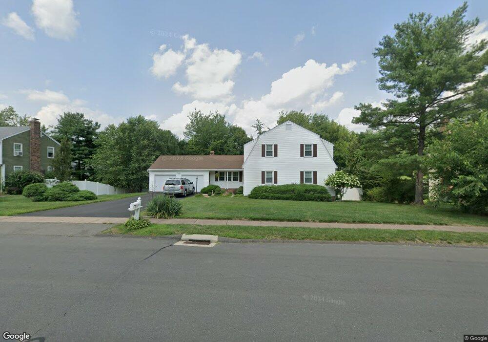
353 Hang Dog Ln Wethersfield, CT 06109
Estimated Value: $547,000 - $622,000
4
Beds
3
Baths
2,462
Sq Ft
$237/Sq Ft
Est. Value
About This Home
This home is located at 353 Hang Dog Ln, Wethersfield, CT 06109 and is currently estimated at $583,673, approximately $237 per square foot. 353 Hang Dog Ln is a home located in Hartford County with nearby schools including Highcrest School, Woodcrest Elementary School, and Silas Deane Middle School.
Ownership History
Date
Name
Owned For
Owner Type
Purchase Details
Closed on
May 22, 1998
Sold by
Rooney Robert D
Bought by
Keylin Alexander and Keylin Concetta
Current Estimated Value
Home Financials for this Owner
Home Financials are based on the most recent Mortgage that was taken out on this home.
Original Mortgage
$35,769
Interest Rate
7.05%
Create a Home Valuation Report for This Property
The Home Valuation Report is an in-depth analysis detailing your home's value as well as a comparison with similar homes in the area
Home Values in the Area
Average Home Value in this Area
Purchase History
| Date | Buyer | Sale Price | Title Company |
|---|---|---|---|
| Keylin Alexander | $177,500 | -- |
Source: Public Records
Mortgage History
| Date | Status | Borrower | Loan Amount |
|---|---|---|---|
| Open | Keylin Alexander | $50,000 | |
| Closed | Keylin Alexander | $68,000 | |
| Closed | Keylin Alexander | $35,769 | |
| Open | Keylin Alexander | $122,000 |
Source: Public Records
Tax History Compared to Growth
Tax History
| Year | Tax Paid | Tax Assessment Tax Assessment Total Assessment is a certain percentage of the fair market value that is determined by local assessors to be the total taxable value of land and additions on the property. | Land | Improvement |
|---|---|---|---|---|
| 2025 | $15,695 | $380,750 | $112,840 | $267,910 |
| 2024 | $9,974 | $230,770 | $84,880 | $145,890 |
| 2023 | $9,642 | $230,770 | $84,880 | $145,890 |
| 2022 | $9,480 | $230,770 | $84,880 | $145,890 |
| 2021 | $9,385 | $230,770 | $84,880 | $145,890 |
| 2020 | $9,390 | $230,770 | $84,880 | $145,890 |
| 2019 | $9,402 | $230,770 | $84,880 | $145,890 |
| 2018 | $10,126 | $248,300 | $84,700 | $163,600 |
| 2017 | $9,875 | $248,300 | $84,700 | $163,600 |
| 2016 | $9,569 | $248,300 | $84,700 | $163,600 |
| 2015 | $9,483 | $248,300 | $84,700 | $163,600 |
| 2014 | $9,123 | $248,300 | $84,700 | $163,600 |
Source: Public Records
Map
Nearby Homes
- 325 Fox Hill Rd
- 0 Old Post Rd
- 155 Old Common Rd
- 268 Fox Hill Rd
- 42 Rose Ct
- 5 Robeth Ln
- 19 Jacob Dr
- 211 Fairlane Dr
- 1279 Maple St
- 45 Sandy Dr
- 18 Stone Hill Dr
- 6 Vinnie Dr
- 88 Highland St
- 67 Luca (Homesite 6) Ln
- 53 Luca (Homesite 4) Ln
- 8 Stella Dr
- 0 Collier Rd
- 61 Luca Ln
- 76 Luca Lane Homesite 8
- 39 Cottonwood Rd Unit 39
- 361 Hang Dog Ln
- 38 Goff Brook Cir
- 46 Goff Brook Cir
- 30 Goff Brook Cir
- 364 Hang Dog Ln
- 337 Hang Dog Ln
- 56 Goff Brook Cir
- 371 Hang Dog Ln
- 32 Dusty Ln
- 22 Goff Brook Cir
- 329 Hang Dog Ln
- 62 Goff Brook Cir
- 40 Dusty Ln
- 31 Goff Brook Cir
- 39 Goff Brook Cir
- 47 Goff Brook Cir
- 14 Goff Brook Cir
- 15 Dusty Ln
- 15 Minnie Ln
- 53 Goff Brook Cir