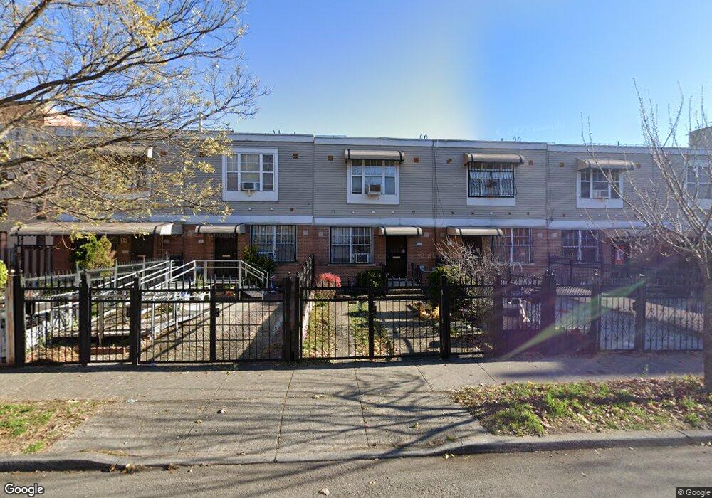
353 Sheffield Ave Brooklyn, NY 11207
Brownsville NeighborhoodEstimated Value: $524,953 - $676,000
--
Bed
--
Bath
1,116
Sq Ft
$545/Sq Ft
Est. Value
About This Home
This home is located at 353 Sheffield Ave, Brooklyn, NY 11207 and is currently estimated at $608,738, approximately $545 per square foot. 353 Sheffield Ave is a home located in Kings County with nearby schools including P.S. 328 - Phyllis Wheatley, J.H.S 292 Margaret S. Douglas, and Achievement First - East New York School.
Ownership History
Date
Name
Owned For
Owner Type
Purchase Details
Closed on
Apr 13, 1999
Sold by
Nehemiah Housing Development Fund Co Inc
Bought by
Calliste Kathleen
Current Estimated Value
Home Financials for this Owner
Home Financials are based on the most recent Mortgage that was taken out on this home.
Original Mortgage
$65,000
Interest Rate
7.65%
Create a Home Valuation Report for This Property
The Home Valuation Report is an in-depth analysis detailing your home's value as well as a comparison with similar homes in the area
Home Values in the Area
Average Home Value in this Area
Purchase History
| Date | Buyer | Sale Price | Title Company |
|---|---|---|---|
| Calliste Kathleen | $94,000 | First American Title Ins Co |
Source: Public Records
Mortgage History
| Date | Status | Borrower | Loan Amount |
|---|---|---|---|
| Previous Owner | Calliste Kathleen | $65,000 | |
| Closed | Calliste Kathleen | $20,000 |
Source: Public Records
Tax History Compared to Growth
Tax History
| Year | Tax Paid | Tax Assessment Tax Assessment Total Assessment is a certain percentage of the fair market value that is determined by local assessors to be the total taxable value of land and additions on the property. | Land | Improvement |
|---|---|---|---|---|
| 2025 | $4,198 | $27,900 | $12,480 | $15,420 |
| 2024 | $4,198 | $30,480 | $12,480 | $18,000 |
| 2023 | $4,212 | $34,260 | $12,480 | $21,780 |
| 2022 | $3,906 | $32,400 | $12,480 | $19,920 |
| 2021 | $3,885 | $26,580 | $12,480 | $14,100 |
| 2020 | $2,914 | $25,380 | $12,480 | $12,900 |
| 2019 | $3,644 | $25,380 | $12,480 | $12,900 |
| 2018 | $3,317 | $17,284 | $7,161 | $10,123 |
| 2017 | $2,911 | $16,306 | $6,183 | $10,123 |
| 2016 | $2,468 | $15,384 | $5,261 | $10,123 |
| 2015 | $668 | $14,515 | $4,392 | $10,123 |
| 2014 | $668 | $14,515 | $4,392 | $10,123 |
Source: Public Records
Map
Nearby Homes
- 637 Blake Ave
- 353 Pennsylvania Ave
- 444 New Jersey Ave
- 317 Pennsylvania Ave
- 663 Sutter Ave
- 667 Sutter Ave
- 297 Pennsylvania Ave
- 486 Vermont St
- 439 Vermont St
- 477 Vermont St
- 297 Hinsdale St
- 342 Wyona St
- 34&36 Marginal St
- 412 Bradford St
- 459 Belmont Ave
- 440 Miller Ave
- 406 Hinsdale St
- 774 Blake Ave
- 443 Miller Ave
- 402 van Siclen Ave
- 355 Sheffield Ave
- 351 Sheffield Ave
- 357 Sheffield Ave
- 349 Sheffield Ave
- 359 Sheffield Ave
- 361 Sheffield Ave
- 363 Sheffield Ave Unit 367
- 363-367 Sheffield Ave
- 366 Pennsylvania Ave
- 369 Sheffield Ave
- 378 Pennsylvania Ave
- 627 Blake Ave
- 629 Blake Ave
- 625 Blake Ave
- 625 Blake Ave Unit Office
- 625 Blake Ave Unit 2R
- 375 Sheffield Ave
- 633 Blake Ave
- 639 Blake Ave
- 626 Sutter Ave