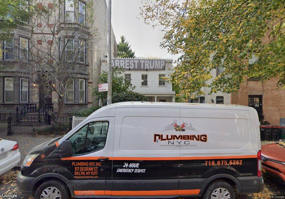
354 12th St Brooklyn, NY 11215
South Slope NeighborhoodEstimated Value: $1,868,000 - $2,326,000
--
Bed
--
Bath
1,390
Sq Ft
$1,500/Sq Ft
Est. Value
About This Home
This home is located at 354 12th St, Brooklyn, NY 11215 and is currently estimated at $2,085,000, approximately $1,500 per square foot. 354 12th St is a home located in Kings County with nearby schools including Magnet School of Math Science & Design Technology.
Ownership History
Date
Name
Owned For
Owner Type
Purchase Details
Closed on
Jul 26, 2001
Sold by
Arbeiter Laurie A
Bought by
Arbeiter Laurie A and Hobbs Jennifer L
Current Estimated Value
Purchase Details
Closed on
Jul 17, 2000
Sold by
Palladino Cara
Bought by
Arbeiter Laurie A
Purchase Details
Closed on
May 2, 1994
Sold by
Policastro Richard
Bought by
Gordon Carol P
Create a Home Valuation Report for This Property
The Home Valuation Report is an in-depth analysis detailing your home's value as well as a comparison with similar homes in the area
Home Values in the Area
Average Home Value in this Area
Purchase History
| Date | Buyer | Sale Price | Title Company |
|---|---|---|---|
| Arbeiter Laurie A | -- | -- | |
| Arbeiter Laurie A | -- | -- | |
| Arbeiter Laurie A | $70,000 | -- | |
| Arbeiter Laurie A | -- | -- | |
| Gordon Carol P | -- | -- | |
| Gordon Carol P | -- | -- |
Source: Public Records
Tax History Compared to Growth
Tax History
| Year | Tax Paid | Tax Assessment Tax Assessment Total Assessment is a certain percentage of the fair market value that is determined by local assessors to be the total taxable value of land and additions on the property. | Land | Improvement |
|---|---|---|---|---|
| 2025 | $3,972 | $135,900 | $27,840 | $108,060 |
| 2024 | $3,972 | $125,280 | $27,840 | $97,440 |
| 2023 | $3,842 | $110,700 | $27,840 | $82,860 |
| 2022 | $3,427 | $111,420 | $27,840 | $83,580 |
| 2021 | $2,719 | $106,560 | $27,840 | $78,720 |
| 2020 | $13 | $129,180 | $27,840 | $101,340 |
| 2019 | $3,447 | $102,720 | $27,840 | $74,880 |
| 2018 | $3,213 | $15,763 | $3,253 | $12,510 |
| 2017 | $3,067 | $15,045 | $3,547 | $11,498 |
| 2016 | $2,865 | $14,330 | $4,560 | $9,770 |
| 2015 | $1,492 | $14,330 | $6,846 | $7,484 |
| 2014 | $1,492 | $13,732 | $5,575 | $8,157 |
Source: Public Records
Map
Nearby Homes
- 362 12th St Unit 3
- 362 12th St Unit 2
- 368 12th St Unit 5
- 370 12th St Unit 5
- 333 14th St Unit PSPOT1
- 378 12th St Unit 2
- 428 11th St
- 379 12th St Unit 2A
- 379 12th St Unit 2B
- 379 12th St Unit 3B
- 379 12th St Unit 3A
- 379 12th St Unit 1A
- 386A 12th St
- 454 11th St Unit 4L.
- 299 13th St Unit 4B
- 394 12th St Unit 5
- 449 11th St
- 285 13th St
- 366 W 11th St Unit 6EF
- 298 12th St Unit 1R
- 356 12th St Unit ROOF2
- 356 12th St Unit ROOF1
- 356 12th St Unit 4B
- 356 12th St Unit 4A
- 356 12th St Unit 3B
- 356 12th St Unit 3A
- 356 12th St Unit 2B
- 356 12th St Unit 2A
- 356 12th St Unit 1B
- 356 12th St Unit 1A
- 356 12th St
- 356 12 St Unit 3B
- 358 12th St Unit 8
- 358 12th St Unit 4L
- 358 12th St Unit L4
- 358 12th St Unit 1L
- 358 12th St Unit 3L
- 358 12th St Unit L1
- 358 12th St Unit 4R
- 358 12th St Unit L3
