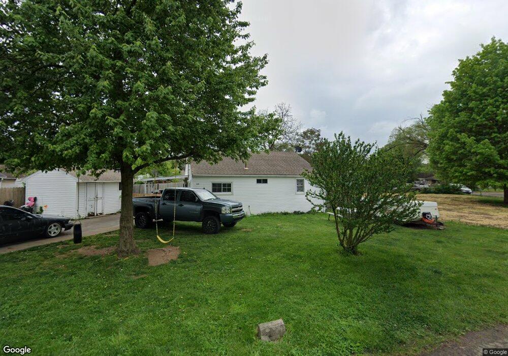
354 Broadmead Ave Dayton, OH 45404
Avondale NeighborhoodEstimated Value: $107,551 - $127,000
3
Beds
1
Bath
990
Sq Ft
$121/Sq Ft
Est. Value
About This Home
This home is located at 354 Broadmead Ave, Dayton, OH 45404 and is currently estimated at $119,888, approximately $121 per square foot. 354 Broadmead Ave is a home located in Montgomery County with nearby schools including Stebbins High School, Pathway School of Discovery, and Horizon Science Academy Dayton Downtown.
Ownership History
Date
Name
Owned For
Owner Type
Purchase Details
Closed on
Nov 25, 2015
Sold by
Darnell Delta Sue and Darnell Ronald B
Bought by
Mccoy John R and Mccoy Angi
Current Estimated Value
Home Financials for this Owner
Home Financials are based on the most recent Mortgage that was taken out on this home.
Original Mortgage
$45,900
Interest Rate
2.96%
Mortgage Type
Balloon
Create a Home Valuation Report for This Property
The Home Valuation Report is an in-depth analysis detailing your home's value as well as a comparison with similar homes in the area
Home Values in the Area
Average Home Value in this Area
Purchase History
| Date | Buyer | Sale Price | Title Company |
|---|---|---|---|
| Mccoy John R | $47,000 | Attorney |
Source: Public Records
Mortgage History
| Date | Status | Borrower | Loan Amount |
|---|---|---|---|
| Closed | Mccoy John R | $45,900 |
Source: Public Records
Tax History Compared to Growth
Tax History
| Year | Tax Paid | Tax Assessment Tax Assessment Total Assessment is a certain percentage of the fair market value that is determined by local assessors to be the total taxable value of land and additions on the property. | Land | Improvement |
|---|---|---|---|---|
| 2024 | $1,101 | $22,640 | $5,160 | $17,480 |
| 2023 | $1,101 | $22,640 | $5,160 | $17,480 |
| 2022 | $1,175 | $18,110 | $4,120 | $13,990 |
| 2021 | $1,197 | $18,110 | $4,120 | $13,990 |
| 2020 | $1,197 | $18,110 | $4,120 | $13,990 |
| 2019 | $1,580 | $17,760 | $3,710 | $14,050 |
| 2018 | $1,314 | $17,760 | $3,710 | $14,050 |
| 2017 | $1,313 | $17,760 | $3,710 | $14,050 |
| 2016 | $1,304 | $17,110 | $4,120 | $12,990 |
| 2015 | $800 | $17,110 | $4,120 | $12,990 |
| 2014 | $800 | $17,110 | $4,120 | $12,990 |
| 2012 | -- | $17,600 | $4,080 | $13,520 |
Source: Public Records
Map
Nearby Homes
- 546 Wynora Ave
- 518 Tyron Ave
- - Prince Albert Blvd
- -- Prince Albert Blvd
- 2460 Bushnell Ave
- 2249 Prince Albert Blvd
- -- Valley Pike
- - Valley Pike
- 2249 - Valley Pike
- 2301 Valley Pike
- 2249 Valley Pike
- - Rondowa Ave
- -- Rondowa Ave
- 2245 Valley Pike
- 641 Prince Albert Blvd
- 29 Barcelona Ave
- 241 Community Dr
- 1930 Brandt Pike
- 3586 Lane Garden Ct
- 34 Ingleside Ave
- 2348 Forest Home Ave
- 2350 Forest Home Ave
- 2353 Guernsey Dell Ave
- 2357 Guernsey Dell Ave
- 2401 Guernsey Dell Ave
- 2346 Forest Home Ave
- 2349 Guernsey Dell Ave
- 2404 Forest Home Ave
- 500 Wynora Ave
- 2345 Guernsey Dell Ave
- 2407 Guernsey Dell Ave
- 2343 Guernsey Dell Ave
- 2406 Forest Home Ave
- 2342 Forest Home Ave
- 501 Wynora Ave
- 2409 Guernsey Dell Ave
- 2341 Guernsey Dell Ave
- 2408 Forest Home Ave
- 512 Wynora Ave
- 2340 Forest Home Ave
