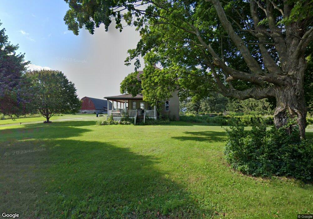
35436 State Hwy 30 Lanesboro, MN 55949
Estimated Value: $390,263 - $489,000
5
Beds
2
Baths
3,372
Sq Ft
$135/Sq Ft
Est. Value
About This Home
This home is located at 35436 State Hwy 30, Lanesboro, MN 55949 and is currently estimated at $454,316, approximately $134 per square foot. 35436 State Hwy 30 is a home located in Fillmore County with nearby schools including Lanesboro Elementary School and Lanesboro High School.
Ownership History
Date
Name
Owned For
Owner Type
Purchase Details
Closed on
Dec 27, 2011
Sold by
Yohe Michael E and Yohe Betsey L
Bought by
Mosdal Jarred I and Mosdal Katleen S
Current Estimated Value
Home Financials for this Owner
Home Financials are based on the most recent Mortgage that was taken out on this home.
Original Mortgage
$15,720
Interest Rate
3.97%
Mortgage Type
New Conventional
Purchase Details
Closed on
Feb 28, 2008
Sold by
Snyder Peter A and Snyder Barbara A
Bought by
Yohe Michae E and Yohe Betsy L
Home Financials for this Owner
Home Financials are based on the most recent Mortgage that was taken out on this home.
Original Mortgage
$181,600
Interest Rate
5.75%
Mortgage Type
New Conventional
Create a Home Valuation Report for This Property
The Home Valuation Report is an in-depth analysis detailing your home's value as well as a comparison with similar homes in the area
Home Values in the Area
Average Home Value in this Area
Purchase History
| Date | Buyer | Sale Price | Title Company |
|---|---|---|---|
| Mosdal Jarred I | $198,400 | None Available | |
| Yohe Michae E | $227,000 | None Available |
Source: Public Records
Mortgage History
| Date | Status | Borrower | Loan Amount |
|---|---|---|---|
| Closed | Mosdal Jarred I | $15,720 | |
| Previous Owner | Yohe Michae E | $181,600 |
Source: Public Records
Tax History Compared to Growth
Tax History
| Year | Tax Paid | Tax Assessment Tax Assessment Total Assessment is a certain percentage of the fair market value that is determined by local assessors to be the total taxable value of land and additions on the property. | Land | Improvement |
|---|---|---|---|---|
| 2025 | $2,262 | $360,400 | $112,400 | $248,000 |
| 2024 | $2,262 | $260,100 | $80,600 | $179,500 |
| 2023 | $1,614 | $260,100 | $80,600 | $179,500 |
| 2022 | $1,614 | $223,400 | $108,100 | $115,300 |
| 2021 | $1,614 | $193,100 | $77,800 | $115,300 |
| 2020 | $1,326 | $193,100 | $77,800 | $115,300 |
| 2019 | $1,608 | $218,100 | $86,300 | $131,800 |
| 2018 | $1,284 | $218,100 | $86,300 | $131,800 |
| 2017 | -- | $201,700 | $75,900 | $125,800 |
| 2016 | $882 | $194,500 | $68,700 | $125,800 |
| 2015 | $1,024 | $149,000 | $60,768 | $88,232 |
| 2014 | $1,024 | $140,200 | $60,024 | $80,176 |
| 2013 | $1,024 | $148,300 | $60,732 | $87,568 |
Source: Public Records
Map
Nearby Homes
- 34869 Fawn Dr
- 34760 Fawn Dr
- Tbd State Highway 16
- 208 Elmwood St E
- 206 Elmwood St E
- 105 Parkway Ave N
- 402 Hillcrest St E
- 409 Hillcrest St E
- 201 Ridgeview Ln S Unit 204
- 201 Ridgeview Ln S Unit 201
- 407 Johnson Dr
- 301 Kirkwood St E
- TBD State 16
- 708 Parkway Ave S
- 709 Rochelle Ave S
- 300 Whittier St W
- TBD30 Cherokee Rd
- 8 Lots - 1 Price Briella Ave
- 120 W Jessie St
- 302 N Mill St
- 35436 State Hwy 30
- 35436 State Hwy 30
- 35436 State Hwy 30
- 35436 State Hwy 30
- 35436 State Hwy 30
- 35610 State Hwy 30
- 32201 State Hwy 250
- 31989 Furrow Rd
- 35800 330th St
- 35581 330th St
- 34755 State Hwy 30
- 34755 State Hwy 30
- 34755 State Hwy 30
- 32236 County 105
- 32060 Furrow Rd
- 34588 State Hwy 30
- 31587 State Hwy 250
- 34526 State Hwy 30
- 36290 State Hwy 30