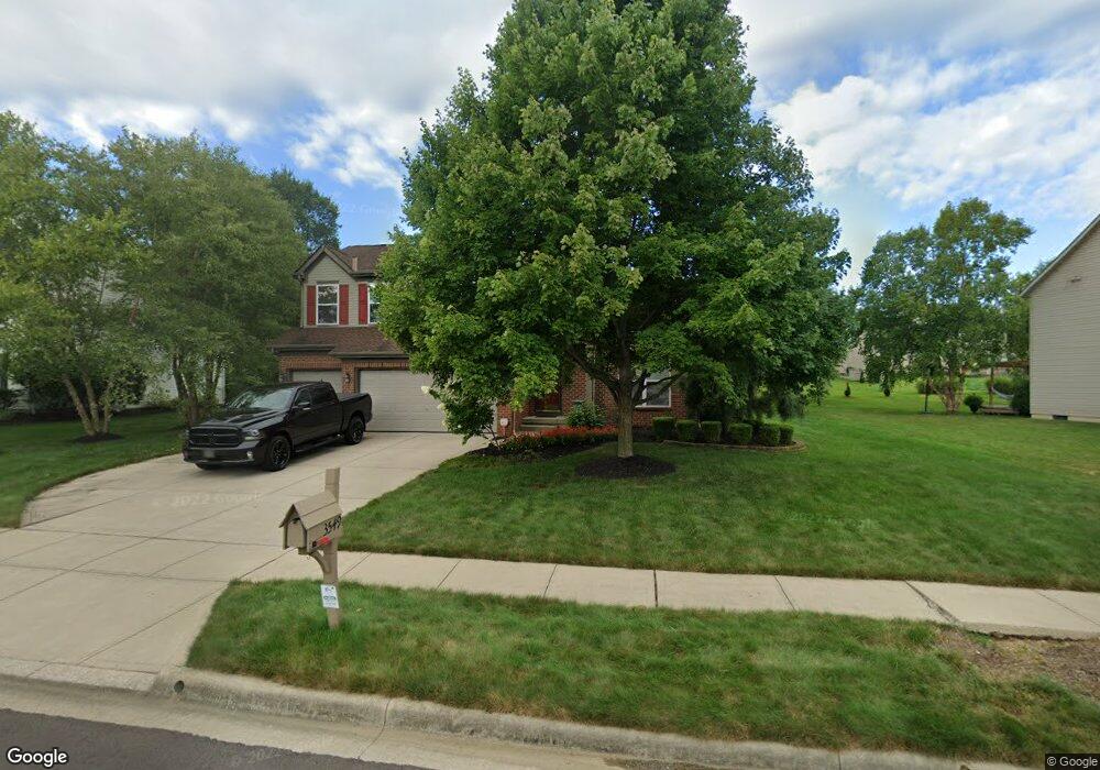
3549 Manchester Dr Powell, OH 43065
Liberty Township NeighborhoodEstimated Value: $518,000 - $564,000
3
Beds
3
Baths
2,284
Sq Ft
$237/Sq Ft
Est. Value
About This Home
This home is located at 3549 Manchester Dr, Powell, OH 43065 and is currently estimated at $542,396, approximately $237 per square foot. 3549 Manchester Dr is a home located in Delaware County with nearby schools including Tyler Run Elementary School, Olentangy Liberty Middle School, and Olentangy Liberty High School.
Ownership History
Date
Name
Owned For
Owner Type
Purchase Details
Closed on
Sep 1, 1999
Sold by
Joshua Investment Co
Bought by
Andrews Cheryl R and Popyak George D
Current Estimated Value
Home Financials for this Owner
Home Financials are based on the most recent Mortgage that was taken out on this home.
Original Mortgage
$223,910
Outstanding Balance
$65,209
Interest Rate
7.59%
Mortgage Type
New Conventional
Estimated Equity
$477,187
Create a Home Valuation Report for This Property
The Home Valuation Report is an in-depth analysis detailing your home's value as well as a comparison with similar homes in the area
Home Values in the Area
Average Home Value in this Area
Purchase History
| Date | Buyer | Sale Price | Title Company |
|---|---|---|---|
| Andrews Cheryl R | $248,790 | -- |
Source: Public Records
Mortgage History
| Date | Status | Borrower | Loan Amount |
|---|---|---|---|
| Open | Andrews Cheryl R | $223,910 |
Source: Public Records
Tax History Compared to Growth
Tax History
| Year | Tax Paid | Tax Assessment Tax Assessment Total Assessment is a certain percentage of the fair market value that is determined by local assessors to be the total taxable value of land and additions on the property. | Land | Improvement |
|---|---|---|---|---|
| 2024 | $7,649 | $145,990 | $32,730 | $113,260 |
| 2023 | $7,679 | $145,990 | $32,730 | $113,260 |
| 2022 | $7,584 | $114,310 | $22,750 | $91,560 |
| 2021 | $7,630 | $114,310 | $22,750 | $91,560 |
| 2020 | $7,667 | $114,310 | $22,750 | $91,560 |
| 2019 | $6,677 | $103,780 | $22,750 | $81,030 |
| 2018 | $6,708 | $103,780 | $22,750 | $81,030 |
| 2017 | $6,638 | $95,130 | $20,370 | $74,760 |
| 2016 | $6,545 | $95,130 | $20,370 | $74,760 |
| 2015 | $5,919 | $95,130 | $20,370 | $74,760 |
| 2014 | $6,001 | $95,130 | $20,370 | $74,760 |
| 2013 | $5,999 | $92,960 | $20,370 | $72,590 |
Source: Public Records
Map
Nearby Homes
- 91 Tiller Dr
- 261 Andover Dr
- 274 Stamford Dr
- 524 Commons Dr Unit 524
- 55 Timber Oak Ct
- 2672 Sawmill Reserve Dr Unit 2672
- 2961 Lexington Dr
- 4933 Emerald Lakes Blvd Unit 4903
- 2168 Summit Row Blvd
- 8803 Yates Point Ct
- 8796 Yates Point Ct
- 255 Winter Hill Place
- 3910 Summit View Rd
- 2013 Summit Row Blvd
- 2228 Gnarled Pine Dr
- 1937 Liberty St
- 2020 Liberty St
- 87 Murphys Oval Unit N87
- 8741 Jamey Ct
- 120 S Liberty St
- 3541 Manchester Dr
- 3563 Manchester Dr
- 3541 Waterbury Ln
- 3527 Waterbury Ln
- 3577 Manchester Dr
- 3553 Waterbury Ln
- 3534 Manchester Dr
- 3542 Manchester Dr
- 10474 Brettridge Dr
- 3513 Waterbury Ln
- 3526 Manchester Dr
- 3562 Manchester Dr
- 3595 Manchester Dr
- 10490 Brettridge Dr
- 3565 Waterbury Ln
- 3516 Manchester Dr
- 3503 Waterbury Ln
- 10467 Rochelle Dr
- 3530 Waterbury Ln
- 3479 Waltham Ct