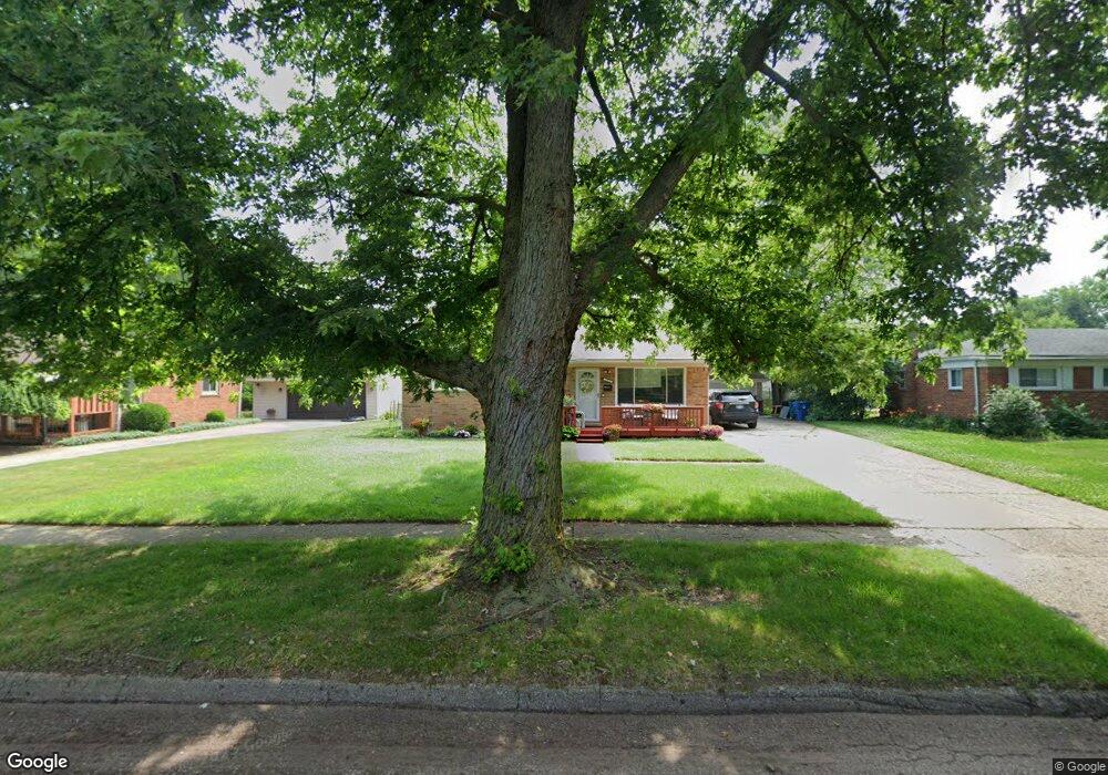
3558 David K Dr Waterford, MI 48329
Waterford Township NeighborhoodEstimated Value: $217,000 - $267,000
3
Beds
1
Bath
1,053
Sq Ft
$227/Sq Ft
Est. Value
About This Home
This home is located at 3558 David K Dr, Waterford, MI 48329 and is currently estimated at $238,928, approximately $226 per square foot. 3558 David K Dr is a home located in Oakland County with nearby schools including Schoolcraft Elementary School, Waterford Kettering High School, and Mason Middle School.
Ownership History
Date
Name
Owned For
Owner Type
Purchase Details
Closed on
Dec 23, 2020
Sold by
Hancock Max J and Sizemore Rorianne
Bought by
Hancock Annice Dean and Hancock Brianna
Current Estimated Value
Home Financials for this Owner
Home Financials are based on the most recent Mortgage that was taken out on this home.
Original Mortgage
$110,272
Interest Rate
2.9%
Mortgage Type
FHA
Purchase Details
Closed on
Feb 23, 2017
Sold by
Hancock Annice Dean and Hancock Max J
Bought by
Hancock Annice Dean and Hancock Max J
Purchase Details
Closed on
Feb 18, 2017
Sold by
Hancock Max J and Hancock Annice Dean
Bought by
Hancock Max J and Hancock Annice Dean
Create a Home Valuation Report for This Property
The Home Valuation Report is an in-depth analysis detailing your home's value as well as a comparison with similar homes in the area
Home Values in the Area
Average Home Value in this Area
Purchase History
| Date | Buyer | Sale Price | Title Company |
|---|---|---|---|
| Hancock Annice Dean | $150,000 | Amrock | |
| Hancock Annice Dean | -- | None Available | |
| Hancock Max J | -- | None Available |
Source: Public Records
Mortgage History
| Date | Status | Borrower | Loan Amount |
|---|---|---|---|
| Previous Owner | Hancock Annice Dean | $110,272 |
Source: Public Records
Tax History Compared to Growth
Tax History
| Year | Tax Paid | Tax Assessment Tax Assessment Total Assessment is a certain percentage of the fair market value that is determined by local assessors to be the total taxable value of land and additions on the property. | Land | Improvement |
|---|---|---|---|---|
| 2024 | $1,059 | $93,390 | $0 | $0 |
| 2023 | $1,010 | $88,080 | $0 | $0 |
| 2022 | $1,955 | $75,400 | $0 | $0 |
| 2021 | $1,839 | $71,000 | $0 | $0 |
| 2020 | $925 | $69,710 | $0 | $0 |
| 2019 | $1,545 | $67,870 | $0 | $0 |
| 2018 | $1,534 | $61,790 | $0 | $0 |
| 2017 | $1,414 | $61,790 | $0 | $0 |
| 2016 | $1,411 | $57,540 | $0 | $0 |
| 2015 | -- | $52,070 | $0 | $0 |
| 2014 | -- | $41,180 | $0 | $0 |
| 2011 | -- | $42,900 | $0 | $0 |
Source: Public Records
Map
Nearby Homes
- 6275 Williams Lake Rd
- 6015 Rowley Blvd
- 3867 Percy King Rd
- 6031 Southward Ave
- 6391 Rowley Blvd
- 6376 Lanman Dr
- 3077 Nanwich Dr
- 3880 Lotus Dr
- 5502 Rowley Blvd
- 3912 Cambrook Ln
- 4083 Ledgestone Dr
- 6625 Lanman Dr
- 000 Waterloo St
- 6533 Cloverton Dr
- 4281 Marcus Rd
- 6522 Saline Dr
- 3229 Homestead Dr
- 4148 Conne Mara Ln
- 6570 Saline Dr
- 4341 Barnard Rd
- 3570 David K Dr
- 3546 David K Dr
- 3534 David K Dr
- 3553 David K Dr
- 3565 David K Dr
- 3522 David K Dr
- 3541 David K Dr
- 3577 David K Dr
- 6089 Graper Dr
- 6077 Graper Dr
- 3529 David K Dr
- 6063 Graper Dr
- 3510 David K Dr
- 3549 Airport Rd
- 3575 Airport Rd
- 3589 David K Dr
- 6049 Graper Dr
- 3517 David K Dr
- 3554 Percy King Rd
- 3566 Percy King Rd