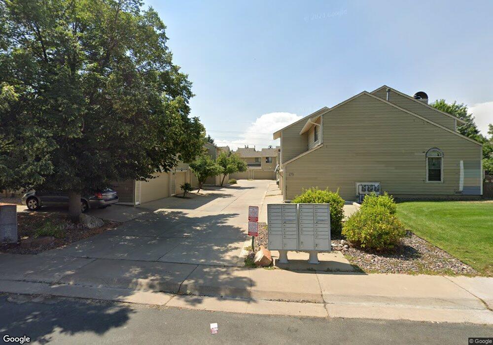
358 S Taft Ct Unit 106 Louisville, CO 80027
Estimated Value: $400,000 - $431,000
2
Beds
1
Bath
884
Sq Ft
$471/Sq Ft
Est. Value
About This Home
This home is located at 358 S Taft Ct Unit 106, Louisville, CO 80027 and is currently estimated at $416,444, approximately $471 per square foot. 358 S Taft Ct Unit 106 is a home located in Boulder County with nearby schools including Fireside Elementary School, Monarch K-8 School, and Monarch High School.
Ownership History
Date
Name
Owned For
Owner Type
Purchase Details
Closed on
Jan 10, 2018
Sold by
Ringener Craig A
Bought by
Ring Investments Llc
Current Estimated Value
Purchase Details
Closed on
Jan 25, 2007
Sold by
Ross Donald L
Bought by
The Donald L Ross Family Trust
Purchase Details
Closed on
Feb 5, 1992
Bought by
Ringener Jana K and Ringener Craig A
Purchase Details
Closed on
Apr 19, 1991
Bought by
Ringener Jana K and Ringener Craig A
Purchase Details
Closed on
Jun 7, 1985
Bought by
Ringener Jana K and Ringener Craig A
Purchase Details
Closed on
Mar 1, 1984
Bought by
Ringener Jana K and Ringener Craig A
Create a Home Valuation Report for This Property
The Home Valuation Report is an in-depth analysis detailing your home's value as well as a comparison with similar homes in the area
Home Values in the Area
Average Home Value in this Area
Purchase History
| Date | Buyer | Sale Price | Title Company |
|---|---|---|---|
| Ring Investments Llc | -- | None Available | |
| The Donald L Ross Family Trust | -- | None Available | |
| Ringener Jana K | $69,800 | -- | |
| Ringener Jana K | $80,900 | -- | |
| Ringener Jana K | $73,000 | -- | |
| Ringener Jana K | $70,500 | -- |
Source: Public Records
Tax History Compared to Growth
Tax History
| Year | Tax Paid | Tax Assessment Tax Assessment Total Assessment is a certain percentage of the fair market value that is determined by local assessors to be the total taxable value of land and additions on the property. | Land | Improvement |
|---|---|---|---|---|
| 2025 | $2,277 | $27,919 | -- | $27,919 |
| 2024 | $2,277 | $27,919 | -- | $27,919 |
| 2023 | $2,239 | $25,338 | -- | $29,023 |
| 2022 | $2,030 | $21,093 | $0 | $21,093 |
| 2021 | $2,310 | $24,946 | $0 | $24,946 |
| 2020 | $2,137 | $22,837 | $0 | $22,837 |
| 2019 | $2,107 | $22,837 | $0 | $22,837 |
| 2018 | $1,954 | $21,874 | $0 | $21,874 |
| 2017 | $1,915 | $24,182 | $0 | $24,182 |
| 2016 | $1,498 | $17,026 | $0 | $17,026 |
| 2015 | $1,420 | $14,240 | $0 | $14,240 |
| 2014 | $1,217 | $14,240 | $0 | $14,240 |
Source: Public Records
Map
Nearby Homes
- 362 S Taft Ct Unit 108
- 284 S Taft Ct Unit 76
- 305 S Taft Ct Unit 33
- 323 S Taft Ct Unit 26
- 749 Apple Ct
- 279 S Taft Ct Unit 53
- 641 W Dahlia St
- 546 Ridgeview Dr
- 567 Manorwood Ln
- 572 Ridgeview Dr
- 539 Coal Creek Ln
- 620 Ridgeview Dr
- 159 S Polk Ave
- 118 S Tanager Ct
- 716 Club Cir
- 730 Copper Ln Unit 106
- 812 W Mulberry St
- 203 Springs Dr
- 408 Fillmore Ct
- 1057 W Century Dr Unit 212
- 360 S Taft Ct Unit 107
- 356 S Taft Ct Unit 105
- 354 S Taft Ct Unit 104
- 352 S Taft Ct Unit 103
- 350 S Taft Ct Unit 102
- 348 S Taft Ct Unit 101
- 346 S Taft Ct Unit 100
- 344 S Taft Ct Unit 99
- 342 S Taft Ct Unit 98
- 340 S Taft Ct Unit 97
- 328 S Taft Ct Unit 96
- 334 S Taft Ct Unit 93
- 336 S Taft Ct Unit 92
- 338 S Taft Ct Unit 91
- 332 S Taft Ct Unit 94
- 330 S Taft Ct Unit 95
- 362 S Taft Ct Unit 18-108
- 386 S Taft Ct Unit 120
- 384 S Taft Ct Unit 119
- 382 S Taft Ct Unit 118