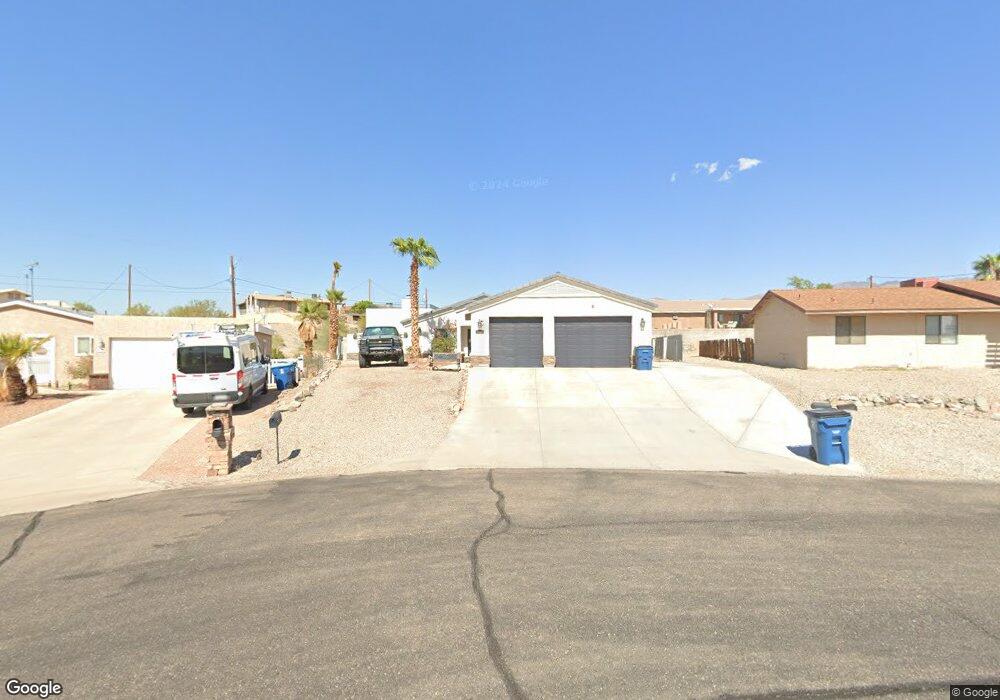
3581 Bali Dr Lake Havasu City, AZ 86406
Estimated Value: $590,000 - $640,000
--
Bed
1
Bath
2,402
Sq Ft
$258/Sq Ft
Est. Value
About This Home
This home is located at 3581 Bali Dr, Lake Havasu City, AZ 86406 and is currently estimated at $619,197, approximately $257 per square foot. 3581 Bali Dr is a home located in Mohave County with nearby schools including Jamaica Elementary School, Thunderbolt Middle School, and Lake Havasu High School.
Ownership History
Date
Name
Owned For
Owner Type
Purchase Details
Closed on
Feb 12, 2024
Sold by
Navaretta John
Bought by
Navaretta Trust and Navaretta
Current Estimated Value
Purchase Details
Closed on
Dec 11, 2006
Sold by
Navaretta John C and Navaretta Josephine
Bought by
Navaretta Cristina M
Home Financials for this Owner
Home Financials are based on the most recent Mortgage that was taken out on this home.
Original Mortgage
$205,000
Interest Rate
6.33%
Mortgage Type
Unknown
Purchase Details
Closed on
Mar 13, 2006
Sold by
Schopen Jerome A and Schopen Elizabeth F
Bought by
Navaretta John C and Navaretta Josephine
Create a Home Valuation Report for This Property
The Home Valuation Report is an in-depth analysis detailing your home's value as well as a comparison with similar homes in the area
Home Values in the Area
Average Home Value in this Area
Purchase History
| Date | Buyer | Sale Price | Title Company |
|---|---|---|---|
| Navaretta Trust | -- | None Listed On Document | |
| Navaretta Cristina M | $257,000 | State Title Agency Inc | |
| Navaretta John C | $107,000 | State Title Agency Inc |
Source: Public Records
Mortgage History
| Date | Status | Borrower | Loan Amount |
|---|---|---|---|
| Previous Owner | Navaretta Cristina M | $205,000 |
Source: Public Records
Tax History Compared to Growth
Tax History
| Year | Tax Paid | Tax Assessment Tax Assessment Total Assessment is a certain percentage of the fair market value that is determined by local assessors to be the total taxable value of land and additions on the property. | Land | Improvement |
|---|---|---|---|---|
| 2026 | -- | -- | -- | -- |
| 2025 | $1,888 | $51,511 | $0 | $0 |
| 2024 | $1,888 | $55,879 | $0 | $0 |
| 2023 | $1,888 | $50,445 | $0 | $0 |
| 2022 | $1,818 | $35,489 | $0 | $0 |
| 2021 | $2,033 | $32,939 | $0 | $0 |
| 2019 | $1,649 | $23,452 | $0 | $0 |
| 2018 | $1,594 | $21,337 | $0 | $0 |
| 2017 | $1,566 | $20,273 | $0 | $0 |
| 2016 | $1,388 | $19,422 | $0 | $0 |
| 2015 | $1,351 | $17,510 | $0 | $0 |
Source: Public Records
Map
Nearby Homes
- 3565 El Rey Ln
- 3420 Mcculloch Blvd N
- 3665 Pelican Place
- 3413 Landau Ln
- 3410 El Dorado Ave N
- 3504 Pioneer Dr
- 3380 Monte Carlo Ave
- 3751 Mission Dr S
- 3381 El Dorado Ave N
- 3365 Monte Carlo Ave
- 3541 Chesapeake
- 3276 Dolphin Dr
- 3300 Monte Carlo Ave
- 3493 Mitchell Ln
- 3313 Sand Piper Dr
- 3250 El Dorado Ave N
- 3808 Whaler Dr
- 3306 Kiowa Blvd S
- 3828 Cherry Tree Blvd
- 3240 Mcculloch Blvd N