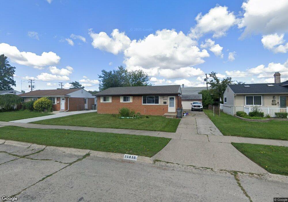
35815 Griswald St Clinton Township, MI 48035
Estimated Value: $209,000 - $240,000
3
Beds
1
Bath
980
Sq Ft
$224/Sq Ft
Est. Value
About This Home
This home is located at 35815 Griswald St, Clinton Township, MI 48035 and is currently estimated at $219,870, approximately $224 per square foot. 35815 Griswald St is a home located in Macomb County with nearby schools including Clintondale High School and St. Thecla Catholic School.
Ownership History
Date
Name
Owned For
Owner Type
Purchase Details
Closed on
Nov 19, 2008
Sold by
Secretary Of Housing & Urban Development
Bought by
Papiez Steven
Current Estimated Value
Purchase Details
Closed on
Nov 12, 2007
Sold by
Everhome Mortgage Co
Bought by
Hud
Purchase Details
Closed on
May 4, 2007
Sold by
Wiley Monique and Persley Lori B
Bought by
Everhome Mortgage Co
Purchase Details
Closed on
Jun 9, 2004
Sold by
Puskar Loretta C and Cook Valerie
Bought by
Wiley Monique and Persley Lori B
Create a Home Valuation Report for This Property
The Home Valuation Report is an in-depth analysis detailing your home's value as well as a comparison with similar homes in the area
Home Values in the Area
Average Home Value in this Area
Purchase History
| Date | Buyer | Sale Price | Title Company |
|---|---|---|---|
| Papiez Steven | $65,000 | None Available | |
| Hud | -- | None Available | |
| Everhome Mortgage Co | $144,276 | None Available | |
| Wiley Monique | $141,000 | -- |
Source: Public Records
Tax History Compared to Growth
Tax History
| Year | Tax Paid | Tax Assessment Tax Assessment Total Assessment is a certain percentage of the fair market value that is determined by local assessors to be the total taxable value of land and additions on the property. | Land | Improvement |
|---|---|---|---|---|
| 2025 | $2,845 | $85,600 | $0 | $0 |
| 2024 | $1,718 | $76,500 | $0 | $0 |
| 2023 | $1,716 | $69,600 | $0 | $0 |
| 2022 | $2,552 | $66,000 | $0 | $0 |
| 2021 | $2,647 | $62,700 | $0 | $0 |
| 2020 | $1,520 | $59,700 | $0 | $0 |
| 2019 | $2,896 | $53,000 | $0 | $0 |
| 2018 | $2,695 | $48,300 | $0 | $0 |
| 2017 | $2,718 | $40,700 | $7,300 | $33,400 |
| 2016 | $2,459 | $40,700 | $0 | $0 |
| 2015 | -- | $35,900 | $0 | $0 |
| 2014 | -- | $34,000 | $0 | $0 |
| 2011 | -- | $39,800 | $11,900 | $27,900 |
Source: Public Records
Map
Nearby Homes
- 35685 Griswald St
- 36027 Vaughn St
- 35501 Griswald St
- 35903 Little MacK Ave
- 35403 Seville St
- 35375 Groesbeck Hwy
- 20830 Lantz St
- 0000 Garfield
- 36069 Eaton Dr
- 20176 15 Mile Rd
- 15 Mile
- 20011 Abrahm St
- 20309 Abrahm St
- 20002 S Great Oaks Cir
- 18976 Dixie Dr
- 34606 Beaconsfield St
- 37236 Great Oaks Ct
- 19975 S Great Oaks Cir
- 20550 Vermander Ave
- 20410 Woodward St
- 35801 Griswald St
- 35829 Griswald St
- 35781 Griswald St
- 35843 Griswald St
- 35810 Griswald St
- 35767 Griswald St
- 35904 Groesbeck Hwy
- 35871 Vaughn St
- 35774 Griswald St
- 35753 Griswald St
- 35885 Vaughn St
- 35733 Rutherford St
- 35752 Griswald St
- 35739 Griswald St
- 35844 Rutherford St
- 35830 Rutherford St
- 35816 Rutherford St
- 35802 Rutherford St
- 20208 Dubois St
- 35738 Griswald St