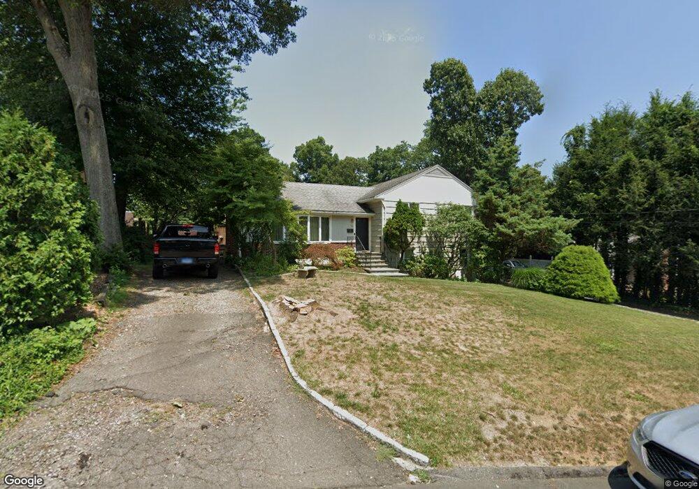
36 Berrian Rd Stamford, CT 06905
Turn of the River-Newfield NeighborhoodEstimated Value: $754,000 - $898,830
3
Beds
3
Baths
1,649
Sq Ft
$496/Sq Ft
Est. Value
About This Home
This home is located at 36 Berrian Rd, Stamford, CT 06905 and is currently estimated at $817,708, approximately $495 per square foot. 36 Berrian Rd is a home located in Fairfield County with nearby schools including Newfield School, Rippowam Middle School, and Stamford High School.
Ownership History
Date
Name
Owned For
Owner Type
Purchase Details
Closed on
Sep 20, 1999
Sold by
Suss Florence and Jankowitz Stanley
Bought by
Suss Jeffrey M
Current Estimated Value
Purchase Details
Closed on
Aug 20, 1999
Sold by
Jankowitz Stanley and Farber Rosalie
Bought by
Suss Jeffrey M
Create a Home Valuation Report for This Property
The Home Valuation Report is an in-depth analysis detailing your home's value as well as a comparison with similar homes in the area
Home Values in the Area
Average Home Value in this Area
Purchase History
| Date | Buyer | Sale Price | Title Company |
|---|---|---|---|
| Suss Jeffrey M | $257,500 | -- | |
| Suss Jeffrey M | $257,500 | -- | |
| Suss Jeffrey M | $257,500 | -- | |
| Suss Jeffrey M | $257,500 | -- |
Source: Public Records
Mortgage History
| Date | Status | Borrower | Loan Amount |
|---|---|---|---|
| Open | Suss Jeffrey M | $350,000 | |
| Closed | Suss Jeffrey M | $200,000 |
Source: Public Records
Tax History Compared to Growth
Tax History
| Year | Tax Paid | Tax Assessment Tax Assessment Total Assessment is a certain percentage of the fair market value that is determined by local assessors to be the total taxable value of land and additions on the property. | Land | Improvement |
|---|---|---|---|---|
| 2025 | $11,622 | $491,200 | $338,590 | $152,610 |
| 2024 | $11,366 | $491,200 | $338,590 | $152,610 |
| 2023 | $12,211 | $491,200 | $338,590 | $152,610 |
| 2022 | $10,744 | $401,780 | $263,510 | $138,270 |
| 2021 | $10,627 | $401,780 | $263,510 | $138,270 |
| 2020 | $10,354 | $401,780 | $263,510 | $138,270 |
| 2019 | $10,354 | $401,780 | $263,510 | $138,270 |
| 2018 | $9,972 | $401,780 | $263,510 | $138,270 |
| 2017 | $9,742 | $374,680 | $245,270 | $129,410 |
| 2016 | $9,468 | $374,680 | $245,270 | $129,410 |
| 2015 | $9,221 | $374,680 | $245,270 | $129,410 |
| 2014 | $8,914 | $374,680 | $245,270 | $129,410 |
Source: Public Records
Map
Nearby Homes
- 21 Nichols Ave
- 27 Emma Rd
- 113 Wood Ridge Dr
- 6 Walnut Ridge Ct
- 433 High Ridge Rd
- 12 Walnut Ridge Ct
- 31 Rosano Rd
- 34 Bradley Place
- 14 Barmore Dr
- 56 Bradley Place
- 31 Gray Farms Rd
- 182 Turner Rd
- 31 Woodridge Dr S
- 22 Hastings Ln
- 38 Lancaster Place
- 122 Brook Run Ln
- 100 Hirsch Rd
- 39 Camore St
- 24 Haig Ave
- 393 Upper Haig Ave