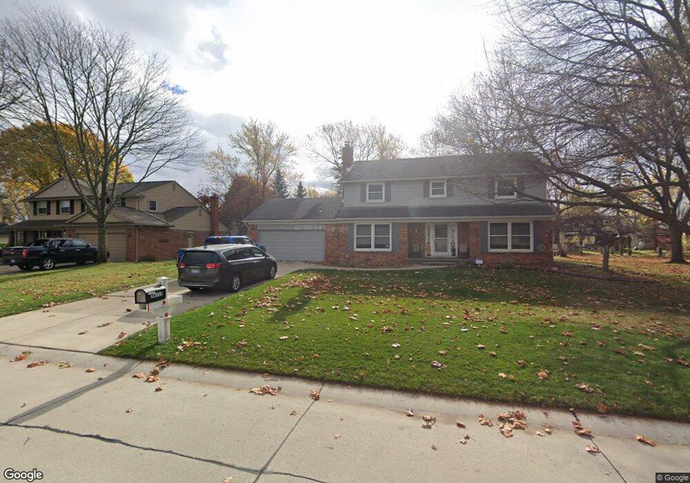
36115 Old Homestead Dr Farmington Hills, MI 48335
Estimated Value: $433,727 - $508,000
4
Beds
3
Baths
2,352
Sq Ft
$200/Sq Ft
Est. Value
About This Home
This home is located at 36115 Old Homestead Dr, Farmington Hills, MI 48335 and is currently estimated at $470,682, approximately $200 per square foot. 36115 Old Homestead Dr is a home located in Oakland County with nearby schools including Hillside Elementary School, Power Middle School, and Farmington High School.
Ownership History
Date
Name
Owned For
Owner Type
Purchase Details
Closed on
Mar 3, 2023
Sold by
Deuby Timothy C and Deuby Melinda Joy-Komsa
Bought by
Deuby Living Trust
Current Estimated Value
Purchase Details
Closed on
May 12, 2008
Sold by
Kaminski Mary E
Bought by
Deuby Melinda J and Deuby Timothy C
Home Financials for this Owner
Home Financials are based on the most recent Mortgage that was taken out on this home.
Original Mortgage
$207,000
Interest Rate
5.87%
Mortgage Type
Purchase Money Mortgage
Purchase Details
Closed on
Nov 26, 2001
Sold by
Edmund J Kaminski Tr
Bought by
Kaminski Mary E
Purchase Details
Closed on
Dec 29, 1995
Sold by
Kaminski Edmund J
Bought by
Kaminski Mary E
Create a Home Valuation Report for This Property
The Home Valuation Report is an in-depth analysis detailing your home's value as well as a comparison with similar homes in the area
Home Values in the Area
Average Home Value in this Area
Purchase History
| Date | Buyer | Sale Price | Title Company |
|---|---|---|---|
| Deuby Living Trust | -- | -- | |
| Deuby Melinda J | $230,000 | None Available | |
| Kaminski Mary E | -- | -- | |
| Kaminski Mary E | -- | -- |
Source: Public Records
Mortgage History
| Date | Status | Borrower | Loan Amount |
|---|---|---|---|
| Previous Owner | Deuby Melinda J | $207,000 |
Source: Public Records
Tax History Compared to Growth
Tax History
| Year | Tax Paid | Tax Assessment Tax Assessment Total Assessment is a certain percentage of the fair market value that is determined by local assessors to be the total taxable value of land and additions on the property. | Land | Improvement |
|---|---|---|---|---|
| 2024 | $4,282 | $183,690 | $35,000 | $148,690 |
| 2022 | $4,114 | $146,210 | $30,500 | $115,710 |
| 2021 | $4,683 | $142,870 | $30,500 | $112,370 |
| 2020 | $3,895 | $141,540 | $30,500 | $111,040 |
| 2018 | $6,008 | $126,480 | $0 | $0 |
| 2015 | -- | $107,430 | $0 | $0 |
| 2014 | -- | $96,950 | $0 | $0 |
| 2011 | -- | $90,090 | $0 | $0 |
Source: Public Records
Map
Nearby Homes
- 37731 Stableview Dr
- 24543 Martel Dr Unit 70
- 24501 Walden Woods
- 35550 Pleasant Valley Rd
- 36896 Chesapeake Rd
- 25583 Bridlepath Ln
- 0000 Howard Rd
- 26636 Valhalla Dr
- 23935 Drake Rd
- 20757 Lujon Dr
- 36300 Howard Rd
- 26610 Valhalla Dr
- 37159 Howard Rd
- 36680 Howard Rd
- 30714 Franklin Hills Ct
- 35509 Heritage Ln
- 35572 Heritage Ln Unit 58
- 27155 Drake Rd
- 34062 Lyncroft St
- 23300 Hillview Ct
- 35991 Old Homestead Dr
- 36137 Old Homestead Dr
- 35966 Charter Crest Rd
- 35984 Charter Crest Rd
- 35998 Charter Crest Rd
- 25311 Crown Point Ct
- 35948 Charter Crest Rd
- 35973 Old Homestead Dr
- 25314 Crown Point Ct
- 36154 Old Homestead Dr
- 35932 Charter Crest Rd
- 35955 Old Homestead Dr
- 25325 Crown Point Ct
- 35973 Charter Crest Rd
- 35955 Charter Crest Rd
- 36133 Johnstown Rd
- 36111 Johnstown Rd
- 35987 Charter Crest Rd
- 35954 Old Homestead Dr
- 25338 Crown Point Ct