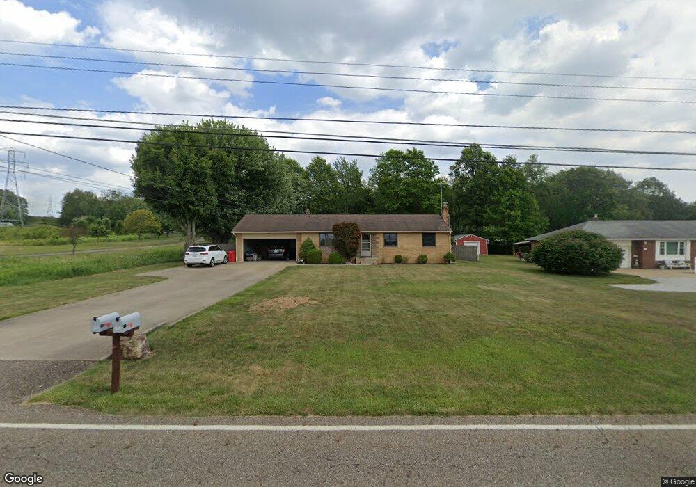
3614 Meese Rd Louisville, OH 44641
Estimated Value: $193,000 - $232,000
4
Beds
3
Baths
1,092
Sq Ft
$200/Sq Ft
Est. Value
About This Home
This home is located at 3614 Meese Rd, Louisville, OH 44641 and is currently estimated at $218,759, approximately $200 per square foot. 3614 Meese Rd is a home located in Stark County with nearby schools including Louisville High School and St. Thomas Aquinas High School & Middle School.
Ownership History
Date
Name
Owned For
Owner Type
Purchase Details
Closed on
Oct 27, 2022
Sold by
Hathaway Robert O and Hathaway Renee J
Bought by
Hathaway Robert O and Hathaway Renee J
Current Estimated Value
Purchase Details
Closed on
Sep 14, 2000
Sold by
Paumier Renee J and Paumier Renee J
Bought by
Hathaway Renee J and Hathaway Robert O
Home Financials for this Owner
Home Financials are based on the most recent Mortgage that was taken out on this home.
Original Mortgage
$22,000
Interest Rate
8.05%
Mortgage Type
Purchase Money Mortgage
Create a Home Valuation Report for This Property
The Home Valuation Report is an in-depth analysis detailing your home's value as well as a comparison with similar homes in the area
Home Values in the Area
Average Home Value in this Area
Purchase History
| Date | Buyer | Sale Price | Title Company |
|---|---|---|---|
| Hathaway Robert O | -- | -- | |
| Hathaway Renee J | -- | Gateway Title Service Agency |
Source: Public Records
Mortgage History
| Date | Status | Borrower | Loan Amount |
|---|---|---|---|
| Previous Owner | Hathaway Renee J | $22,000 |
Source: Public Records
Tax History Compared to Growth
Tax History
| Year | Tax Paid | Tax Assessment Tax Assessment Total Assessment is a certain percentage of the fair market value that is determined by local assessors to be the total taxable value of land and additions on the property. | Land | Improvement |
|---|---|---|---|---|
| 2025 | -- | $71,610 | $15,750 | $55,860 |
| 2024 | -- | $71,610 | $15,750 | $55,860 |
| 2023 | $2,771 | $56,880 | $12,780 | $44,100 |
| 2022 | $1,389 | $56,880 | $12,780 | $44,100 |
| 2021 | $2,786 | $56,880 | $12,780 | $44,100 |
| 2020 | $2,336 | $50,410 | $11,520 | $38,890 |
| 2019 | $2,346 | $50,410 | $11,520 | $38,890 |
| 2018 | $2,338 | $50,410 | $11,520 | $38,890 |
| 2017 | $2,169 | $44,600 | $8,610 | $35,990 |
| 2016 | $2,121 | $44,600 | $8,610 | $35,990 |
| 2015 | $2,127 | $44,600 | $8,610 | $35,990 |
| 2014 | $138 | $41,480 | $8,020 | $33,460 |
| 2013 | $1,073 | $41,480 | $8,020 | $33,460 |
Source: Public Records
Map
Nearby Homes
- 3390 Meese Rd NE
- 2110 Edmar St
- 1812 E Broad St
- 1715 High St
- 8225 Georgetown St
- 908 Sand Lot Cir
- 641 S Nickelplate St
- 2015 E Main St
- 520 S Silver St
- 308 Superior St
- 728 E Broad St
- 0 Michigan Blvd
- 1702 View Pointe Ave
- 510 S Bauman Ct
- 204 E Broad St
- 107 E Broad St
- 1639 Horizon Dr
- 325 Lincoln Ave
- 1990 Belfort Ave
- 1170 Winding Ridge Ave
- 3594 Meese Rd
- 3630 Meese Rd
- 3633 Meese Rd
- 3566 Meese Rd
- 3565 Meese Rd
- 3544 Meese Rd NE
- 3544 Meese Rd NE
- 8835 Rue Helena St
- 3663 Meese Rd
- 3545 Meese Rd
- 8861 Rue Helena St
- 8861 Rue Helena St
- 8861 Rue Helena St
- 8861 Rue Helena St
- 3640 Meese Rd
- 8881 Rue Helena St
- 3628 Meese Rd
- 3510 Meese Rd NE
- 3699 Meese Rd
- 3699 Meese Rd NE