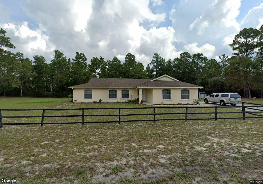
3630 Trade St Deltona, FL 32738
Estimated Value: $306,000 - $386,000
3
Beds
2
Baths
2,178
Sq Ft
$163/Sq Ft
Est. Value
About This Home
This home is located at 3630 Trade St, Deltona, FL 32738 and is currently estimated at $355,287, approximately $163 per square foot. 3630 Trade St is a home located in Volusia County with nearby schools including Pride Elementary School, Heritage Middle School, and Pine Ridge High School.
Ownership History
Date
Name
Owned For
Owner Type
Purchase Details
Closed on
Feb 23, 2004
Sold by
Robins Ronald and Robins Beverly
Bought by
Harrod Richard Robert and Harrod Teresita B
Current Estimated Value
Purchase Details
Closed on
Dec 15, 1991
Bought by
Harrod Richard R and Harrod Teresita B
Purchase Details
Closed on
Oct 15, 1988
Bought by
Harrod Richard R and Harrod Teresita B
Purchase Details
Closed on
Apr 15, 1982
Bought by
Harrod Richard R and Harrod Teresita B
Purchase Details
Closed on
Sep 15, 1979
Bought by
Harrod Richard R and Harrod Teresita B
Create a Home Valuation Report for This Property
The Home Valuation Report is an in-depth analysis detailing your home's value as well as a comparison with similar homes in the area
Home Values in the Area
Average Home Value in this Area
Purchase History
| Date | Buyer | Sale Price | Title Company |
|---|---|---|---|
| Harrod Richard Robert | $49,900 | -- | |
| Harrod Richard R | $18,900 | -- | |
| Harrod Richard R | $18,500 | -- | |
| Harrod Richard R | $7,000 | -- | |
| Harrod Richard R | $100 | -- | |
| Harrod Richard R | $5,500 | -- |
Source: Public Records
Tax History Compared to Growth
Tax History
| Year | Tax Paid | Tax Assessment Tax Assessment Total Assessment is a certain percentage of the fair market value that is determined by local assessors to be the total taxable value of land and additions on the property. | Land | Improvement |
|---|---|---|---|---|
| 2025 | $1,959 | $133,642 | -- | -- |
| 2024 | $1,959 | $129,876 | -- | -- |
| 2023 | $1,959 | $126,094 | $0 | $0 |
| 2022 | $1,928 | $122,421 | $0 | $0 |
| 2021 | $1,964 | $118,855 | $0 | $0 |
| 2020 | $1,935 | $117,214 | $0 | $0 |
| 2019 | $1,946 | $114,579 | $0 | $0 |
| 2018 | $1,919 | $112,443 | $0 | $0 |
| 2017 | $1,894 | $110,130 | $0 | $0 |
| 2016 | $1,828 | $107,865 | $0 | $0 |
| 2015 | $1,849 | $106,726 | $0 | $0 |
| 2014 | $1,823 | $105,879 | $0 | $0 |
Source: Public Records
Map
Nearby Homes
- 690 Colchester Ave
- 0 Howland Blvd Unit V4908648
- 0 Howland Blvd Unit MFRO6102246
- 0 Howland Blvd Unit O5513139
- 0 Howland Blvd Unit MFRV4943556
- 3795 Pinehurst St
- 630 Mosquero Ave
- 3400 Trade St
- 590 Twin Lake Ave
- 937 Howland Blvd
- 144 Fort Smith Blvd
- 3441 Sandlor Dr
- 3390 George Sauls St
- 3519 Fernanda Dr
- 3527 Fernanda Dr
- 935 Howland Blvd
- 1046 Wanderer Dr
- 3565 Fernanda Dr
- 0 Ryland St Unit MFRO6322194
- 3236 Phonetia Dr
- 725 Colchester Ave
- 716 Teather Ave
- 717 Colchester Ave
- 708 Teather Ave
- 714 Colchester Ave
- 706 Colchester Ave
- 709 Colchester Ave
- 713 Teather Ave
- 3670 Trade St
- 721 Vardon Ave
- 3590 Trade St
- 698 Colchester Ave
- 714 Lola Ave
- 701 Colchester Ave
- 705 Teather Ave
- 713 Vardon Ave
- 706 Lola Ave
- 705 Vardon Ave
- 697 Teather Ave
- 693 Colchester Ave