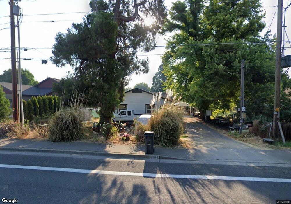
3648 Bursell Rd Central Point, OR 97502
Estimated Value: $275,000 - $320,000
3
Beds
1
Bath
952
Sq Ft
$301/Sq Ft
Est. Value
About This Home
This home is located at 3648 Bursell Rd, Central Point, OR 97502 and is currently estimated at $286,521, approximately $300 per square foot. 3648 Bursell Rd is a home located in Jackson County with nearby schools including Central Point Elementary School, Scenic Middle School, and Crater High School.
Ownership History
Date
Name
Owned For
Owner Type
Purchase Details
Closed on
Feb 23, 2011
Sold by
The Bank Of New York Mellon
Bought by
Burns Kathleen
Current Estimated Value
Purchase Details
Closed on
Sep 27, 2010
Sold by
Lucas Donald
Bought by
The Bank Of New York Mellon
Purchase Details
Closed on
Jan 5, 2010
Sold by
Lucas Donald and Lucas Tara
Bought by
Bank Of America Home Loans and Countrywide Bac Home Loans Servicing
Purchase Details
Closed on
Dec 27, 2006
Sold by
Lucas Donald
Bought by
Lucas Donald and Lucas Tara
Home Financials for this Owner
Home Financials are based on the most recent Mortgage that was taken out on this home.
Original Mortgage
$137,120
Interest Rate
7.85%
Mortgage Type
Purchase Money Mortgage
Purchase Details
Closed on
Dec 15, 2006
Sold by
Snyder Travis
Bought by
Lucas Donald
Home Financials for this Owner
Home Financials are based on the most recent Mortgage that was taken out on this home.
Original Mortgage
$137,120
Interest Rate
7.85%
Mortgage Type
Purchase Money Mortgage
Purchase Details
Closed on
Oct 2, 2006
Sold by
Altus Construction Inc
Bought by
Snyder Travis
Purchase Details
Closed on
Sep 29, 2006
Sold by
Menefee Marsha
Bought by
Altus Construction Inc
Purchase Details
Closed on
Jul 28, 2005
Sold by
Anderson Marsha L
Bought by
Menefee Marsha
Home Financials for this Owner
Home Financials are based on the most recent Mortgage that was taken out on this home.
Original Mortgage
$430,000
Interest Rate
5.56%
Mortgage Type
Unknown
Purchase Details
Closed on
Sep 16, 2004
Sold by
Wirth Steven Anthony and Wirth Corine P
Bought by
Anderson Marsha L
Home Financials for this Owner
Home Financials are based on the most recent Mortgage that was taken out on this home.
Original Mortgage
$335,000
Interest Rate
5.94%
Mortgage Type
Purchase Money Mortgage
Purchase Details
Closed on
Oct 20, 1999
Sold by
Olsen Charles K and Olsen Lucille V
Bought by
Wirth Steven and Wirth Corine
Create a Home Valuation Report for This Property
The Home Valuation Report is an in-depth analysis detailing your home's value as well as a comparison with similar homes in the area
Home Values in the Area
Average Home Value in this Area
Purchase History
| Date | Buyer | Sale Price | Title Company |
|---|---|---|---|
| Burns Kathleen | $49,000 | Fidelity Natl Title Co Of Or | |
| The Bank Of New York Mellon | $66,600 | None Available | |
| Bank Of America Home Loans | -- | None Available | |
| Lucas Donald | -- | Accommodation | |
| Lucas Donald | $171,400 | Lawyers Title Ins | |
| Snyder Travis | $135,000 | Lawyers Title Ins | |
| Altus Construction Inc | -- | Lawyers Title Ins | |
| Menefee Marsha | -- | Lawyers Title Insurance Corp | |
| Anderson Marsha L | $295,000 | Lawyers Title Ins | |
| Wirth Steven | $149,930 | Key Title Company |
Source: Public Records
Mortgage History
| Date | Status | Borrower | Loan Amount |
|---|---|---|---|
| Previous Owner | Lucas Donald | $137,120 | |
| Previous Owner | Menefee Marsha | $430,000 | |
| Previous Owner | Anderson Marsha L | $335,000 |
Source: Public Records
Tax History Compared to Growth
Tax History
| Year | Tax Paid | Tax Assessment Tax Assessment Total Assessment is a certain percentage of the fair market value that is determined by local assessors to be the total taxable value of land and additions on the property. | Land | Improvement |
|---|---|---|---|---|
| 2025 | $2,542 | $152,890 | $90,710 | $62,180 |
| 2024 | $2,542 | $148,440 | $88,070 | $60,370 |
| 2023 | $2,460 | $144,120 | $85,510 | $58,610 |
| 2022 | $2,403 | $144,120 | $85,510 | $58,610 |
| 2021 | $2,334 | $139,930 | $83,030 | $56,900 |
| 2020 | $2,151 | $130,980 | $78,280 | $52,700 |
| 2019 | $1,968 | $120,110 | $70,520 | $49,590 |
| 2018 | $1,960 | $99,800 | $58,180 | $41,620 |
| 2017 | $1,646 | $99,800 | $58,180 | $41,620 |
| 2016 | $1,586 | $96,350 | $55,400 | $40,950 |
| 2015 | $1,453 | $87,580 | $50,360 | $37,220 |
| 2014 | $1,277 | $77,740 | $43,800 | $33,940 |
Source: Public Records
Map
Nearby Homes
- 851 Juanita Way
- 571 Briarwood Dr
- 3496 Edella St
- 3364 Bursell Rd
- 921 Pittview Ave
- 1065 Edwina Ave
- 3358 Bursell Rd
- 928 Brandi Way
- 555 Freeman Rd Unit 128
- 555 Freeman Rd Unit 146
- 555 Freeman Rd Unit 204
- 555 Freeman Rd Unit 209
- 755 S 4th St
- 531 Bush St
- 1060 Hopkins Rd
- 881 Westrop Dr
- 301 Freeman Rd Unit 100
- 301 Freeman Rd Unit 23
- 301 Freeman Rd Unit 85
- 1017 Fairfield Ave
- 3652 Bursell Rd
- 3642 Bursell Rd
- 3656 Bursell Rd
- 3622 Bursell Rd
- 737 Hemlock Ct
- 3660 Bursell Rd
- 3672 Bursell Rd
- 3621 Bursell Rd
- 745 Hemlock Ct
- 828 Hopkins Rd
- 3606 Bursell Rd
- 3664 Bursell Rd
- 1037 Kensington Ct
- 729 Hemlock Ct
- 832 Hopkins Rd
- 749 Hemlock Ave
- 0 Hopkins Rd
- 3592 Bursell Rd
- 841 Juanita Way
- 842 Hopkins Rd