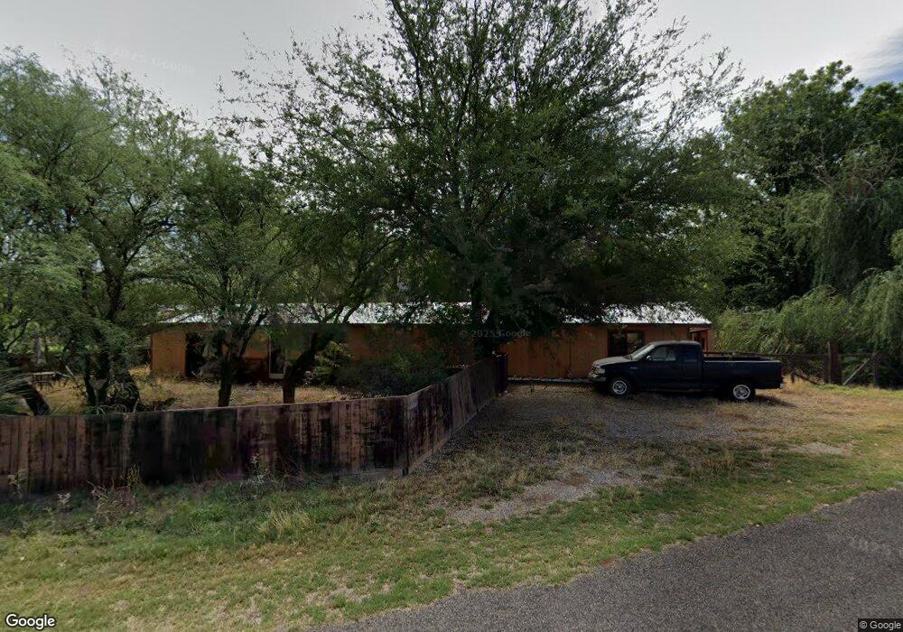
3661 E El Paso Dr Unit 5 Cottonwood, AZ 86326
Estimated Value: $356,591 - $454,000
3
Beds
2
Baths
1,700
Sq Ft
$238/Sq Ft
Est. Value
About This Home
This home is located at 3661 E El Paso Dr Unit 5, Cottonwood, AZ 86326 and is currently estimated at $404,648, approximately $238 per square foot. 3661 E El Paso Dr Unit 5 is a home located in Yavapai County with nearby schools including Dr Daniel Bright Elementary School, Cottonwood Elementary School, and Cottonwood Community School.
Ownership History
Date
Name
Owned For
Owner Type
Purchase Details
Closed on
Oct 13, 2011
Sold by
U S Bank National Association
Bought by
Bonhomme Patrick and Bonhomme Sandra
Current Estimated Value
Purchase Details
Closed on
Mar 21, 2011
Sold by
Tackett Randy Lee
Bought by
Bank Of America National Association
Purchase Details
Closed on
Nov 23, 2005
Sold by
Tackett Randy Lee and Tackett Laura
Bought by
Tackett Randy Lee
Home Financials for this Owner
Home Financials are based on the most recent Mortgage that was taken out on this home.
Original Mortgage
$154,000
Interest Rate
9.37%
Mortgage Type
New Conventional
Purchase Details
Closed on
Apr 11, 2005
Sold by
Tackett Billie Jo
Bought by
Tackett Randy Lee
Home Financials for this Owner
Home Financials are based on the most recent Mortgage that was taken out on this home.
Original Mortgage
$130,800
Interest Rate
10%
Mortgage Type
New Conventional
Purchase Details
Closed on
Mar 31, 2005
Sold by
Tackett Randy L
Bought by
Tackett Randy L
Home Financials for this Owner
Home Financials are based on the most recent Mortgage that was taken out on this home.
Original Mortgage
$130,800
Interest Rate
10%
Mortgage Type
New Conventional
Purchase Details
Closed on
Mar 29, 2001
Sold by
Benson John I
Bought by
Tackett Randy L and Tackett Billie Jo
Home Financials for this Owner
Home Financials are based on the most recent Mortgage that was taken out on this home.
Original Mortgage
$23,000
Interest Rate
6.98%
Mortgage Type
Seller Take Back
Purchase Details
Closed on
Dec 4, 2000
Sold by
Benson John L
Bought by
Tackett Randy L
Home Financials for this Owner
Home Financials are based on the most recent Mortgage that was taken out on this home.
Original Mortgage
$94,900
Interest Rate
7.67%
Mortgage Type
New Conventional
Purchase Details
Closed on
Nov 17, 1993
Sold by
Benson John I and Benson Vallie G
Bought by
Benson John I and Benson Vallie G
Home Financials for this Owner
Home Financials are based on the most recent Mortgage that was taken out on this home.
Original Mortgage
$12,000
Interest Rate
6.3%
Create a Home Valuation Report for This Property
The Home Valuation Report is an in-depth analysis detailing your home's value as well as a comparison with similar homes in the area
Home Values in the Area
Average Home Value in this Area
Purchase History
| Date | Buyer | Sale Price | Title Company |
|---|---|---|---|
| Bonhomme Patrick | $45,000 | Lsi Title | |
| U S Bank National Association | -- | Lsi Title | |
| Bank Of America National Association | $49,764 | Lsi Title Agency Inc | |
| Tackett Randy Lee | -- | Chicago Title Ins Co | |
| Tackett Randy Lee | $6,625 | -- | |
| Tackett Randy Lee | $6,625 | -- | |
| Tackett Randy L | -- | Nations Title Agency Of Az | |
| Tackett Randy L | $25,000 | Chicago Title Insurance Co | |
| Tackett Randy L | $99,900 | Chicago Title Insurance Co | |
| Benson John I | -- | First American Title Ins Co |
Source: Public Records
Mortgage History
| Date | Status | Borrower | Loan Amount |
|---|---|---|---|
| Previous Owner | Tackett Randy Lee | $154,000 | |
| Previous Owner | Tackett Randy L | $130,800 | |
| Previous Owner | Tackett Randy L | $23,000 | |
| Previous Owner | Tackett Randy L | $94,900 | |
| Previous Owner | Benson John I | $12,000 |
Source: Public Records
Tax History Compared to Growth
Tax History
| Year | Tax Paid | Tax Assessment Tax Assessment Total Assessment is a certain percentage of the fair market value that is determined by local assessors to be the total taxable value of land and additions on the property. | Land | Improvement |
|---|---|---|---|---|
| 2026 | $1,319 | $32,364 | -- | -- |
| 2024 | $1,331 | $31,569 | -- | -- |
| 2023 | $1,331 | $25,334 | $0 | $0 |
| 2022 | $1,373 | $20,904 | $2,186 | $18,718 |
| 2021 | $1,506 | $2,337 | $2,337 | $0 |
| 2020 | $1,552 | $0 | $0 | $0 |
| 2019 | $1,602 | $0 | $0 | $0 |
| 2018 | $1,537 | $0 | $0 | $0 |
| 2017 | $1,469 | $0 | $0 | $0 |
| 2016 | $1,432 | $0 | $0 | $0 |
| 2015 | $963 | $0 | $0 | $0 |
| 2014 | -- | $0 | $0 | $0 |
Source: Public Records
Map
Nearby Homes
- 3732 E Comanche Dr
- 1945 S State Route 260 --
- 4197 E Sabino Trail
- 2042 S Puma Cir
- 1331 S Kelli Ln
- 1520 S Tanager Ln
- 0000 Caitlin Ln
- 4027 E Sabino Trail
- 1380 S Bates Rd
- 1339 S Boban Ln
- 4506 E Silver Leaf Trail
- 4547 E Diablo Dr
- 2647 Lobo Cir
- 4586 E Diablo Dr
- 4593 E Silver Leaf Trail
- 3461 Tower Dr
- 4000 E Mustang Dr
- 4540 E Bird Ln
- 3900 E Cassie Ln
- 3980 E Cassie Ln