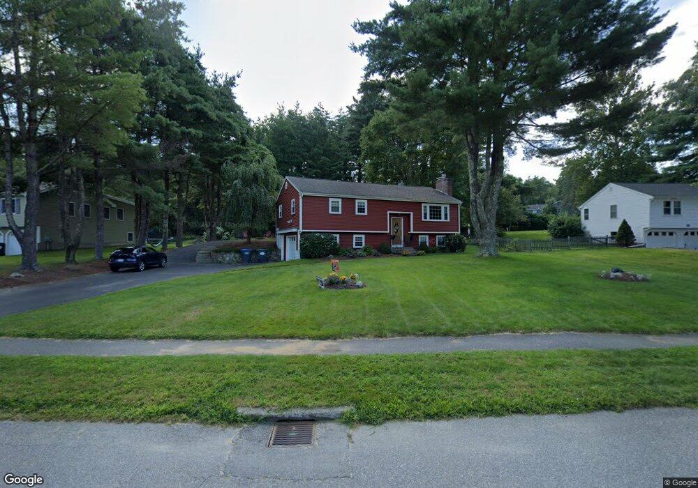
37 Juniper Brook Rd Northborough, MA 01532
Estimated Value: $740,205 - $821,000
4
Beds
3
Baths
1,754
Sq Ft
$448/Sq Ft
Est. Value
About This Home
This home is located at 37 Juniper Brook Rd, Northborough, MA 01532 and is currently estimated at $786,551, approximately $448 per square foot. 37 Juniper Brook Rd is a home located in Worcester County with nearby schools including Marguerite E. Peaslee Elementary School, Robert E. Melican Middle School, and Algonquin Regional High School.
Ownership History
Date
Name
Owned For
Owner Type
Purchase Details
Closed on
Dec 8, 2000
Sold by
Renzetti Michael P and Renzetti Donna M
Bought by
Lake Kristen M and Lake Jonathan D
Current Estimated Value
Create a Home Valuation Report for This Property
The Home Valuation Report is an in-depth analysis detailing your home's value as well as a comparison with similar homes in the area
Home Values in the Area
Average Home Value in this Area
Purchase History
| Date | Buyer | Sale Price | Title Company |
|---|---|---|---|
| Lake Kristen M | $233,200 | -- |
Source: Public Records
Mortgage History
| Date | Status | Borrower | Loan Amount |
|---|---|---|---|
| Open | Lake Kristen M | $125,000 | |
| Closed | Lake Kristen M | $125,000 | |
| Closed | Lake Kristen M | $130,000 |
Source: Public Records
Tax History Compared to Growth
Tax History
| Year | Tax Paid | Tax Assessment Tax Assessment Total Assessment is a certain percentage of the fair market value that is determined by local assessors to be the total taxable value of land and additions on the property. | Land | Improvement |
|---|---|---|---|---|
| 2025 | $9,632 | $675,900 | $261,100 | $414,800 |
| 2024 | $8,765 | $613,800 | $216,400 | $397,400 |
| 2023 | $8,550 | $578,100 | $204,300 | $373,800 |
| 2022 | $8,111 | $491,900 | $194,500 | $297,400 |
| 2021 | $7,831 | $457,400 | $176,700 | $280,700 |
| 2020 | $8,056 | $467,000 | $176,700 | $290,300 |
| 2019 | $7,838 | $457,000 | $171,400 | $285,600 |
| 2018 | $7,297 | $419,600 | $167,100 | $252,500 |
| 2017 | $6,780 | $389,900 | $167,100 | $222,800 |
| 2016 | $6,380 | $371,600 | $163,700 | $207,900 |
| 2015 | $5,968 | $356,700 | $166,400 | $190,300 |
| 2014 | $5,727 | $345,200 | $166,400 | $178,800 |
Source: Public Records
Map
Nearby Homes
- 349 Brigham St
- 12 Saddle Hill Dr
- 223 South St
- 2 Codman Way Unit 409
- 2 Codman Way Unit 113
- 2 Codman Way Unit 110
- 2 Codman Way Unit 411
- 2 Codman Way Unit 402
- 2 Codman Way Unit 5103
- 2 Codman Way Unit 111
- 2 Codman Way Unit 104
- 2 Codman Way Unit 302
- 2 Codman Way Unit 109
- 2 Codman Way Unit 410
- 2 Codman Way Unit 112
- 2 Codman Way Unit 304
- 5 Peters Farm Way Unit 106
- 5 Peters Farm Way Unit 406
- 5 Peters Farm Way Unit 113
- 5 Peters Farm Way Unit 105
- 35 Juniper Brook Rd
- 39 Juniper Brook Rd
- 33 Juniper Brook Rd
- 58 Juniper Brook Rd
- 41 Juniper Brook Rd
- 56 Juniper Brook Rd
- 25 Juniper Brook Rd
- 27 Juniper Brook Rd
- 29 Juniper Brook Rd
- 43 Juniper Brook Rd
- 54 Juniper Brook Rd
- 23 Juniper Brook Rd
- 270 School St
- 31 Juniper Brook Rd
- 1 Juniper Brook Rd
- 52 Juniper Brook Rd
- 284 School St
- 2 Juniper Ln
- 19 Juniper Brook Rd
- 50 Juniper Brook Rd