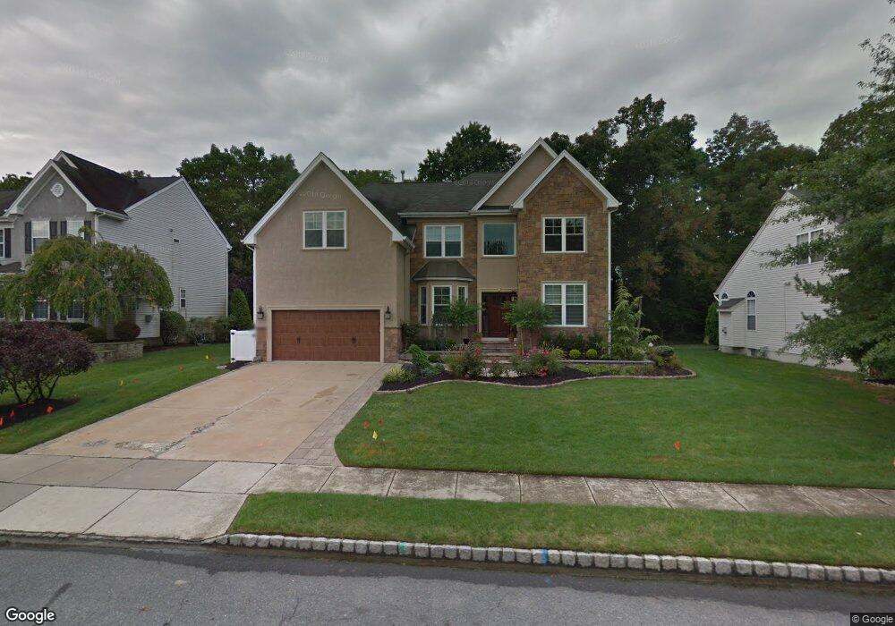
37 Normandy Rd Marlton, NJ 08053
Estimated Value: $876,000 - $918,000
--
Bed
--
Bath
3,162
Sq Ft
$282/Sq Ft
Est. Value
About This Home
This home is located at 37 Normandy Rd, Marlton, NJ 08053 and is currently estimated at $892,213, approximately $282 per square foot. 37 Normandy Rd is a home located in Burlington County with nearby schools including H.L. Beeler Elementary School, Frances Demasi Middle School, and Lenape High School.
Ownership History
Date
Name
Owned For
Owner Type
Purchase Details
Closed on
Oct 28, 2015
Sold by
Dorfman Matthew and Dorfman Lauren
Bought by
Dorfman Matthew and Dorfman Lauren
Current Estimated Value
Purchase Details
Closed on
Dec 6, 2007
Sold by
Nabrzeski Richard W and Nabrzeski Kathryn J
Bought by
Dorfman Matthew and Dorfman Lauren
Home Financials for this Owner
Home Financials are based on the most recent Mortgage that was taken out on this home.
Original Mortgage
$101,190
Outstanding Balance
$64,338
Interest Rate
6.3%
Mortgage Type
Unknown
Estimated Equity
$827,875
Purchase Details
Closed on
Feb 18, 1999
Sold by
Orleans Corp Of New Jersey
Bought by
Nabrzeski Richard W and Nabrzeski Kathryn J
Home Financials for this Owner
Home Financials are based on the most recent Mortgage that was taken out on this home.
Original Mortgage
$212,900
Interest Rate
6.78%
Mortgage Type
Balloon
Create a Home Valuation Report for This Property
The Home Valuation Report is an in-depth analysis detailing your home's value as well as a comparison with similar homes in the area
Home Values in the Area
Average Home Value in this Area
Purchase History
| Date | Buyer | Sale Price | Title Company |
|---|---|---|---|
| Dorfman Matthew | -- | Premier Abstract & Title Age | |
| Dorfman Matthew | $582,000 | None Available | |
| Nabrzeski Richard W | $266,170 | Security First Title Partner |
Source: Public Records
Mortgage History
| Date | Status | Borrower | Loan Amount |
|---|---|---|---|
| Open | Dorfman Matthew | $101,190 | |
| Open | Dorfman Matthew | $417,000 | |
| Previous Owner | Nabrzeski Richard W | $212,900 |
Source: Public Records
Tax History Compared to Growth
Tax History
| Year | Tax Paid | Tax Assessment Tax Assessment Total Assessment is a certain percentage of the fair market value that is determined by local assessors to be the total taxable value of land and additions on the property. | Land | Improvement |
|---|---|---|---|---|
| 2025 | $17,041 | $499,000 | $140,000 | $359,000 |
| 2024 | $16,033 | $499,000 | $140,000 | $359,000 |
| 2023 | $16,033 | $499,000 | $140,000 | $359,000 |
| 2022 | $15,314 | $499,000 | $140,000 | $359,000 |
| 2021 | $14,955 | $499,000 | $140,000 | $359,000 |
| 2020 | $14,760 | $499,000 | $140,000 | $359,000 |
| 2019 | $14,641 | $499,000 | $140,000 | $359,000 |
| 2018 | $14,436 | $499,000 | $140,000 | $359,000 |
| 2017 | $14,266 | $499,000 | $140,000 | $359,000 |
| 2016 | $13,917 | $499,000 | $140,000 | $359,000 |
| 2015 | $13,673 | $499,000 | $140,000 | $359,000 |
| 2014 | $13,283 | $499,000 | $140,000 | $359,000 |
Source: Public Records
Map
Nearby Homes
- 125 Crown Prince Dr
- 223 Crown Prince Dr
- 48 Keegan Ct
- 21 Woodthrush Ct
- 174 Greenbrook Dr
- 3 United States Cir
- 8 Jonquil Place
- 3 Tuscany Way
- 108 Meadowview Cir
- 109 Meadowview Cir
- 3 Abington Rd
- 46 Morning Glory Dr
- 208 Stallion Ct
- 123 Wyndmere Rd
- 29 Longhurst Rd
- 108 Weaver Dr
- 6 Bluff Ct
- 59 Eddy Way
- 18 Holmes Ln
- 32 Carlton Ave