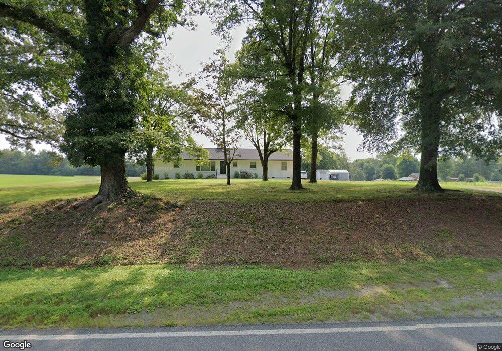
370 Brown Rd Reidsville, NC 27320
Estimated Value: $320,000 - $452,000
--
Bed
--
Bath
2,117
Sq Ft
$185/Sq Ft
Est. Value
About This Home
This home is located at 370 Brown Rd, Reidsville, NC 27320 and is currently estimated at $392,634, approximately $185 per square foot. 370 Brown Rd is a home located in Rockingham County with nearby schools including Bethany Elementary School, Rockingham County Middle School, and Rockingham County High School.
Ownership History
Date
Name
Owned For
Owner Type
Purchase Details
Closed on
Oct 25, 2021
Sold by
Tuggle Richard D and Tuggle Jennie R
Bought by
Tuggle Richard D and Tuggle Jennie R
Current Estimated Value
Home Financials for this Owner
Home Financials are based on the most recent Mortgage that was taken out on this home.
Original Mortgage
$224,000
Outstanding Balance
$204,710
Interest Rate
2.8%
Mortgage Type
New Conventional
Estimated Equity
$187,924
Purchase Details
Closed on
Feb 20, 2008
Sold by
Lee Michael H and Lee Suzanne H
Bought by
Tuggle Richard D
Home Financials for this Owner
Home Financials are based on the most recent Mortgage that was taken out on this home.
Original Mortgage
$172,500
Interest Rate
5.85%
Mortgage Type
Purchase Money Mortgage
Create a Home Valuation Report for This Property
The Home Valuation Report is an in-depth analysis detailing your home's value as well as a comparison with similar homes in the area
Home Values in the Area
Average Home Value in this Area
Purchase History
| Date | Buyer | Sale Price | Title Company |
|---|---|---|---|
| Tuggle Richard D | -- | None Available | |
| Tuggle Richard D | $172,500 | None Available |
Source: Public Records
Mortgage History
| Date | Status | Borrower | Loan Amount |
|---|---|---|---|
| Open | Tuggle Richard D | $224,000 | |
| Closed | Tuggle Richard D | $172,500 |
Source: Public Records
Tax History Compared to Growth
Tax History
| Year | Tax Paid | Tax Assessment Tax Assessment Total Assessment is a certain percentage of the fair market value that is determined by local assessors to be the total taxable value of land and additions on the property. | Land | Improvement |
|---|---|---|---|---|
| 2025 | $2,253 | $321,866 | $67,080 | $254,786 |
| 2024 | $2,127 | $321,866 | $67,080 | $254,786 |
| 2023 | $2,127 | $190,780 | $41,589 | $149,191 |
| 2022 | $1,536 | $190,780 | $41,589 | $149,191 |
| 2021 | $1,101 | $136,773 | $41,589 | $95,184 |
| 2020 | $1,156 | $136,773 | $41,589 | $95,184 |
| 2019 | $1,121 | $136,773 | $41,589 | $95,184 |
| 2018 | $1,040 | $128,992 | $46,894 | $82,098 |
| 2017 | $1,040 | $128,992 | $46,894 | $82,098 |
| 2015 | $1,050 | $128,992 | $46,894 | $82,098 |
| 2014 | $1,052 | $128,992 | $46,894 | $82,098 |
Source: Public Records
Map
Nearby Homes
- Parcel C Iron Works Rd
- 4830 Nc Highway 65
- 00 Almond Rd
- 64.88 Ac Purcell Rd
- 11630 U S Highway 158
- 613 Barker Rd
- 2041 Sandy Cross Rd
- 0 Jones Chapel Rd
- 130 Laced Maple Ct
- 223 Wendy Oak Rd
- 205 Pearman Rd
- 1731 Sandy Cross Rd
- 132 Parkview Ln
- 6821 Nc Highway 65
- 421 Wil O Pat Rd
- 13552 U S 158
- 744 Monroeton Rd
- 223 Church Street Extension
- 387 Vernon Rd
- 410 Niblick Dr
- 398 Brown Rd
- 377 Brown Rd
- 424 Brown Rd
- 290 Troublesome Rd
- 124 Harvest Rd
- 260 Brown Rd
- 428 Brown Rd
- 241 Brown Rd
- 159 Harvest Rd
- 221 Harvest Rd
- 570 Brown Rd
- 261 Harvest Rd
- 280 Harvest Rd
- 327 Troublesome Rd
- 368 Troublesome Rd
- 3344 Iron Works Rd
- 436 Troublesome Rd
- 421 Troublesome Rd
- 3454 Iron Works Rd
- 225 Troublesome Rd