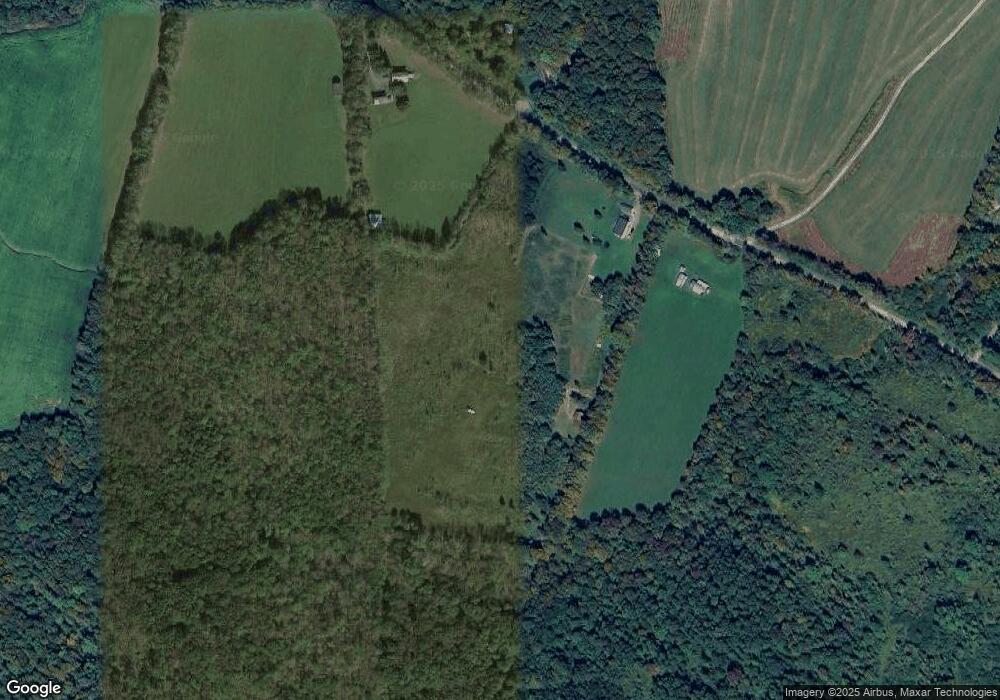
371 Brown Gale Rd Mc Donough, NY 13801
Estimated Value: $198,000 - $235,000
3
Beds
2
Baths
1,456
Sq Ft
$148/Sq Ft
Est. Value
About This Home
This home is located at 371 Brown Gale Rd, Mc Donough, NY 13801 and is currently estimated at $215,555, approximately $148 per square foot. 371 Brown Gale Rd is a home located in Chenango County with nearby schools including Stanford J. Gibson Primary School, Perry Browne Intermediate School, and Norwich Middle School.
Ownership History
Date
Name
Owned For
Owner Type
Purchase Details
Closed on
May 13, 2022
Sold by
Nye Charles E
Bought by
Austin David P and Austin Olivia
Current Estimated Value
Home Financials for this Owner
Home Financials are based on the most recent Mortgage that was taken out on this home.
Original Mortgage
$152,000
Outstanding Balance
$143,379
Interest Rate
4.5%
Mortgage Type
Purchase Money Mortgage
Estimated Equity
$72,176
Purchase Details
Closed on
Jan 14, 2021
Sold by
Bagnall Prop P Llc
Bought by
Nye Charles E
Home Financials for this Owner
Home Financials are based on the most recent Mortgage that was taken out on this home.
Original Mortgage
$135,000
Interest Rate
2.71%
Mortgage Type
FHA
Purchase Details
Closed on
Aug 12, 2019
Sold by
Chenango County Of
Bought by
Bagnall Property Partners
Create a Home Valuation Report for This Property
The Home Valuation Report is an in-depth analysis detailing your home's value as well as a comparison with similar homes in the area
Home Values in the Area
Average Home Value in this Area
Purchase History
| Date | Buyer | Sale Price | Title Company |
|---|---|---|---|
| Austin David P | $169,900 | None Available | |
| Nye Charles E | $150,000 | None Available | |
| Nye Charles E | $150,000 | None Available | |
| Bagnall Property Partners | $12,555 | -- | |
| Bagnall Property Partners | $12,555 | -- |
Source: Public Records
Mortgage History
| Date | Status | Borrower | Loan Amount |
|---|---|---|---|
| Open | Austin David P | $152,000 | |
| Previous Owner | Nye Charles E | $135,000 |
Source: Public Records
Tax History Compared to Growth
Tax History
| Year | Tax Paid | Tax Assessment Tax Assessment Total Assessment is a certain percentage of the fair market value that is determined by local assessors to be the total taxable value of land and additions on the property. | Land | Improvement |
|---|---|---|---|---|
| 2024 | $4,597 | $91,635 | $17,880 | $73,755 |
| 2023 | $4,637 | $91,635 | $17,880 | $73,755 |
| 2022 | $4,639 | $91,635 | $17,880 | $73,755 |
| 2021 | $4,539 | $91,635 | $17,880 | $73,755 |
| 2020 | $1,403 | $27,300 | $18,300 | $9,000 |
| 2019 | $3,410 | $27,300 | $18,300 | $9,000 |
| 2018 | $3,410 | $77,900 | $18,300 | $59,600 |
| 2017 | $3,201 | $77,900 | $18,300 | $59,600 |
| 2016 | $3,175 | $77,900 | $18,300 | $59,600 |
| 2015 | -- | $77,900 | $18,300 | $59,600 |
| 2014 | -- | $77,900 | $18,300 | $59,600 |
Source: Public Records
Map
Nearby Homes
- 105 County Road 47
- 878 County Road 10
- 824 County Road 10
- 425 N Tower Rd
- 776 County Road 10
- 137 County Road 47
- 0 Balsam Tyler Rd
- L7.415 County Road 7
- 0 South Rd Unit R1598632
- 2356 State Highway 220
- 164 County Road 8
- 199 Cottage Ln
- 201 Bliven Sherman Rd
- 1691 State Highway 220
- 274 Reservoir Hill Rd
- 2886 State Highway 220
- 491 Tamarac Rd
- 117 Kinny Rd
- 186 Pigeon Hill Rd
- 816 New York 23
- 438 Rollie Brown Rd
- 0 Rollie Brown Rd
- 284 Brown-Gale Rd
- 465 Rollie Brown Rd
- 465 Brown Gale Rd
- 496 Simpson Rd
- 398 Brown Gale Rd
- 938 County Road 8
- 948 County Road 8
- 892 County Road 8
- 964 County Road 8
- 963 County Road 8
- 949 County Road 8
- 878 County Road 8
- 1024 County Road 8
- 990 County Road 8
- 981 County Road 8
- 989 County Road 8
- 1020 County Road 8
- 1015 County Road 8
