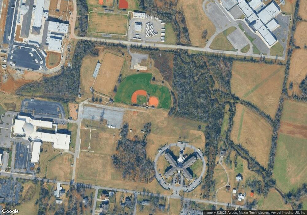
373 NW Rutland Rd Mount Juliet, TN 37122
Estimated Value: $517,000 - $2,300,607
--
Bed
1
Bath
1,461
Sq Ft
$892/Sq Ft
Est. Value
About This Home
This home is located at 373 NW Rutland Rd, Mount Juliet, TN 37122 and is currently estimated at $1,303,402, approximately $892 per square foot. 373 NW Rutland Rd is a home located in Wilson County with nearby schools including Stoner Creek Elementary School, West Wilson Middle School, and Mt. Juliet High School.
Ownership History
Date
Name
Owned For
Owner Type
Purchase Details
Closed on
Jun 4, 2015
Sold by
First Baptist Church Of
Bought by
First Baptist Church Of Mt Juliet
Current Estimated Value
Home Financials for this Owner
Home Financials are based on the most recent Mortgage that was taken out on this home.
Original Mortgage
$1,499,140
Interest Rate
3.88%
Mortgage Type
New Conventional
Purchase Details
Closed on
Dec 30, 2003
Sold by
First Baptist Church
Bought by
Rutland Place Inc
Purchase Details
Closed on
Oct 2, 2002
Sold by
Vivrett Mary K and Vivrett Emmitt
Bought by
First Baptist Church Of Mt
Purchase Details
Closed on
Apr 4, 1904
Bought by
Vivrett John Bell and Vivrett Mary K
Create a Home Valuation Report for This Property
The Home Valuation Report is an in-depth analysis detailing your home's value as well as a comparison with similar homes in the area
Home Values in the Area
Average Home Value in this Area
Purchase History
| Date | Buyer | Sale Price | Title Company |
|---|---|---|---|
| First Baptist Church Of Mt Juliet | -- | -- | |
| Rutland Place Inc | -- | -- | |
| First Baptist Church Of Mt | $712,880 | -- | |
| Vivrett John Bell | -- | -- |
Source: Public Records
Mortgage History
| Date | Status | Borrower | Loan Amount |
|---|---|---|---|
| Closed | Vivrett John Bell | $1,499,140 |
Source: Public Records
Tax History Compared to Growth
Tax History
| Year | Tax Paid | Tax Assessment Tax Assessment Total Assessment is a certain percentage of the fair market value that is determined by local assessors to be the total taxable value of land and additions on the property. | Land | Improvement |
|---|---|---|---|---|
| 2024 | $1,540 | $80,650 | $80,650 | -- |
| 2022 | $1,540 | $80,650 | $80,650 | $0 |
| 2021 | $1,628 | $80,650 | $80,650 | $0 |
| 2020 | $1,318 | $80,650 | $80,650 | $0 |
| 2019 | $164 | $49,050 | $49,050 | $0 |
| 2018 | $1,318 | $49,050 | $49,050 | $0 |
| 2017 | $1,318 | $49,050 | $49,050 | $0 |
| 2016 | $1,318 | $49,050 | $49,050 | $0 |
| 2015 | $1,359 | $49,050 | $49,050 | $0 |
| 2014 | $1,307 | $47,170 | $0 | $0 |
Source: Public Records
Map
Nearby Homes
- 1402 Fairview Dr
- 0 E Division St
- 0 Clemmons Rd
- Finley Plan at Bradshaw Farms - Cottages
- Amberbrook Plan at Bradshaw Farms - Cottages
- Harrison Plan at Bradshaw Farms - Cottages
- 112 Crosby Dr
- Chadwick Plan at Bradshaw Farms - Cottages
- 4600 Boxcroft Cir
- 3294 Camden Ct
- 2019 Hidden Cove Rd
- 3020 Kingston Cir N
- 431 Waterbrook Dr
- 1940 E Division St
- 2116 Putnam Ln
- 1103 Orcadian Dr
- 310 Lynwood Station Blvd
- 308 Lynwood Station Blvd
- 1111 Orcadian Dr S
- 312 Lynwood Station Blvd
- 489 NW Rutland Rd
- 116 Carrick Ct
- 529 NW Rutland Rd
- 346 NW Rutland Rd
- 380 NW Rutland Rd
- 494 NW Rutland Rd
- 306 NW Rutland Rd
- 102 Hunter Dr
- 102 102 Hunter Dr
- 532 NW Rutland Rd
- 610 Hollow Wood Trail
- 104 Hunter Dr
- 131 Lane Dr Unit 258
- 131 Lane Dr
- 615 NW Rutland Rd
- 105 Hunter Dr
- 134 Lane Dr
- 640 NW Rutland Rd
- 106 Hunter Dr
- 133 Lane Dr
