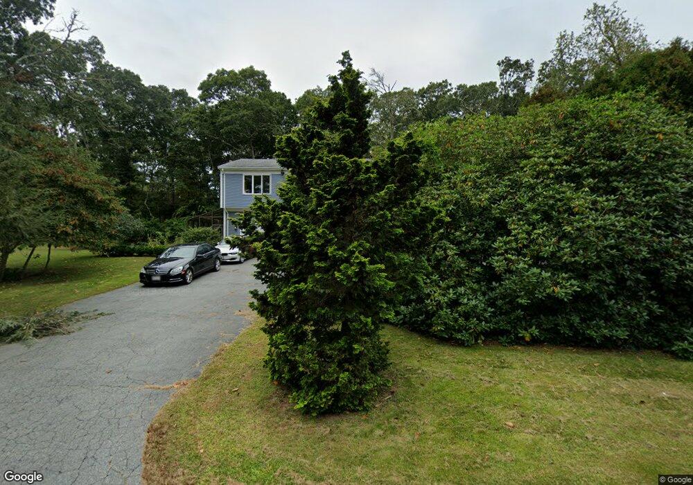
375 River Rd Westport, MA 02790
Acoaxet NeighborhoodEstimated Value: $513,000 - $1,362,703
5
Beds
4
Baths
2,600
Sq Ft
$379/Sq Ft
Est. Value
About This Home
This home is located at 375 River Rd, Westport, MA 02790 and is currently estimated at $986,234, approximately $379 per square foot. 375 River Rd is a home located in Bristol County with nearby schools including Alice A. Macomber Primary School, Westport Elementary School, and Westport Middle-High School.
Ownership History
Date
Name
Owned For
Owner Type
Purchase Details
Closed on
May 30, 2008
Sold by
Ostroff Elaine B
Bought by
Goldizen Derrill T and Goldizen Lisa S
Current Estimated Value
Home Financials for this Owner
Home Financials are based on the most recent Mortgage that was taken out on this home.
Original Mortgage
$250,000
Interest Rate
5.91%
Mortgage Type
Purchase Money Mortgage
Purchase Details
Closed on
May 1, 1987
Sold by
Brenner George H
Bought by
Ostroff Earl C
Home Financials for this Owner
Home Financials are based on the most recent Mortgage that was taken out on this home.
Original Mortgage
$100,000
Interest Rate
8.99%
Mortgage Type
Purchase Money Mortgage
Create a Home Valuation Report for This Property
The Home Valuation Report is an in-depth analysis detailing your home's value as well as a comparison with similar homes in the area
Home Values in the Area
Average Home Value in this Area
Purchase History
| Date | Buyer | Sale Price | Title Company |
|---|---|---|---|
| Goldizen Derrill T | $550,000 | -- | |
| Ostroff Earl C | $235,000 | -- |
Source: Public Records
Mortgage History
| Date | Status | Borrower | Loan Amount |
|---|---|---|---|
| Open | Ostroff Earl C | $235,000 | |
| Closed | Ostroff Earl C | $250,000 | |
| Previous Owner | Ostroff Earl C | $20,000 | |
| Previous Owner | Ostroff Earl C | $100,000 |
Source: Public Records
Tax History Compared to Growth
Tax History
| Year | Tax Paid | Tax Assessment Tax Assessment Total Assessment is a certain percentage of the fair market value that is determined by local assessors to be the total taxable value of land and additions on the property. | Land | Improvement |
|---|---|---|---|---|
| 2025 | $7,367 | $988,800 | $567,500 | $421,300 |
| 2024 | $6,969 | $901,600 | $489,700 | $411,900 |
| 2023 | $7,139 | $874,900 | $467,400 | $407,500 |
| 2022 | $5,922 | $826,200 | $467,400 | $358,800 |
| 2021 | $5,922 | $687,000 | $374,200 | $312,800 |
| 2020 | $5,672 | $672,800 | $360,000 | $312,800 |
| 2019 | $5,087 | $615,100 | $328,400 | $286,700 |
| 2018 | $3,761 | $460,300 | $235,200 | $225,100 |
| 2017 | $3,670 | $460,500 | $254,000 | $206,500 |
| 2016 | $3,684 | $465,800 | $275,200 | $190,600 |
| 2015 | $3,615 | $455,900 | $256,500 | $199,400 |
Source: Public Records
Map
Nearby Homes
- 19 Seabury Ln
- 255 John Dyer Rd
- 1580 Main Rd
- 245 John Dyer Rd
- 1346 Main Rd Unit B
- 1881 Main Rd
- 17 Quail Trail
- 189 Brayton Point Rd
- 505 Long Hwy
- 1702J Drift Rd
- 116 Amy Hart Path
- 1702 Drift Rd
- 304 Brayton Point Rd
- 0 Reed Rd (Ss)
- 83 Long Hwy
- 90 Two Rod Rd
- 101 Adamsville Rd
- 184 Field Stone Ln
- 0 Willow Ave
- 128 Maple Ave
- 395 River Rd
- 1 Cook Ln
- 383 River Rd
- 5 Cook Ln Unit winter
- 383 River Rd Unit winter
- 383 River Rd Unit vacation
- 5 Cook Ln Unit 1
- 5 Cook Ln
- 5 Cook Ln Unit 5
- 21 Lana Ln Unit COOK
- 342A River Rd
- 342 River Rd
- 342 River Rd
- 0 Cook Ln
- Lot 2 Cook Ln
- 362 River Rd
- 378 River Rd Unit 380
- 16 Lana Ln Unit COOK
- 401 River Rd
- 390 River Rd