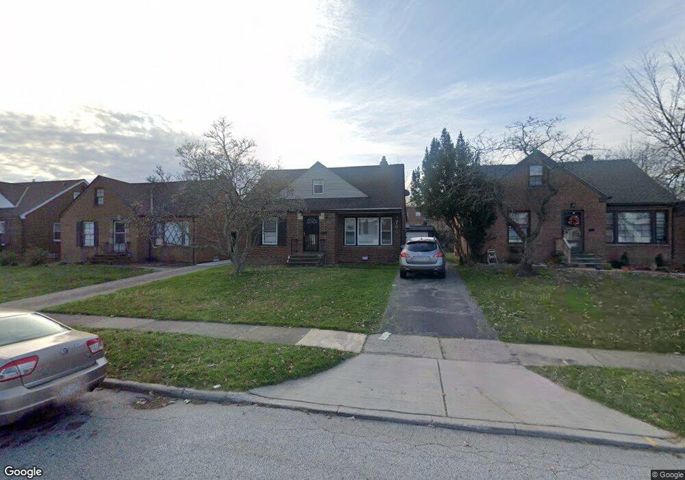
3764 Colony Rd Cleveland, OH 44118
Estimated Value: $129,000 - $164,000
2
Beds
1
Bath
1,052
Sq Ft
$143/Sq Ft
Est. Value
About This Home
This home is located at 3764 Colony Rd, Cleveland, OH 44118 and is currently estimated at $150,144, approximately $142 per square foot. 3764 Colony Rd is a home located in Cuyahoga County with nearby schools including Gearity Professional Development School, Monticello Middle School, and Cleveland Heights High School.
Ownership History
Date
Name
Owned For
Owner Type
Purchase Details
Closed on
Sep 5, 2017
Sold by
Atlins Eric
Bought by
Omgb Investments Group Llc
Current Estimated Value
Purchase Details
Closed on
Sep 2, 2005
Sold by
Kidd Sabrina J
Bought by
Atkins Eric
Home Financials for this Owner
Home Financials are based on the most recent Mortgage that was taken out on this home.
Original Mortgage
$130,000
Interest Rate
5.82%
Mortgage Type
Fannie Mae Freddie Mac
Purchase Details
Closed on
Jun 10, 1999
Sold by
Chambers Cathy
Bought by
Tisdale Don Q
Purchase Details
Closed on
Feb 18, 1993
Sold by
Ponder Gale
Bought by
Chambers Cathy
Purchase Details
Closed on
Aug 30, 1990
Sold by
Ponder Gale
Bought by
Ponder Gale
Purchase Details
Closed on
Dec 12, 1989
Sold by
Crow S L and K L
Bought by
Ponder Gale
Purchase Details
Closed on
Jan 26, 1987
Sold by
Schwartz Rena Ann
Bought by
Crow S L and K L
Purchase Details
Closed on
Jan 1, 1975
Bought by
Schwartz Rena Ann
Create a Home Valuation Report for This Property
The Home Valuation Report is an in-depth analysis detailing your home's value as well as a comparison with similar homes in the area
Home Values in the Area
Average Home Value in this Area
Purchase History
| Date | Buyer | Sale Price | Title Company |
|---|---|---|---|
| Omgb Investments Group Llc | $67,000 | Innovative Title & Escrow Sv | |
| Atkins Eric | $130,000 | Heights Title Agency | |
| Tisdale Don Q | $65,000 | -- | |
| Chambers Cathy | -- | -- | |
| Ponder Gale | -- | -- | |
| Ponder Gale | $65,700 | -- | |
| Crow S L | -- | -- | |
| Schwartz Rena Ann | -- | -- |
Source: Public Records
Mortgage History
| Date | Status | Borrower | Loan Amount |
|---|---|---|---|
| Previous Owner | Atkins Eric | $130,000 |
Source: Public Records
Tax History Compared to Growth
Tax History
| Year | Tax Paid | Tax Assessment Tax Assessment Total Assessment is a certain percentage of the fair market value that is determined by local assessors to be the total taxable value of land and additions on the property. | Land | Improvement |
|---|---|---|---|---|
| 2024 | $4,225 | $44,415 | $9,835 | $34,580 |
| 2023 | $3,538 | $28,840 | $7,140 | $21,700 |
| 2022 | $3,522 | $28,840 | $7,140 | $21,700 |
| 2021 | $3,460 | $28,840 | $7,140 | $21,700 |
| 2020 | $3,153 | $23,450 | $5,810 | $17,640 |
| 2019 | $3,000 | $67,000 | $16,600 | $50,400 |
| 2018 | $3,001 | $23,450 | $5,810 | $17,640 |
| 2017 | $3,262 | $23,320 | $4,590 | $18,730 |
| 2016 | $3,096 | $23,320 | $4,590 | $18,730 |
| 2015 | $4,647 | $23,320 | $4,590 | $18,730 |
| 2014 | $4,647 | $24,540 | $4,830 | $19,710 |
Source: Public Records
Map
Nearby Homes
- 13765 Cedar Rd Unit 303C
- 13726 Cedar Rd
- 13805 Cedar Rd Unit 203
- 3809 Warrendale Rd
- 13677 Cedar Rd
- 3778 E Antisdale Rd
- 3781 Bushnell Rd
- 2192 Barrington Rd
- 3797 Bushnell Rd
- 3733 E Antisdale Rd
- 3841 Washington Blvd
- 2216 Barrington Rd
- 3631 Cummings Rd
- 2244 Edgerton Rd
- 13605 Cedar Rd
- 2227 Cranston Rd
- 2203 Brockway Rd
- 3621 Cedarbrook Rd
- 1948 Staunton Rd
- 2232 Fenwick Rd
- 3770 Colony Rd
- 3760 Colony Rd
- 3774 Colony Rd
- 3756 Colony Rd
- 3780 Colony Rd
- 3765 Colony Rd
- 3771 Colony Rd
- 3759 Colony Rd
- 3752 Colony Rd
- 3775 Colony Rd
- 3784 Colony Rd
- 13769 Cedar Rd Unit 203
- 13769 Cedar Rd Unit 302
- 13769 Cedar Rd Unit 105
- 13769 Cedar Rd Unit 205
- 13769 Cedar Rd Unit 104
- 13769 Cedar Rd Unit 206
- 13769 Cedar Rd Unit 101
- 13769 Cedar Rd Unit 202
- 13769 Cedar Rd