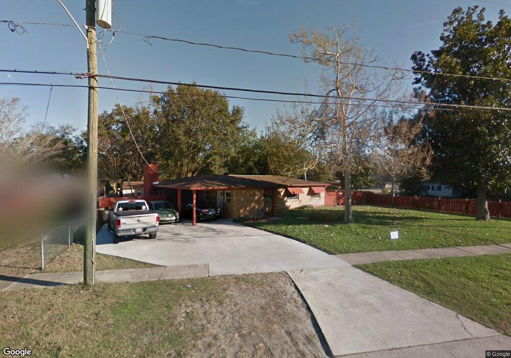
3779 Lane Ave S Unit 10 Jacksonville, FL 32210
Cedar Hills NeighborhoodEstimated Value: $234,072 - $272,000
3
Beds
2
Baths
2,089
Sq Ft
$120/Sq Ft
Est. Value
About This Home
This home is located at 3779 Lane Ave S Unit 10, Jacksonville, FL 32210 and is currently estimated at $251,018, approximately $120 per square foot. 3779 Lane Ave S Unit 10 is a home located in Duval County with nearby schools including Cedar Hills Elementary School, Portola High School, and Westside High School.
Ownership History
Date
Name
Owned For
Owner Type
Purchase Details
Closed on
Aug 11, 1995
Sold by
Lee Ralph and Lee Ralph C
Bought by
Moses Anthony and Moses Catherine J
Current Estimated Value
Home Financials for this Owner
Home Financials are based on the most recent Mortgage that was taken out on this home.
Original Mortgage
$60,690
Interest Rate
7.54%
Mortgage Type
Assumption
Purchase Details
Closed on
Jan 17, 1995
Sold by
Lee Ralph and Lee Mary K
Bought by
Lee Ralph and Lee Mary K
Create a Home Valuation Report for This Property
The Home Valuation Report is an in-depth analysis detailing your home's value as well as a comparison with similar homes in the area
Home Values in the Area
Average Home Value in this Area
Purchase History
| Date | Buyer | Sale Price | Title Company |
|---|---|---|---|
| Moses Anthony | $59,500 | -- | |
| Lee Ralph | $100 | -- |
Source: Public Records
Mortgage History
| Date | Status | Borrower | Loan Amount |
|---|---|---|---|
| Closed | Moses Anthony | $60,690 |
Source: Public Records
Tax History Compared to Growth
Tax History
| Year | Tax Paid | Tax Assessment Tax Assessment Total Assessment is a certain percentage of the fair market value that is determined by local assessors to be the total taxable value of land and additions on the property. | Land | Improvement |
|---|---|---|---|---|
| 2025 | $3,409 | $188,054 | $40,880 | $147,174 |
| 2024 | $3,202 | $183,509 | $35,000 | $148,509 |
| 2023 | $3,202 | $177,380 | $35,000 | $142,380 |
| 2022 | $2,832 | $170,622 | $35,000 | $135,622 |
| 2021 | $2,532 | $132,604 | $23,000 | $109,604 |
| 2020 | $2,387 | $123,550 | $23,000 | $100,550 |
| 2019 | $212 | $82,443 | $0 | $0 |
| 2018 | $212 | $80,906 | $0 | $0 |
| 2017 | $212 | $79,242 | $0 | $0 |
| 2016 | $212 | $77,613 | $0 | $0 |
| 2015 | $212 | $77,074 | $0 | $0 |
| 2014 | $804 | $76,463 | $0 | $0 |
Source: Public Records
Map
Nearby Homes
- 6715 Cotton Tail Ln
- 3936 Macgregor Dr
- 3955 Macgregor Dr
- 7108 Prellie St
- 7145 Esther St
- 6926 Thurston Rd
- 3915 Rodby Dr
- 7174 Matthew St
- 6838 Lake Mist Ln
- 6855 Lake Mist Ln
- 6882 Lake Mist Ln
- 6865 Lake Mist Ln
- 6770 Tinkerbell Ln
- 3914 Cobalt Ave E
- 6848 Tinkerbell Ln
- 4240 Oriely Dr
- 2418 Lane Ave S
- 2514 Red Robin Dr E
- 7014 Christopher Robin Dr
- 2636 Firestone Rd
- 6831 Cartegena Ct
- 6831 Cartegena Ct Unit 10
- 3765 Lane Ave S
- 6824 Rojo Ct
- 6823 Cartegena Ct
- 3811 Lane Ave S
- 3808 Freel Rd
- 3770 Ave S
- 3770 Lane Ave S
- 6814 Rojo Ct
- 3758 Lane Ave S
- 3808 Lane Ave S
- 6813 Cartegena Ct
- 3818 Freel Rd
- 6827 Rojo Ct
- 3823 Lane Ave S
- 3748 Ave S
- 3748 Lane Ave S
- 3741 Torres Ct Unit 10
- 3807 Freel Rd