Estimated Value: $396,251 - $453,000
3
Beds
2
Baths
1,337
Sq Ft
$321/Sq Ft
Est. Value
About This Home
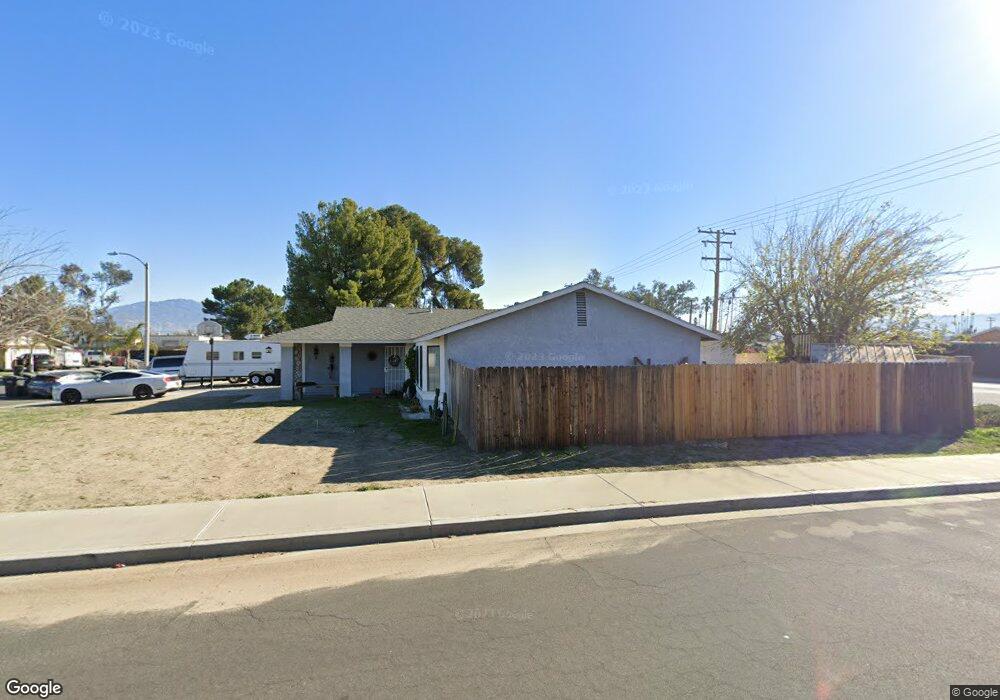
This home is located at 379 Presidents Ave, Hemet, CA 92543 and is currently estimated at $429,313, approximately $321 per square foot. 379 Presidents Ave is a home located in Riverside County with nearby schools including Park Hill Elementary School, North Mountain Middle School, and San Jacinto High School.
Ownership History
Date
Name
Owned For
Owner Type
Purchase Details
Closed on
Feb 27, 2008
Sold by
Litwin Roseanne
Bought by
Litwin Nicholas P
Current Estimated Value
Purchase Details
Closed on
Feb 7, 2002
Sold by
Litwin Nicholas P
Bought by
Litwin Nicholas P and Litwin Roseanne
Home Financials for this Owner
Home Financials are based on the most recent Mortgage that was taken out on this home.
Original Mortgage
$81,000
Interest Rate
6.8%
Purchase Details
Closed on
Aug 4, 1993
Sold by
Litwin Polly A
Bought by
Litwin Nicholas P
Create a Home Valuation Report for This Property
The Home Valuation Report is an in-depth analysis detailing your home's value as well as a comparison with similar homes in the area
Home Values in the Area
Average Home Value in this Area
Purchase History
| Date | Buyer | Sale Price | Title Company |
|---|---|---|---|
| Litwin Nicholas P | -- | None Available | |
| Litwin Nicholas P | -- | Gateway Title | |
| Litwin Nicholas P | -- | -- |
Source: Public Records
Mortgage History
| Date | Status | Borrower | Loan Amount |
|---|---|---|---|
| Closed | Litwin Nicholas P | $81,000 |
Source: Public Records
Tax History Compared to Growth
Tax History
| Year | Tax Paid | Tax Assessment Tax Assessment Total Assessment is a certain percentage of the fair market value that is determined by local assessors to be the total taxable value of land and additions on the property. | Land | Improvement |
|---|---|---|---|---|
| 2025 | $1,826 | $148,200 | $56,277 | $91,923 |
| 2023 | $1,826 | $142,447 | $54,093 | $88,354 |
| 2022 | $1,860 | $139,655 | $53,033 | $86,622 |
| 2021 | $2,005 | $136,918 | $51,994 | $84,924 |
| 2020 | $1,940 | $135,515 | $51,461 | $84,054 |
| 2019 | $1,725 | $132,858 | $50,452 | $82,406 |
| 2018 | $1,694 | $130,254 | $49,463 | $80,791 |
| 2017 | $1,662 | $127,701 | $48,494 | $79,207 |
| 2016 | $1,590 | $125,198 | $47,544 | $77,654 |
| 2015 | $1,570 | $123,320 | $46,831 | $76,489 |
| 2014 | $1,527 | $120,906 | $45,914 | $74,992 |
Source: Public Records
Map
Nearby Homes
- 769 Harding St
- 860 Polk Ct
- 731 Buchanan St
- 308 Bristolwood Rd
- 931 Donner St
- 681 Taschner Dr
- 920 N Palm Ave
- 675 W Oakland Ave Unit A-4
- 675 W Oakland Ave Unit G2
- 675 W Oakland Ave Unit A9
- 876 Aria Rd
- 25180 N Buena Vista St
- 1060 Pertano Ln
- 430 N Palm Ave Unit 7
- 430 N Palm Ave Unit 70
- 430 N Palm Ave Unit 72
- 520 Kit Ave
- 1145 Viento Dr
- 530 W Devonshire Ave Unit 4
- 530 W Devonshire Ave Unit 23
- 369 Presidents Ave
- 421 Presidents Ave
- 330 W Menlo Ave
- 380 Presidents Ave
- 441 Presidents Ave
- 340 Presidents Ave
- 360 Presidents Ave
- 368 Siesta Ct
- 430 Presidents Ave
- 697 Sonrisa St
- 352 Siesta Ct
- 461 Presidents Ave
- 450 Presidents Ave
- 365 Eisenhower Ct
- 320 Siesta Ct
- 385 Eisenhower Ct
- 687 Sonrisa St
- 726 Harding St
- 345 Eisenhower Ct
- 481 Presidents Ave