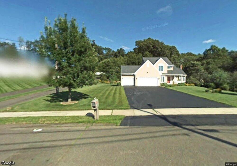
38 Winchester Dr North Haven, CT 06473
Estimated Value: $640,000 - $685,000
4
Beds
3
Baths
2,420
Sq Ft
$272/Sq Ft
Est. Value
About This Home
This home is located at 38 Winchester Dr, North Haven, CT 06473 and is currently estimated at $659,217, approximately $272 per square foot. 38 Winchester Dr is a home located in New Haven County with nearby schools including North Haven Middle School and North Haven High School.
Ownership History
Date
Name
Owned For
Owner Type
Purchase Details
Closed on
Oct 22, 2018
Sold by
Houston Michael E
Bought by
Houston Michael E and Houston Cynthia A
Current Estimated Value
Purchase Details
Closed on
Apr 28, 1999
Sold by
Ravenswood Dev Co
Bought by
Houston Michael E and Hodge Cynthia A
Create a Home Valuation Report for This Property
The Home Valuation Report is an in-depth analysis detailing your home's value as well as a comparison with similar homes in the area
Home Values in the Area
Average Home Value in this Area
Purchase History
| Date | Buyer | Sale Price | Title Company |
|---|---|---|---|
| Houston Michael E | -- | -- | |
| Houston Michael E | $109,900 | -- | |
| Houston Michael E | $109,900 | -- |
Source: Public Records
Mortgage History
| Date | Status | Borrower | Loan Amount |
|---|---|---|---|
| Previous Owner | Houston Michael E | $250,000 | |
| Previous Owner | Houston Michael E | $167,300 | |
| Previous Owner | Houston Michael E | $249,000 | |
| Previous Owner | Houston Michael E | $244,000 |
Source: Public Records
Tax History Compared to Growth
Tax History
| Year | Tax Paid | Tax Assessment Tax Assessment Total Assessment is a certain percentage of the fair market value that is determined by local assessors to be the total taxable value of land and additions on the property. | Land | Improvement |
|---|---|---|---|---|
| 2025 | $11,000 | $373,380 | $92,400 | $280,980 |
| 2024 | $10,536 | $304,170 | $92,410 | $211,760 |
| 2023 | $9,931 | $304,170 | $92,410 | $211,760 |
| 2022 | $9,341 | $304,170 | $92,410 | $211,760 |
| 2021 | $13,083 | $304,170 | $92,410 | $211,760 |
| 2020 | $9,344 | $304,170 | $92,410 | $211,760 |
| 2019 | $9,780 | $313,670 | $100,940 | $212,730 |
| 2018 | $9,780 | $313,670 | $100,940 | $212,730 |
| 2017 | $9,592 | $313,670 | $100,940 | $212,730 |
| 2016 | $9,576 | $313,670 | $100,940 | $212,730 |
| 2015 | $9,228 | $313,670 | $100,940 | $212,730 |
| 2014 | $9,286 | $330,470 | $116,410 | $214,060 |
Source: Public Records
Map
Nearby Homes
- 38 Pine River Rd
- 4 Lombard Cir Unit 4
- 2 Lombard Cir Unit 2
- 38 Lexington Gardens Unit 38
- 22 Lombard Cir Unit 22
- 155 Mill Rd
- 20 Lombard Cir Unit 20
- 63 Sackett Point Rd
- 15 Turner Dr
- 40 Newbury Ct Unit 40
- 5 Tennyson Ave
- 32 Justine Dr
- 84 Grove Rd
- 29 Justine Dr
- 33 Justine Dr
- 81 Warner Rd
- 201 Rimmon Rd
- 53 Manor Dr
- 1 Pond View Cir Unit 1
- 55 Grove Rd
- 54 Winchester Dr
- 66 Winchester Dr
- 65 Winchester Dr
- 24 Winchester Dr
- 20 Winchester Dr
- 37 Winchester Dr
- 14 Lexington Gardens
- 14 Lexington Gardens Unit 14
- 74 Lexington Gardens
- 76 Lexington Gardens
- 70 Lexington Gardens
- 59 Lexington Gardens
- 54 Lexington Gardens
- 75 Lexington Gardens
- 48 Lexington Gardens
- 60 Lexington Gardens
- 45 Lexington Gardens
- 45 Lexington Gardens Unit 45
- 71 Lexington Gardens
- 69 Lexington Gardens