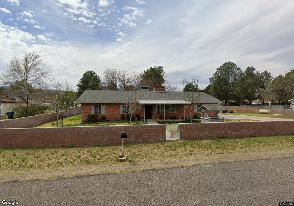
380 E Parade Ground Cir Camp Verde, AZ 86322
Estimated Value: $331,294 - $467,000
--
Bed
--
Bath
1,668
Sq Ft
$247/Sq Ft
Est. Value
About This Home
This home is located at 380 E Parade Ground Cir, Camp Verde, AZ 86322 and is currently estimated at $412,074, approximately $247 per square foot. 380 E Parade Ground Cir is a home located in Yavapai County with nearby schools including Camp Verde Elementary School, Camp Verde Middle School, and Camp Verde High School.
Ownership History
Date
Name
Owned For
Owner Type
Purchase Details
Closed on
Nov 16, 2017
Sold by
Martin Kenneth Gerald and Martin Linda Jane
Bought by
Martin Kenneth Gerald and Martin Linda Jane
Current Estimated Value
Purchase Details
Closed on
Apr 22, 2016
Sold by
Peace Robert L and Peace Frances K
Bought by
Martin Kenneth G and Martin Linda J
Home Financials for this Owner
Home Financials are based on the most recent Mortgage that was taken out on this home.
Original Mortgage
$171,000
Outstanding Balance
$136,072
Interest Rate
3.73%
Mortgage Type
Seller Take Back
Estimated Equity
$276,002
Purchase Details
Closed on
Jun 29, 2010
Sold by
Peace Robert and Peace Frances
Bought by
Peace Robert L and Peace Frances K
Purchase Details
Closed on
Aug 29, 2003
Sold by
Mauldin Wesley A and Mauldin Betty L
Bought by
Peace Robert and Peace Frances
Home Financials for this Owner
Home Financials are based on the most recent Mortgage that was taken out on this home.
Original Mortgage
$124,800
Interest Rate
6.22%
Mortgage Type
Purchase Money Mortgage
Purchase Details
Closed on
Oct 23, 2001
Sold by
Mauldin Wesley A and Mauldin Betty L
Bought by
Mauldin Wesley A and Mauldin Betty L
Purchase Details
Closed on
May 23, 1996
Sold by
Mauldin Wesley A and Mauldin Betty L
Bought by
Mauldin Wesley A and Mauldin Betty L
Create a Home Valuation Report for This Property
The Home Valuation Report is an in-depth analysis detailing your home's value as well as a comparison with similar homes in the area
Home Values in the Area
Average Home Value in this Area
Purchase History
| Date | Buyer | Sale Price | Title Company |
|---|---|---|---|
| Martin Kenneth Gerald | -- | None Available | |
| Martin Kenneth G | $190,000 | Yavapai Title | |
| Peace Robert L | -- | None Available | |
| Peace Robert | $156,000 | First American Title Ins Co | |
| Mauldin Wesley A | -- | Chicago Title Insurance Co | |
| Mauldin Wesley A | -- | Chicago Title Insurance Co | |
| Mauldin Wesley A | -- | -- |
Source: Public Records
Mortgage History
| Date | Status | Borrower | Loan Amount |
|---|---|---|---|
| Open | Martin Kenneth G | $171,000 | |
| Previous Owner | Peace Robert | $124,800 |
Source: Public Records
Tax History Compared to Growth
Tax History
| Year | Tax Paid | Tax Assessment Tax Assessment Total Assessment is a certain percentage of the fair market value that is determined by local assessors to be the total taxable value of land and additions on the property. | Land | Improvement |
|---|---|---|---|---|
| 2026 | $2,146 | $30,864 | -- | -- |
| 2024 | $2,047 | $31,096 | -- | -- |
| 2023 | $2,122 | $26,040 | $3,119 | $22,921 |
| 2022 | $2,047 | $21,365 | $2,012 | $19,353 |
| 2021 | $2,106 | $19,981 | $2,347 | $17,634 |
| 2020 | $2,059 | $0 | $0 | $0 |
| 2019 | $2,038 | $0 | $0 | $0 |
| 2018 | $1,952 | $0 | $0 | $0 |
| 2017 | $1,950 | $0 | $0 | $0 |
| 2016 | $1,901 | $0 | $0 | $0 |
| 2015 | -- | $0 | $0 | $0 |
| 2014 | -- | $0 | $0 | $0 |
Source: Public Records
Map
Nearby Homes
- 297 E Parade Ground Cir
- 248 S River Cave Rd
- 107 E Wee Hollow Dr
- 0 N Montezuma Heights Rd Unit 6934514
- 105 E Wee Hollow Dr
- 126 E Wee Hollow Dr
- 67 E Goddard Ln
- 78 E Goddard Ln
- 100 E Wee Hollow Dr
- 102 W Arnold St
- 385 S 4th St
- 0 Finnie Flat Rd Unit 532826
- 0 Finnie Flat Rd Unit 6833640
- 703 S Sgt Woodall Dr
- 315 W Hereford Dr
- 784 S Peach Ln
- 360 W Finnie Flat Rd Unit 16
- 2375 S San Dominique Rd
- 3 E State Route 260 --
- 595 S Park Cir