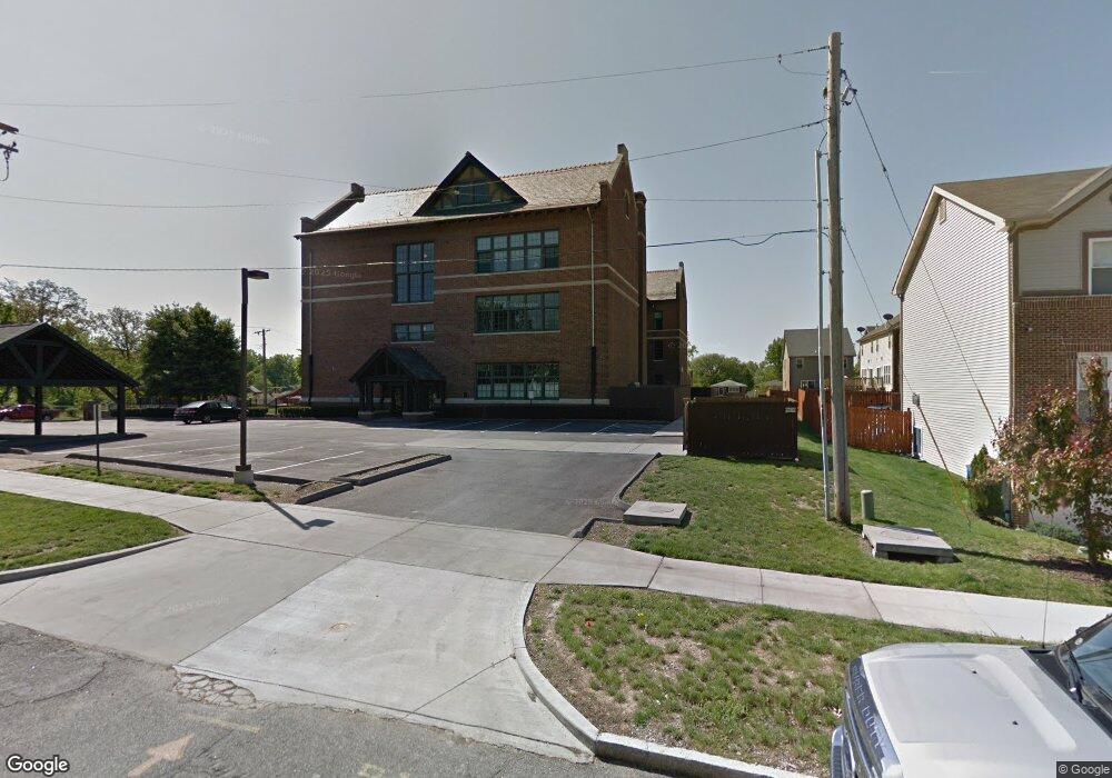
3815 Mccausland Ave Saint Louis, MO 63109
Lindenwood Park NeighborhoodEstimated Value: $148,000 - $299,000
--
Bed
1
Bath
781
Sq Ft
$285/Sq Ft
Est. Value
About This Home
This home is located at 3815 Mccausland Ave, Saint Louis, MO 63109 and is currently estimated at $222,401, approximately $284 per square foot. 3815 Mccausland Ave is a home located in St. Louis City with nearby schools including Mason Elementary School, Long International Middle School, and Roosevelt High School.
Ownership History
Date
Name
Owned For
Owner Type
Purchase Details
Closed on
Jan 26, 2018
Sold by
Khoudian Gagik
Bought by
Whipkey Michael R and Whipkey Carie A
Current Estimated Value
Purchase Details
Closed on
May 15, 2012
Sold by
Lindenwood School Lofts Llc
Bought by
Khoudian Gagik
Home Financials for this Owner
Home Financials are based on the most recent Mortgage that was taken out on this home.
Original Mortgage
$168,547
Interest Rate
4.02%
Mortgage Type
VA
Create a Home Valuation Report for This Property
The Home Valuation Report is an in-depth analysis detailing your home's value as well as a comparison with similar homes in the area
Home Values in the Area
Average Home Value in this Area
Purchase History
| Date | Buyer | Sale Price | Title Company |
|---|---|---|---|
| Whipkey Michael R | -- | None Available | |
| Khoudian Gagik | -- | Continental Title Company |
Source: Public Records
Mortgage History
| Date | Status | Borrower | Loan Amount |
|---|---|---|---|
| Previous Owner | Khoudian Gagik | $168,547 |
Source: Public Records
Tax History Compared to Growth
Tax History
| Year | Tax Paid | Tax Assessment Tax Assessment Total Assessment is a certain percentage of the fair market value that is determined by local assessors to be the total taxable value of land and additions on the property. | Land | Improvement |
|---|---|---|---|---|
| 2025 | $2,659 | $34,610 | -- | $34,610 |
| 2024 | $2,453 | $31,760 | -- | $31,760 |
| 2023 | $2,453 | $31,760 | $0 | $31,760 |
| 2022 | $2,453 | $29,680 | $0 | $29,680 |
| 2021 | $2,450 | $29,680 | $0 | $29,680 |
| 2020 | $2,431 | $29,680 | $0 | $29,680 |
| 2019 | $295 | $3,610 | $0 | $3,610 |
| 2018 | $304 | $3,610 | $0 | $3,610 |
| 2017 | $299 | $3,610 | $0 | $3,610 |
| 2016 | $303 | $3,610 | $0 | $3,610 |
| 2015 | $274 | $3,610 | $0 | $3,610 |
| 2014 | $274 | $3,610 | $0 | $3,610 |
| 2013 | -- | $3,610 | $0 | $3,610 |
Source: Public Records
Map
Nearby Homes
- 3815 Mccausland Ave Unit 4
- 6973 Winona Ave
- 7047 Tholozan Ave
- 7038 Pernod Ave
- 7081 Winona Ave
- 7081 Bancroft Ave
- 6962 Sutherland Ave
- 3558 Wabash Ave
- 7114 Bancroft Ave
- 7127 Bancroft Ave
- 7120 Bancroft Ave
- 7059 Lansdowne Ave
- 6968 Lansdowne Ave
- 7044 Lansdowne Ave
- 7048 Lansdowne Ave
- 6659 Tholozan Ave
- 6656 Oleatha Ave
- 6709 Lansdowne Ave
- 6621 Tholozan Ave
- 6811 Marquette Ave
- 3815 Mccausland Ave
- 3815 Mccausland Ave
- 3815 Mccausland Ave
- 3815 Mccausland Ave
- 3815 Mccausland Ave
- 3815 Mccausland Ave
- 3815 Mccausland Ave
- 3815 Mccausland Ave
- 3815 Mccausland Ave
- 3815 Mccausland Ave
- 3815 Mccausland Ave
- 3815 Mccausland Ave
- 3815 Mccausland Ave
- 3815 Mccausland Ave
- 3815 Mccausland Ave
- 3815 Mccausland Ave
- 3815 Mccausland Ave
- 3815 Mccausland Ave
- 3815 Mccausland Ave
- 3815 Mccausland Ave