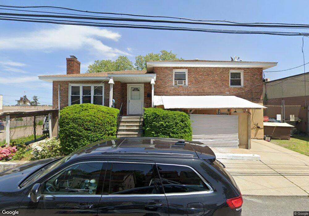
3820 Merritt Ave Bronx, NY 10466
Eastchester NeighborhoodEstimated Value: $590,320 - $917,000
--
Bed
--
Bath
2,668
Sq Ft
$254/Sq Ft
Est. Value
About This Home
This home is located at 3820 Merritt Ave, Bronx, NY 10466 and is currently estimated at $676,830, approximately $253 per square foot. 3820 Merritt Ave is a home located in Bronx County with nearby schools including Cornerstone Academy For Social Action, One World Middle School At Edenwald, and Baychester Middle School.
Ownership History
Date
Name
Owned For
Owner Type
Purchase Details
Closed on
Jan 2, 2025
Sold by
D'Onofrio Anthony and D'Onofrio Elizabeth
Bought by
3820 Merritt Avenue Llc
Current Estimated Value
Purchase Details
Closed on
Nov 12, 1997
Sold by
Naclerio Richard J
Bought by
Donofrio Anthony and Donofrio Elizabeth
Create a Home Valuation Report for This Property
The Home Valuation Report is an in-depth analysis detailing your home's value as well as a comparison with similar homes in the area
Home Values in the Area
Average Home Value in this Area
Purchase History
| Date | Buyer | Sale Price | Title Company |
|---|---|---|---|
| 3820 Merritt Avenue Llc | $600,000 | -- | |
| Donofrio Anthony | $200,000 | Fidelity National Title Ins | |
| Donofrio Anthony | $200,000 | Fidelity National Title Ins |
Source: Public Records
Tax History Compared to Growth
Tax History
| Year | Tax Paid | Tax Assessment Tax Assessment Total Assessment is a certain percentage of the fair market value that is determined by local assessors to be the total taxable value of land and additions on the property. | Land | Improvement |
|---|---|---|---|---|
| 2025 | $8,369 | $44,170 | $16,891 | $27,279 |
| 2024 | $8,369 | $41,670 | $18,996 | $22,674 |
| 2023 | $7,984 | $39,312 | $18,340 | $20,972 |
| 2022 | $7,848 | $51,360 | $26,340 | $25,020 |
| 2021 | $8,211 | $53,940 | $26,340 | $27,600 |
| 2020 | $7,791 | $46,680 | $26,340 | $20,340 |
| 2019 | $7,264 | $45,960 | $26,340 | $19,620 |
| 2018 | $6,678 | $32,760 | $26,340 | $6,420 |
| 2017 | $7,094 | $34,800 | $26,340 | $8,460 |
| 2016 | $7,125 | $35,640 | $26,340 | $9,300 |
| 2015 | $5,679 | $34,440 | $21,960 | $12,480 |
| 2014 | $5,679 | $34,440 | $21,960 | $12,480 |
Source: Public Records
Map
Nearby Homes
- 3735 Rombouts Ave
- 3992 Rombouts Ave
- 3946 Secor Ave
- 2123 Garrett Place
- 2110 Light St
- 4003 Secor Ave
- 3665 Varian Ave
- 3919 Pratt Ave
- 3924 Duryea Ave
- 4040 Pratt Ave
- 4044 Pratt Ave
- 1405 E 233rd St
- 15 Saint Pauls Place
- 3964 Duryea Ave
- 3968 Duryea Ave
- 42 Wildwood Ave
- 3963 Duryea Ave
- 3550 Huguenot Ave
- 3943 Seton Ave
- 2181 Strang Ave
- 2281 Light St
- 2281-2283 Light St
- 1622 E 233rd St
- 3701 Provost Ave
- 1614 E 233rd St
- 3703 Provost Ave
- 3813 Merritt Ave
- 1600 E 233rd St
- 3815 Merritt Ave
- 3811 Merritt Ave
- 3817 Merritt Ave
- 2259 Light St
- 3819 Merritt Ave
- 1626-1630 E 233rd St
- 3821 Merritt Ave
- 2253 Light St
- 2241 Light St
- 2282 Light St
- 3816 Rombouts Ave
- 2284 Light St