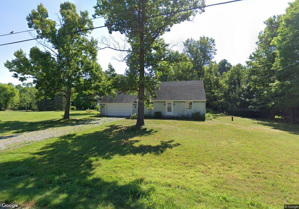
3886 Norwood Ave Alliance, OH 44601
Estimated Value: $182,974 - $203,000
3
Beds
2
Baths
1,575
Sq Ft
$122/Sq Ft
Est. Value
About This Home
This home is located at 3886 Norwood Ave, Alliance, OH 44601 and is currently estimated at $192,744, approximately $122 per square foot. 3886 Norwood Ave is a home located in Stark County with nearby schools including Marlington High School and Regina Coeli/St Joseph School.
Ownership History
Date
Name
Owned For
Owner Type
Purchase Details
Closed on
Oct 28, 2019
Sold by
Dixon Kathryn D and Dixon Kathryn
Bought by
Reeve Molly D and The Kathryn Dixon Irrevocable Trut
Current Estimated Value
Purchase Details
Closed on
Jun 19, 2008
Sold by
Dixon Molly Christine
Bought by
Dixon Kathryn D and Dixon Kathryn
Purchase Details
Closed on
Jun 9, 2008
Sold by
Stinson Rebecca Dianne and Stinson Matthew Paul
Bought by
Dixon Kathryn D and Dixon Kathryn
Purchase Details
Closed on
May 31, 2008
Sold by
Severns Emily Kathryn and Severns Robert James
Bought by
Dixon Kathryn D and Dixon Kathryn
Create a Home Valuation Report for This Property
The Home Valuation Report is an in-depth analysis detailing your home's value as well as a comparison with similar homes in the area
Home Values in the Area
Average Home Value in this Area
Purchase History
| Date | Buyer | Sale Price | Title Company |
|---|---|---|---|
| Reeve Molly D | -- | None Available | |
| Dixon Kathryn D | -- | Attorney | |
| Dixon Kathryn D | -- | Attorney | |
| Dixon Kathryn D | -- | Attorney |
Source: Public Records
Tax History Compared to Growth
Tax History
| Year | Tax Paid | Tax Assessment Tax Assessment Total Assessment is a certain percentage of the fair market value that is determined by local assessors to be the total taxable value of land and additions on the property. | Land | Improvement |
|---|---|---|---|---|
| 2025 | -- | $46,900 | $18,200 | $28,700 |
| 2024 | -- | $46,900 | $18,200 | $28,700 |
| 2023 | $1,063 | $43,340 | $14,670 | $28,670 |
| 2022 | $646 | $43,340 | $14,670 | $28,670 |
| 2021 | $660 | $43,340 | $14,670 | $28,670 |
| 2020 | $1,007 | $37,560 | $12,670 | $24,890 |
| 2019 | $999 | $37,560 | $12,670 | $24,890 |
| 2018 | $1,000 | $37,560 | $12,670 | $24,890 |
| 2017 | $1,042 | $36,620 | $10,540 | $26,080 |
| 2016 | $1,022 | $36,620 | $10,540 | $26,080 |
| 2015 | $1,024 | $36,620 | $10,540 | $26,080 |
| 2014 | $889 | $30,870 | $8,890 | $21,980 |
| 2013 | $445 | $30,870 | $8,890 | $21,980 |
Source: Public Records
Map
Nearby Homes
- 1325 W Beech St
- 277 W Carol St
- 3709 S Union Ave
- 3101 Ridgehill Ave
- 3116 Ridgehill Ave
- 549 Linwood Dr
- 0 Winchester St
- 0 Winchester St Unit 5162877
- 2839 S Rockhill Ave
- 1059 Oakwood Dr
- 0 Bayton St E Unit 5166569
- 0 Bayton St E Unit 25284250
- 2705 Shunk Ave
- 540 E Bayton St
- 2220 Western Ave
- 2195 Blenheim Ave
- 6434 Union Ave NE
- 2364 Shunk Ave
- 2112 Blenheim Ave
- 0 Easton St NE
- 3885 Norwood Ave
- 3885 Norwood Ave
- 1030 Edgeview St
- 3800 Norwood Ave
- 3765 Norwood Ave
- 3741 Norwood Ave
- 1300 Winesap St
- 3714 Norwood Ave
- 3714 Norwood Ave
- 3713 Norwood Ave
- 3690 Norwood Ave
- 3685 Norwood Ave
- 3653 Norwood Ave
- 1001 Birchaven St
- 3660 Rambo Ave
- 3601 Norwood Ave
- 3681 Rambo Ave
- 3665 Rambo Ave
- 3640 Rambo Ave
- 3571 Norwood Ave