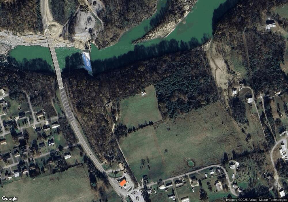
39 Flag Branch Rd Greeneville, TN 37743
Estimated Value: $456,000 - $955,000
3
Beds
2
Baths
3,170
Sq Ft
$206/Sq Ft
Est. Value
About This Home
This home is located at 39 Flag Branch Rd, Greeneville, TN 37743 and is currently estimated at $654,017, approximately $206 per square foot. 39 Flag Branch Rd is a home located in Greene County with nearby schools including Camp Creek Elementary School, South Greene Middle School, and South Greene High School.
Ownership History
Date
Name
Owned For
Owner Type
Purchase Details
Closed on
May 9, 2014
Sold by
Givens Natalie I
Bought by
Freeman Wilbur Frank and Cain Christopher Ray
Current Estimated Value
Purchase Details
Closed on
May 31, 2013
Sold by
Freeman Wilbur Frank
Bought by
Cain Freeman Wilbur Frank Iii Christopher R
Home Financials for this Owner
Home Financials are based on the most recent Mortgage that was taken out on this home.
Original Mortgage
$205,494
Interest Rate
3.37%
Mortgage Type
Commercial
Purchase Details
Closed on
Nov 3, 2005
Sold by
Hartsell Michael
Bought by
Givens Natalie I
Create a Home Valuation Report for This Property
The Home Valuation Report is an in-depth analysis detailing your home's value as well as a comparison with similar homes in the area
Home Values in the Area
Average Home Value in this Area
Purchase History
| Date | Buyer | Sale Price | Title Company |
|---|---|---|---|
| Freeman Wilbur Frank | $45,000 | -- | |
| Cain Freeman Wilbur Frank Iii Christopher R | -- | -- | |
| Freeman Wilbur Frank | -- | -- | |
| Givens Natalie I | $400,000 | -- |
Source: Public Records
Mortgage History
| Date | Status | Borrower | Loan Amount |
|---|---|---|---|
| Previous Owner | Freeman Wilbur Frank | $205,494 |
Source: Public Records
Tax History Compared to Growth
Tax History
| Year | Tax Paid | Tax Assessment Tax Assessment Total Assessment is a certain percentage of the fair market value that is determined by local assessors to be the total taxable value of land and additions on the property. | Land | Improvement |
|---|---|---|---|---|
| 2024 | $1,605 | $97,250 | $10,575 | $86,675 |
| 2023 | $1,605 | $97,250 | $0 | $0 |
| 2022 | $1,145 | $56,825 | $8,425 | $48,400 |
| 2021 | $1,145 | $56,825 | $8,425 | $48,400 |
| 2020 | $1,145 | $56,825 | $8,425 | $48,400 |
| 2019 | $1,145 | $56,825 | $8,425 | $48,400 |
| 2018 | $1,145 | $56,825 | $8,425 | $48,400 |
| 2017 | $1,115 | $56,500 | $8,850 | $47,650 |
| 2016 | $1,058 | $56,500 | $8,850 | $47,650 |
| 2015 | $1,058 | $56,500 | $8,850 | $47,650 |
| 2014 | $1,058 | $56,500 | $8,850 | $47,650 |
Source: Public Records
Map
Nearby Homes
- 7398 Asheville Hwy
- Lot 22 R Golf Villa Dr
- Lot 20R Golf Villa Dr
- Lot 21 R Golf Villa Dr
- Lot 15 Golf Villa Dr
- 10375 107 Cutoff
- 10630 107 Cutoff
- 10065 107 Cutoff
- 5515 Asheville Hwy
- 190 Golf Course Cir
- 215 White Sands Rd
- 0 River View Dr
- Lot 92 River View Dr
- 84 River View Dr
- 79 Links View Dr
- 23 Links View Dr
- 18 Links View Dr
- 25 Links View Dr
- 27 Links View Dr
- 20 Links View Dr
- 000 Greene
- 6699 Asheville Hwy
- 45 Greenfield St
- 0 Asheville Hwy
- 0 Asheville Hwy Unit 129317
- 0 Asheville Hwy Unit 297785
- 0 Asheville Hwy Unit 255212
- 0 Asheville Hwy Unit 107336
- 0 Asheville Hwy Unit 117343
- 0 Asheville Hwy Unit 135052
- 0 Asheville Hwy Unit 110580
- 0 Asheville Hwy Unit 287586
- 0 Asheville Hwy Unit 291689
- 0 Asheville Hwy Unit 291105
- 0 Asheville Hwy Unit 264202
- 0 Asheville Hwy Unit 237381
- 0 Asheville Hwy Unit 212667
- 0 Asheville Hwy Unit 209108
- 0 Asheville Hwy Unit 1 200927
- 0 Asheville Hwy Unit o 152994
