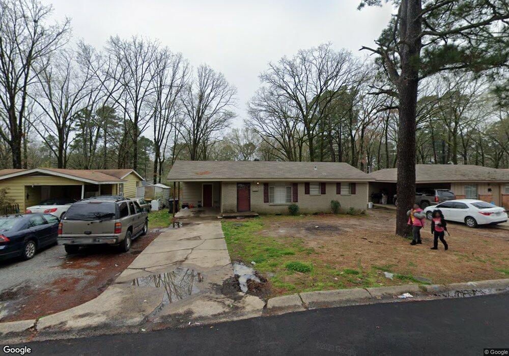
39 Westminister Dr Little Rock, AR 72209
Wakefield NeighborhoodEstimated Value: $82,000 - $112,000
--
Bed
1
Bath
1,184
Sq Ft
$83/Sq Ft
Est. Value
About This Home
This home is located at 39 Westminister Dr, Little Rock, AR 72209 and is currently estimated at $97,987, approximately $82 per square foot. 39 Westminister Dr is a home located in Pulaski County with nearby schools including Wakefield Elementary School, Cloverdale Middle School, and Little Rock Southwest High School.
Ownership History
Date
Name
Owned For
Owner Type
Purchase Details
Closed on
Feb 19, 2020
Sold by
Clean Sweep Management Llc
Bought by
Ellis Kamal R
Current Estimated Value
Purchase Details
Closed on
May 4, 2015
Sold by
Commissioner Of State Lands
Bought by
Clean Sweep Management Llc
Purchase Details
Closed on
Apr 25, 2005
Sold by
King Bernard M
Bought by
King Bernard M and King Denise A
Home Financials for this Owner
Home Financials are based on the most recent Mortgage that was taken out on this home.
Original Mortgage
$63,000
Interest Rate
8.75%
Mortgage Type
Stand Alone Refi Refinance Of Original Loan
Purchase Details
Closed on
Jul 26, 2004
Sold by
Barnett Roger D and Barnett Carla A
Bought by
King Bernard M and King Denise
Home Financials for this Owner
Home Financials are based on the most recent Mortgage that was taken out on this home.
Original Mortgage
$54,000
Interest Rate
8.15%
Mortgage Type
Purchase Money Mortgage
Purchase Details
Closed on
Sep 3, 2003
Sold by
Henry James E and Henry Carolyn J
Bought by
Barnett Roger D and Barnett Carla A
Create a Home Valuation Report for This Property
The Home Valuation Report is an in-depth analysis detailing your home's value as well as a comparison with similar homes in the area
Home Values in the Area
Average Home Value in this Area
Purchase History
| Date | Buyer | Sale Price | Title Company |
|---|---|---|---|
| Ellis Kamal R | -- | None Available | |
| Clean Sweep Management Llc | $6,000 | None Available | |
| King Bernard M | -- | Stewart Title Of Arkansas | |
| King Bernard M | $60,000 | American Abstract & Title Co | |
| Barnett Roger D | $33,000 | American Abstract & Title Co |
Source: Public Records
Mortgage History
| Date | Status | Borrower | Loan Amount |
|---|---|---|---|
| Previous Owner | King Bernard M | $63,000 | |
| Previous Owner | King Bernard M | $54,000 |
Source: Public Records
Tax History Compared to Growth
Tax History
| Year | Tax Paid | Tax Assessment Tax Assessment Total Assessment is a certain percentage of the fair market value that is determined by local assessors to be the total taxable value of land and additions on the property. | Land | Improvement |
|---|---|---|---|---|
| 2025 | $948 | $13,549 | $1,200 | $12,349 |
| 2024 | $837 | $13,549 | $1,200 | $12,349 |
| 2023 | $837 | $13,549 | $1,200 | $12,349 |
| 2022 | $767 | $13,549 | $1,200 | $12,349 |
| 2021 | $701 | $9,950 | $1,700 | $8,250 |
| 2020 | $697 | $9,950 | $1,700 | $8,250 |
| 2019 | $697 | $9,950 | $1,700 | $8,250 |
| 2018 | $697 | $9,950 | $1,700 | $8,250 |
| 2017 | $697 | $9,950 | $1,700 | $8,250 |
| 2016 | $680 | $9,720 | $1,800 | $7,920 |
| 2015 | $681 | $9,720 | $1,800 | $7,920 |
| 2014 | $681 | $9,720 | $1,800 | $7,920 |
Source: Public Records
Map
Nearby Homes
- 29 Rugby Dr
- 19 Daven Ct
- 37 Sheffield Dr
- 22 Daven Ct
- 11 Eaton Dr
- 14 Wellford Dr
- 14 Mansfield Dr
- 40 Wellford Dr
- 31 Allyson Cir
- 000 Young Rd
- 7 Linkay Ct
- 7102 Geyer Springs Rd
- 5303 W 57th St
- 4623 Stratton Ave
- 8301 Stanton Rd
- 5900-5908 Geyer Springs
- 5419 Western Ln
- 4905 Gum Springs Rd Unit 4907 Gum Springs Rd
- 8406 Dreher Ln
- 00 S University Ave
- 41 Westminister Dr
- 37 Westminister Dr
- 45 Westminister Dr
- 35 Westminister Dr
- 12 Exeter Dr
- 16 Exeter Dr
- 10 Exeter Dr
- 18 Exeter Dr
- 47 Westminister Dr
- 40 Westminister Dr
- 8 Exeter Dr
- 42 Westminister Dr
- 38 Westminister Dr
- 46 Westminister Dr
- 20 Exeter Dr
- 36 Westminister Dr
- 48 Westminister Dr
- 28 Westminister Dr
- 26 Westminister Dr
- 32 Westminister Dr